An alaska road trip for geology enthusiasts delivers direct highway access to active subduction zones, strike-slip fault scarps, accreted oceanic terranes, and valley glaciers found nowhere else on the North American road system. By driving key corridors like the Glenn, Richardson, Seward, and Parks Highways, you can inspect deep geological time and active glaciology straight from roadside pullouts.
Most travelers visit Alaska for scenic vistas and wildlife, but the real driver of the state's dramatic topography is its violent, ongoing tectonic assembly. Navigating this vast landscape requires understanding both structural geology and the practical logistical realities of northern driving. This guide outlines the essential bedrock stops, fault zones, and ice fields accessible by paved highway, along with field-tested driving advice to help you run your own geological expedition.
Understanding Alaska's Geologic Mosaic: Plate Collisions and Accreted Terranes
Alaska is not an ancient, stable continental craton like central Canada or the American Midwest. Instead, it is an intricate jigsaw puzzle assembled from exotic terranes—island arcs, oceanic plateaus, and microcontinents—that drifted across ancient ocean basins before colliding with and welding onto the ancestral North American margin across prolonged tectonic periods.
This dynamic process continues today along the southern coast. The Pacific Plate subducts northwestward beneath the North American Plate along the Aleutian Trench. This megathrust interface generates massive earthquakes, feeds the active volcanoes of the Aleutian Arc and Wrangell Volcanic Field, and drives the rapid crustal uplift visible across Southcentral Alaska. The Alaska Division of Geological & Geophysical Surveys (DGGS) maps these complex terranes, illustrating how collision zones define modern highway corridors.
When you take an alaska tectonic landscape tour by vehicle, you do not just observe scenery; you cross suture zones where ancient oceans were crushed out of existence. Geologists identify three major terrane groups right from the pavement:
- The Wrangellia Composite Terrane: Exposed along the Glenn and Richardson highways, this belt includes Paleozoic to Mesozoic volcanic island arc sequences and massive Triassic flood basalts (the Nikolai Greenstone) that originated near the equator.
- The Chugach-Prince William Composite Terrane: Forming the Kenai and Chugach Mountains, this is a massive accretionary prism of Cretaceous to Paleogene turbidites, graywackes, and oceanic basalt slivers scraped off the down-going oceanic plate.
- The Yukon-Tanana Terrane: Located north of the Alaska Range along the upper reaches of the highway network, representing older, metamorphosed continental margin fragments.
Roadcuts along Alaska's paved highways cut cleanly through these structural boundaries. You can stand on marine graywacke deposited in deep ocean trenches at sea level, and just two hours later, examine Jurassic volcanic arc bedrock thrust upward by inland compression.
Core Highway Corridors for an Alaska Road Trip for Geology Enthusiasts
Alaska's limited highway network happens to cut perpendicular to several major structural boundaries, making an alaska road trip for geology enthusiasts remarkably practical without requiring backcountry bush planes. Four highway corridors form the structural backbone of any geological driving itinerary.
1. Glenn Highway (Alaska Route 1): The Forearc Basin and Terrane Suture
Running from Anchorage east toward Glennallen, the Glenn Highway occupies the Matanuska Valley, a structural depression between two distinct geological provinces: the Chugach Mountains to the south (accretionary prism) and the Talkeetna Mountains to the north (volcanic arc). The valley traces the Castle Mountain Fault, an active crustal structure capable of shallow earthquakes.
Driving northeast from Palmer, watch the rock cuts transition between Mileposts 60 and 110. To your right, the Chugach terrane reveals dark, intensely sheared slate and phyllite. To your left, the Talkeetna formations expose Jurassic marine sandstones, siltstones, and volcanic tuffs. Between Mileposts 100 and 115, you encounter the Sheep Mountain and Caribou Creek formations, where altered volcanic rocks and marine sedimentary beds yield Jurassic ammonite and bivalve fossils.
2. Richardson Highway (Alaska Route 4): Crossing the Active Denali Fault
The Richardson Highway connects Valdez on the Prince William Sound coast to Fairbanks in the interior, providing a complete north-south cross-section through the Chugach Mountains, the Wrangell volcanic foreland, and the eastern Alaska Range. South of Copper Center, you can study the Wrangellia sequence, but the true highlight lies farther north near Paxson and Isabel Pass.
At Milepost 217, the highway directly crosses the main trace of the Denali Fault. This extensive right-lateral strike-slip fault ruptured violently in November 2002 during a major magnitude 7.9 event documented by the USGS Earthquake Hazards Program. Pullouts along the Delta River outwash allow you to observe offset moraines, stream channels shifted sideways, and retrofitted infrastructure engineered to withstand ground offsets.
Further south near Valdez, the Richardson drops through Keystone Canyon (Mileposts 14 to 17). Here, the Lowe River has carved a narrow gorge through the Valdez Group—Cretaceous deep-sea flysch and turbidite deposits that have been metamorphosed into slate, metasandstone, and phyllite displaying near-vertical foliation and complex folds.
3. Seward Highway (Alaska Route 1 & 9): Accretionary Prisms and Seismicity
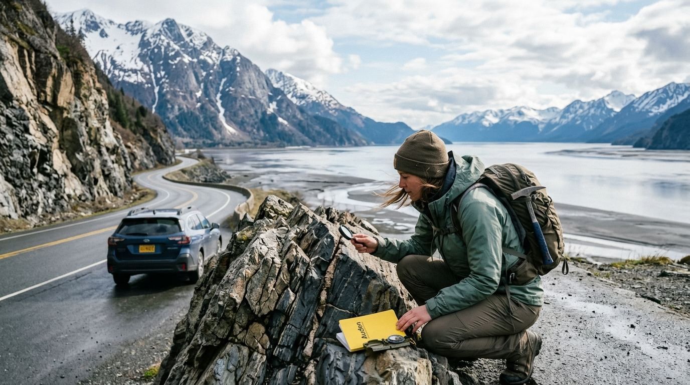
Traversing Turnagain Arm and the Kenai Peninsula, the Seward Highway is a primer in coastal accretion and earthquake mechanics. The rock cuts along Turnagain Arm consist of the Valdez Group mélange—oceanic trench sediments sheared, fractured, and folded under extreme pressure. Look for quartz veins cutting through fractured dark argillites and turbidite sequences exhibiting Bouma cycles.
This corridor also displays vivid structural reminders of the powerful 1964 Great Alaska Earthquake. Coastal areas around Turnagain Arm experienced rapid subsidence during the event, causing seawater to submerge low-lying coastal forests and leaving remnants visible from highway pullouts.
4. Parks Highway (Alaska Route 3): The Alaska Range and Denali Pluton
The Parks Highway connects Anchorage to Fairbanks, skirting the eastern flank of the central Alaska Range. The highway offers long-range views of Denali itself—a colossal granitic pluton (granodiorite) that crystallized deep underground tens of millions of years ago and has since been pushed upward through overlying Paleozoic sedimentary rocks by tectonic forces.
If you plan to explore the interior, note that access into Denali National Park remains truncated. As detailed by the National Park Service Denali conditions dashboard, the Denali Park Road is closed at Mile 43 through summer 2026 due to the Pretty Rocks Landslide. This active rock and clay slide across a structural contact point prompted construction of a bypass bridge across the moving slope. Roadside geology travelers along the Parks Highway itself, however, still have unimpeded access to scenic viewpoints, Nenana River canyon cuts, and the Nenana gravel formations.
Glaciology in Motion: Moraines, Kettle Ponds, and Tidewater Faces
Glaciers are the primary earthmoving agents that carved Alaska's contemporary topography. An alaska road trip for geology enthusiasts gives you ground-level access to active glacial processes that elsewhere require technical mountaineering.
Matanuska Glacier: Valley Ice Dynamics
Matanuska Glacier is the largest glacier in the United States accessible by vehicle, with scenic viewpoints near Milepost 101 and road access at Milepost 102 of the Glenn Highway. Flowing out from the high peaks of the Chugach Mountains, its terminus spreads into a massive lobe on the valley floor.
Walking the outwash plain and terminus area allows you to examine several active glacial landforms:
- Medial and Lateral Moraines: Massive ribbons of dark, unsorted glacial till running parallel to the ice flow, showing how valley glaciers carry rock scraped from valley walls.
- Supraglacial Melt Rivers: Surface streams that cut channels into the blue ice before plunging down vertical shafts known as moulins.
- Terminus Thrust Faulting: Zones where forward ice pressure shoves older, stagnant debris-covered ice over dynamic active ice, creating steep structural ridges along the terminus.
Exit Glacier: Real-Time Deglaciation
Located at the end of Herman Leirer Road off the Seward Highway near Seward, Exit Glacier provides a clear visual record of post-Little Ice Age retreat. As you walk toward the terminus from the Kenai Fjords National Park nature center, dated stone markers show the glacier's historic snout positions from the early nineteenth century through recent decades.
The trail takes you from mature spruce-hemlock forest across younger alder thickets and onto freshly exposed bedrock pavements. Here you can run your hand across glacial striations, chatter marks, and polished hornfels, observing how early pioneer plant species colonize raw, unsorted glacial till.
Pleistocene Troughs vs. Active Tidewater Calving
Highway driving in Southcentral Alaska reveals two distinct glaciological eras. Along Turnagain Arm, you drive the floor of a relict Pleistocene glacial trough—a deep, classic U-shaped valley carved during maximum glacial advances and later flooded by rising sea levels. The hanging valleys perched high above the road (such as those feeding McHugh Creek and Falls Creek) reveal the sheer thickness of the ice that once filled the inlet.
To witness modern tidewater calving, combine your highway drive with a day cruise into Prince William Sound or Kenai Fjords. Tidewater glaciers terminate directly in deep marine water, where buoyant forces and seawater temperatures trigger dramatic calving events. Watching large slabs of ice shear off a face and crash into seawater illustrates the rapid mechanical retreat reshaping coastal fjords.
Volcanic and Tectonic Stops: Experiencing the Ring of Fire
Alaska contains scores of historically active volcanic centers monitored by the USGS Alaska Volcano Observatory, along with crustal fault lines capable of generating major earthquakes. While much of the Aleutian chain is accessible only by ship or aircraft, several distinct highway corridors cut straight past volcanic fields and active rupture scars.
The Wrangell Volcanic Field
As you descend the eastern Glenn Highway toward Glennallen, the Wrangell Mountains rise abruptly across the Copper River Basin. Unlike the Aleutian Arc, which formed via standard oceanic crust subduction, the Wrangell Volcanic Field is tied to transition-zone tectonics and edge-flow melting driven by the subducting Yakutat terrane.
From highway pullouts near Tazlina and Willow Creek, you can see massive stratovolcanoes on clear days:
- Mount Sanford: An eroded andesite stratovolcano featuring a sheer south face carved by steep glacial cirques.
- Mount Drum: An explosive volcanic center that produced dacitic dome collapses and extensive pyroclastic deposits across the Copper River lowlands.
- Mount Wrangell: A massive active andesitic shield volcano with summit fumaroles that continually emit geothermal steam.
Denali Fault Rupture and Trans-Alaska Pipeline Engineering
At Milepost 217 on the Richardson Highway, you can study real-world earthquake engineering. When the Denali Fault ruptured in 2002, the ground experienced notable horizontal displacement directly across the highway corridor.
The Trans-Alaska Pipeline crosses the fault at this precise location. Engineers accounted for the fault's strike-slip mechanics during pipeline design and mounted the structure on Teflon shoe sliders resting on horizontal steel support beams. During the 2002 rupture, the ground shifted violently beneath the pipeline, but the structure slid safely along the supports without rupturing—a triumph of applied structural geology and engineering.
Relics of the 1964 Good Friday Earthquake
The tectonic subsidence caused by the 1964 earthquake left striking landscape relics. Around the head of Turnagain Arm near Girdwood and Portage (Mileposts 75 to 80 on the Seward Highway), Sitka spruce stands were inundated by salt water when the valley floor dropped. Today, the silver, barkless trunks stand as "ghost forests," preserved by brackish silt and tidal sediments.
Nearby, at the former townsite of Portage, structural foundations and fence lines remain partially submerged in mudflats, showing how seismic subduction events instantly alter regional hydrology and coastal morphology.
Logistical Realities of an Alaska Road Trip for Geology Enthusiasts
Field geology requires patience, slow pacing, and close observation. If you plan an Alaska trip using standard driving apps, your itinerary will run into trouble. Alaska's driving conditions differ significantly from those in the Lower 48.
Recalibrate Your Daily Driving Times
In Alaska, highway mileage rarely translates to standard highway driving times. Between seasonal road work, frost heaves, and winding mountain passes, transit times regularly take longer than digital map estimates suggest. Summer maintenance often introduces pilot cars and unpaved bypass sections that cause significant delays across high mountain corridors.
Geological field stops take substantial time. Walking an outwash plain, setting up a camera, or safely examining a rock cut along a highway shoulder adds up quickly. Scheduling overly ambitious driving mileage in a single day means spending most of your trip behind the wheel rather than out inspecting the bedrock.
Dead Zones and Offline Resources
Cellular data is completely absent across extensive stretches of the Glenn, Richardson, and Denali Highways. You cannot rely on web-based geologic maps, live satellite imagery, or search engines while standing on the roadside. Download all DGGS bulletins, USGS quadrangle maps, and satellite layers to an offline-capable tablet or phone before departing Anchorage or Fairbanks. Field geologists and self-drive travelers often carry physical topographic map sheets for regional context.
Roadbed Conditions and Tire Safety
Alaska's highways suffer from continuous permafrost thaw and freeze-thaw cycles that create severe frost heaves—sharp dips and ridges across paved asphalt. Hitting an unexpected frost heave at highway speed can bend rims or damage suspension components.
Pulling off near bedrock roadcuts presents another challenge: sharp, angular scree. Graywacke and basalt fragments sloughing off blast cuts easily puncture standard passenger-car tires. When stopping to examine formations, pull completely into established turnouts rather than parking on soft, rock-strewn shoulders.
Field Gear and Rock Hammer Etiquette
Pack a basic field kit to make roadside stops educational:
- 10x or 20x Hand Lens: Essential for inspecting mineral crystallization in intrusive granites, identifying volcanic phenocrysts, or examining sorting in turbidite sandstones.
- Geological Compass: For measuring strike, dip, and fault planes in exposed roadcuts.
- Sturdy Field Boots and High-Visibility Vest: Heavy rain leaves pullouts muddy, and vehicle traffic travels fast along narrow two-lane corridors. Wear a neon safety vest whenever examining cuts along the roadway.
- Rain Protection: Durable waterproof shells and waterproof notebooks are essential. Summer storms blow off the Gulf of Alaska with little warning.
Collecting Rules: Use extreme discretion with rock hammers. Rock and mineral collecting is strictly prohibited in all National Parks, National Monuments, and State Parks (such as Chugach State Park). Along Alaska Department of Transportation highway rights-of-way, hammering bedrock faces destabilizes rock cuts, creating safety hazards for other drivers. Focus on observation, field sketches, and photography, leaving samples in place.
DIY Route Planning Headaches vs. A Structured Custom Itinerary
Building an itinerary that balances complex geological field stops with basic travel logistics is where most self-drive visitors struggle. DIY planning often feels like an overwhelming research project:
- Lodging Choke Points: Accommodations near critical geological sites (such as Sheep Mountain, Glennallen, Copper Center, or Cantwell) are exceptionally limited. If you do not secure rooms in the exact right geographical order months in advance, you will face punishing multi-hour detours after a long day in the field.
- Ferry and Pass Logistics: Crossing Prince William Sound to link the Richardson Highway back to the Kenai Peninsula requires coordinating with the Alaska Marine Highway System ferry timetable between Valdez and Whittier. Missing that single sailing adds hundreds of highway miles to your route.
- Seasonal Road and Park Changes: Outdated online blogs often recommend routes that are closed or restricted, such as failing to account for the current Denali Park Road mile 43 closure.
| Planning Factor | DIY Field Trip Planning | Alaska Road Trip |
|---|---|---|
| Route Design | Requires cross-referencing geological papers, mileage charts, and construction notices across dozens of browser tabs. | Custom day-by-day Alaska road-trip itinerary built around your pace, physical mobility, and specific geologic interests. |
| Drive Time Reality | Online mapping engines consistently underestimate mountain passes, frost heaves, and seasonal road work delays. | Pacing accounts for real-world driving conditions, fuel gaps, pullout stops, and mountain driving realities. |
| Lodging Selection | Risk of booking behind geographic bottlenecks, forcing hours of backtracking across mountain highways. | Alaska Road Trip hand-picks lodging and gives you direct booking links, but you book it yourself — it does not make reservations on your behalf, so you keep full control and flexibility. |
| Excursions & Ferries | High friction coordinating glacier treks, marine sound crossings, and ferry schedules with overland drive segments. | Alaska Road Trip recommends activities and tours with timing and booking links; you reserve them yourself. |
| Offline Reliability | Fragmented web bookmarks and cloud-saved notes fail completely when cell coverage cuts out along remote highway gaps. | Delivered as a printable, offline-ready PDF in 3-5 business days, with 1-2 revision rounds. |
| Pricing Structure | Careful route planning and pacing can help travelers avoid extra fuel expenses and non-refundable booking errors. | Alaska Road Trip is a one-time flat fee, not a subscription — there are no recurring charges. Itinerary tiers include Lite at $97 for 1 to 5 days, Standard at $197 for up to 14 days, Plus at $297 for 14 or more days, and Concierge at $497, which adds a 30-minute live founder call. |
Every itinerary from Alaska Road Trip comes with a published 14-day money-back guarantee, full refund, no questions asked.
Every itinerary is hand-built by a named founder who has driven these routes on eight Alaska trips between 2015 and 2024, across four seasons. Plans are checked against current conditions for the traveler's dates. Itineraries reflect current-season research at build time, but Alaska Road Trip does not provide real-time booking availability, live tracking, or guaranteed live condition monitoring. Alaska Road Trip does not book flights or rental cars; you arrange those independently.
A 10-Day Geological Highway Sample Route
This balanced 10-day itinerary loops Southcentral Alaska, traversing major suture zones, active faults, and alpine glaciers along fully paved highways.
Day 1: Anchorage to the Matanuska Valley
Arrive in Anchorage and pick up your vehicle. Drive northeast along the Glenn Highway (Route 1) toward Palmer. Stop at the Eklutna pullouts along the Knik River to study the braided glacial outwash plain carrying rock flour from the inner Chugach range. Continue up the Matanuska Valley across the surface trace of the Castle Mountain Fault, overnighting in Palmer or Glacier View.
Day 2: Matanuska Glacier Terminus and Sheep Mountain Formations
Spend the morning exploring the terminus of Matanuska Glacier at Milepost 101. Walk the recessional moraines, observe supraglacial stream incision, and photograph blue compression ice along the terminus wall. In the afternoon, explore roadcuts along Sheep Mountain (Mileposts 113 to 118) to examine hydrothermally altered Jurassic volcanic rocks and marine sedimentary beds. Overnight near Glacier View.
Day 3: Glenn Highway Suture Zone to Glennallen
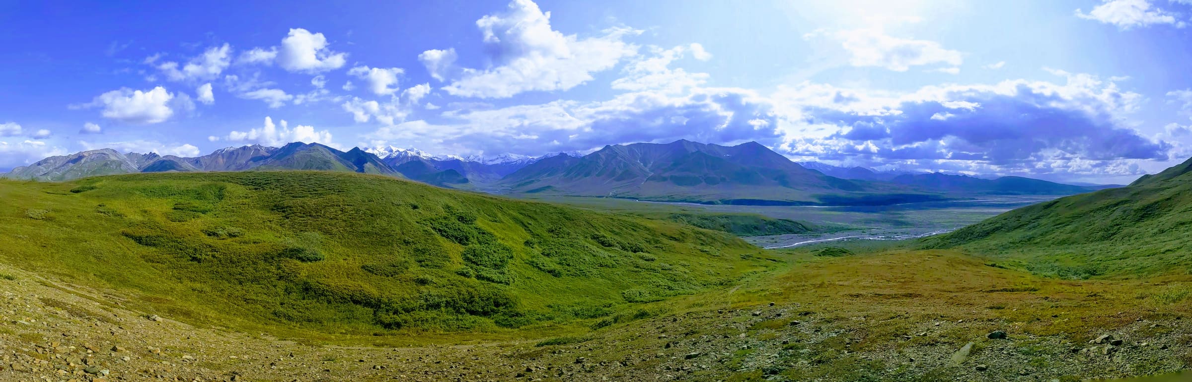
Drive east through Eureka Summit, the highest elevation on the Glenn Highway, which divides the Matanuska and Copper River drainages. As you descend into the Copper River Basin, pull out at panoramic viewpoints to inspect the massive shield profiles of Mount Drum, Mount Sanford, and Mount Wrangell. Overnight in Glennallen or Copper Center.
Day 4: Richardson Highway North to the Denali Fault
Take a day excursion north on the Richardson Highway (Route 4). Drive through Paxson and ascend Isabel Pass into the eastern Alaska Range. Stop at Milepost 217 to examine the 2002 Denali Fault rupture zone and the Trans-Alaska Pipeline's seismic slider supports. Study the Delta River braided gravel system before returning south to overnight in Copper Center.
Day 5: Copper Basin South Through Keystone Canyon to Valdez
Head south along the Richardson Highway toward the coast. Stop at Worthington Glacier (Milepost 29) to inspect an accessible alpine glacier cirque and well-developed terminal moraines. Continue south through Keystone Canyon (Mileposts 14 to 17) to study the near-vertical, metamorphosed flysch and slate beds of the Valdez Group. Overnight in Valdez.
Day 6: Marine Geology and Coastal Fjords
Spend the day in Valdez. Take a regional day cruise into Prince William Sound to observe deep glacial fjords, marine hanging valleys, and tidewater glacier calving faces. Examine how massive ice sheets carved deep bathymetric trenches now filled by marine waters. Overnight in Valdez.
Day 7: Ferry Across Prince William Sound to Whittier and Turnagain Arm
Board the Alaska Marine Highway System ferry from Valdez across Prince William Sound to Whittier. This water crossing bypasses hundreds of highway miles while offering spectacular views of submerged coastal accretionary terranes. Drive through the Anton Anderson Memorial Tunnel out of Whittier and continue along Turnagain Arm. Stop at Portage and Girdwood to inspect the 1964 earthquake ghost forests. Overnight in Girdwood.
Day 8: Turnagain Arm Turbidites to Seward
Drive south along the Seward Highway (Routes 1 and 9) across the Kenai Peninsula. Pull over at roadside cuts between Girdwood and Moose Pass to examine intensely folded and faulted turbidite sequences belonging to the Chugach terrane. Notice how quartz veins have filled tension fractures in the deformed graywacke. Overnight in Seward.
Day 9: Exit Glacier and Kenai Fjords Bedrock
Spend the day in Kenai Fjords National Park. Hike the Exit Glacier trails to view dated retreat markers and walk across scoured, polished bedrock pavements displaying striations and chatter marks. If physical fitness allows, hike up the Harding Icefield Trail to view the expansive Harding Icefield, which feeds dozens of surrounding glaciers. Overnight in Seward.
Day 10: Turnagain Arm Tides, Bore Tides, and Return to Anchorage
Drive north along the Seward Highway back to Anchorage. Time your drive along Turnagain Arm to watch the incoming bore tide—a prominent tidal wave created when the Pacific tide surges into the narrow, shallow, mudflat-filled fjord. Return your vehicle in Anchorage for departure.
Frequently Asked Questions
Can you legally collect rocks and mineral samples along Alaska highways?
Rock collecting is tightly regulated along Alaska's road corridors. You cannot collect rocks, minerals, or fossils within National Parks, National Monuments, or Alaska State Parks, including Chugach State Park along the Seward Highway. Along public highway rights-of-way outside park boundaries, casual surface collecting of small, non-fossil specimens is generally permitted, but excavating roadcuts or using rock hammers on engineered roadside slopes is illegal because it causes rockfall hazards. Geology travelers should check land ownership boundaries before collecting.
What is the best month to take an Alaska road trip for geology enthusiasts?
Late June through August offers the best balance of open highways, snow-free roadside outcrops, and operational tour services. Mid-to-late August is particularly strong for bedrock observation because high-elevation snowbanks have melted back from mountain passes, exposing upper scree slopes and moraine crests. Visiting in May or early June means facing lingering roadside snow covers that obscure significant rock cuts and moraine structures.
Do you need a 4WD vehicle to reach Alaska's best roadside geologic features?
You do not need a four-wheel-drive vehicle to see the core geologic features described in this itinerary. The Glenn, Richardson, Seward, and Parks Highways are paved two-lane state routes accessible in a standard passenger sedan. However, choosing a vehicle with higher ground clearance (such as a crossover or midsize SUV) is advantageous for safely navigating deep frost heaves, gravel pullouts, and seasonal road-construction zones without damaging undercarriage components.
Where can you see active earthquake fault lines from the highway in Alaska?
The most dramatic, visible fault crossing on the paved highway network is the Denali Fault trace at Milepost 217 on the Richardson Highway, north of Paxson. Here, you can observe laterally offset topography from the 2002 magnitude 7.9 earthquake and inspect the retrofitted seismic sliders supporting the Trans-Alaska Pipeline. The Castle Mountain Fault can also be viewed along the northern Glenn Highway corridor, marked by linear scarps and uplifted river terraces along the Matanuska Valley.
Ready to experience Alaska's dramatic tectonic landscapes without the stress of logistics? Let Alaska Road Trip hand-build your custom day-by-day route plan with curated geology stops, realistic drive times, and direct booking links for a flat one-time fee.
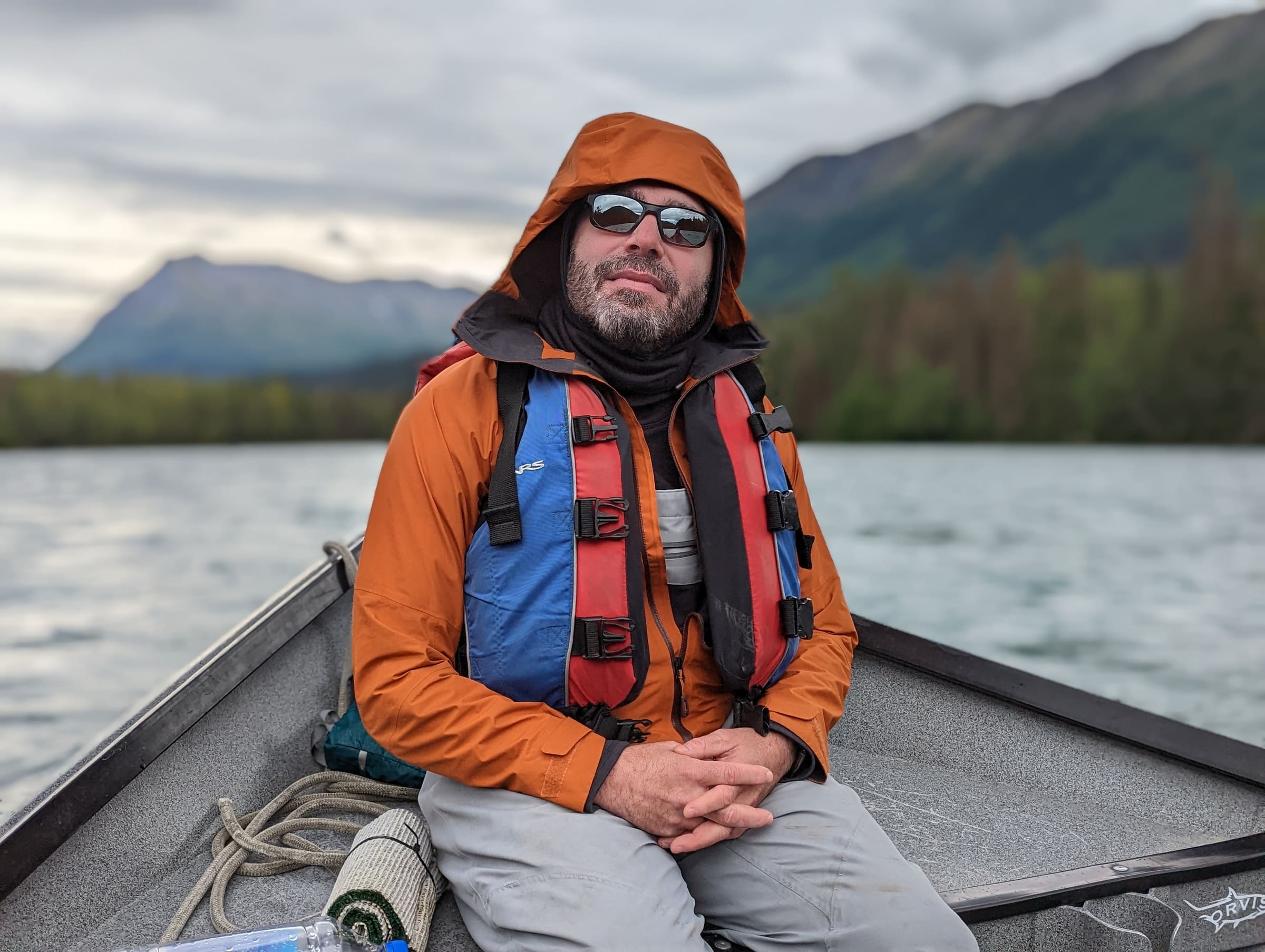
See a real Alaska itinerary before you spend a dollar
A real 3-day plan with driving times, lodging picks, and a daylight chart — free, in your inbox.
One email. No spam. Unsubscribe anytime. Or view it right now — no email needed ↗
Ready for the full plan? Get your custom itinerary — from $197 · 5-day delivery →