Deciding between an alaska road trip ferry vs drive route comes down to whether you want to bypass 2,200 highway miles aboard a coastal ferry or navigate the rugged expanse of the continental highway corridor through British Columbia and the Yukon. Both routes deliver iconic northern scenery, but they demand completely different vehicle preparations, physical pacing, and booking lead times for a 2026 journey.
For independent travelers, couples, and retirees planning a northern road trip, choosing the wrong option can mean stranded vehicles, blown budgets, or spending six days staring at windshield rock chips instead of wildlife. Here is the operational breakdown of the Alaska Marine Highway System versus the Alaska Highway overland route to help you decide which transit strategy fits your 2026 travel timeline.
The Quick Verdict: When to Choose Ferry vs Driving for Alaska
The core difference between the two routes lies in where you spend your energy and capital. The ferry trades financial cost for physical rest and marine scenery, while driving trades personal driving endurance for scheduling flexibility and lower upfront transit charges.
- Choose the Alaska Marine Highway Ferry if: You want to explore roadless Southeast Alaska towns (like Ketchikan, Wrangell, Petersburg, and Juneau), you want to avoid putting 4,500+ round-trip highway miles on your personal vehicle, or you prefer watching whales from a passenger lounge rather than dodging frost heaves for eight hours a day.
- Choose Driving the Overland Highway if: You are traveling with a vehicle longer than 19 feet (where ferry deck rates escalate dramatically), you want absolute autonomy over your daily start times and detours, you are targeting interior destinations like Denali or Fairbanks directly, or you missed the tight winter booking window for marine vehicle deck space.
Driving from the US border at Sweet Grass, Montana, or Abbotsford, British Columbia, to mainland Alaska requires between four and seven days of disciplined, 350- to 500-mile driving stints. By contrast, boarding the mainline Alaska Marine Highway System vessel in Bellingham, Washington, delivers you and your car to Haines or Skagway in roughly three to four days on the water. However, Haines is still 750 road miles away from Anchorage, meaning a ferry journey to mainland Alaska is rarely purely a marine voyage—it is often a combined sea-and-road endeavor.
| Decision Factor | Alaska Marine Highway (Ferry) | Overland Highway Route (Alcan / Cassiar) |
|---|---|---|
| Transit Time (Lower 48 to Haines/Tok) | 3 to 4 days sailing (Bellingham to Haines) | 4 to 7 days steady driving (2,000+ miles) |
| Physical Fatigue | Low: Observation decks, dining cabins, zero driving while underway | High: Active driving, frost heaves, unpaved construction zones, wildlife vigilance |
| Vehicle Wear & Tear | None while parked on the vehicle deck | High: Windshield chips, gravel rash, tire wear, suspension stress |
| Schedule Flexibility | Rigid: Fixed departure dates, strict vehicle check-in times | Flexible: Adjust daily stops, detours, and driving hours in real time |
| Southeast Alaska Access | Direct access to Ketchikan, Sitka, Petersburg, Juneau, and Haines | Zero access to roadless Inside Passage ports |
| Cost for Standard Car (<19 ft) | Higher upfront cost (Vehicle space + passenger fares + optional cabin) | Moderate: Fuel, provincial lodging, and meals spread across 2,000+ miles |
| Cost for Large RVs / Trailers (>21 ft) | Extremely high (deck space priced strictly by linear foot) | Significantly more economical than ferry deck fees despite high fuel consumption |
For those driving to Alaska for the first time, your 2026 departure date dictates this choice earlier than you might expect. The Alaska Marine Highway typically opens summer reservations in late winter or early spring. Vehicle berths for passenger cars and motorhomes routinely sell out for peak summer dates within days of release.
Alaska Road Trip Ferry vs Drive: Cost Breakdown and Hidden Expenses
Comparing the raw dollars of an alaska road trip ferry vs drive route requires looking past fuel pump receipts and ticket baseline quotes. Both options come with distinct cost structures and hidden expenses that trip up unsuspecting travelers.
The Math on Ferry Travel
The Alaska Marine Highway System prices tickets using three distinct components: passenger fares, vehicle linear space, and staterooms. A standard vehicle space covers rigs up to 19 feet in length and up to 8.5 feet in width. Once your rig exceeds 19 feet—even by two inches—the price per linear foot increases dramatically.
For two adults traveling with a standard crossover or compact SUV from Bellingham, Washington, to Haines, Alaska, transit costs break down into three primary buckets:
- Passenger fares: Basic passenger transit tickets for two adults across the multi-day sailing.
- Vehicle deck fare (under 19 feet): Linear deck space allocation for a passenger car or standard crossover.
- Private berth cabin (2-berth or 4-berth): Optional stateroom accommodations for the multi-day voyage. While you can pitch a tent on the solarium deck or sleep in airline-style recliners, most travelers over 50 reserve a private cabin for sleep quality and personal privacy.
- Total baseline ferry transit: Combining passenger tickets, standard vehicle space, and a stateroom routinely represents a substantial upfront multi-thousand-dollar investment.
If you are driving a 25-foot Class C motorhome or towing a travel trailer, that same one-way ferry vehicle fee escalates rapidly due to strict per-foot pricing formulas, making the ferry cost-prohibitive for large rigs unless you limit your voyage to shorter island-hopper connector segments.
The Math on Driving Overland
The drive through British Columbia and the Yukon along Highway 97 (the Alaska Highway) or Highway 37 (the Stewart-Cassiar) spans roughly 2,000 to 2,400 miles from northern border crossings to mainland Alaska hubs. To understand how that translates to your overall budget, review our detailed Alaska road trip cost analysis.
Overland expenses for a typical two-person crew in a passenger SUV over a 5-day highway run typically involve several steady outlays:
- Fuel: Covering 2,200 miles through remote northern British Columbia and the Yukon involves paying remote fuel station premiums, where transport logistics substantially increase prices per liter.
- Lodging: Four to five nights in roadside motels or cabins (e.g., Dawson Creek, Fort Nelson, Watson Lake, Whitehorse) reflect summer peak-season rates driven by limited room inventory along northern highways.
- Food & Dining: Remote roadhouses, roadside cafes, and grocery provisions add steady daily operational costs.
- Total baseline driving transit: For a standard passenger vehicle, the total cash outlay for fuel, food, and lodging is almost often lower than booking mainline ferry deck space and private staterooms.
Overlooked Expenses on the Highway
While the overland drive appears cheaper on paper for standard vehicles, DIY planners frequently forget the secondary maintenance expenses of remote highway driving. The Alaska Highway and Stewart-Cassiar feature seasonal chip-seal maintenance, gravel breaks, and frost heaves that launch loose stones.
A cracked windshield is almost a rite of passage; replacing acoustic or sensor-equipped windshields on modern vehicles often runs hundreds or even thousands of dollars. Heavy tire wear on coarse northern asphalt, headlight rock-guard deflectors, Canadian currency exchange transaction fees, and higher accommodation rates in remote single-motel junctions can quickly narrow the cost gap between sea and asphalt.
Logistics and Transit Times: Alaska Marine Highway vs Driving the Highways
Understanding the logistical rhythm of alaska marine highway vs driving routes is essential for building a reliable calendar. The operational friction points of these two modes could not be more different.
Schedule Rigidity and Mechanical Risk
Driving grants you unilateral control. If the weather is foul at Stone Mountain Provincial Park, you can push another 80 miles to Muncho Lake. If you want to sleep in, you start driving at 10:00 AM instead of 7:00 AM. You are not beholden to port gate times, boarding queues, or industrial schedules.
By contrast, taking the ferry demands precision. When boarding an AMHS vessel with a personal vehicle, you must report to the terminal staging lanes between two and three hours prior to departure. Missing your staging window forfeits your vehicle deck allocation. Furthermore, the AMHS fleet operates an aging roster of vessels—such as the MV Columbia and MV Kennicott—which have historically faced mechanical cancellations or revised schedules due to maintenance backlogs and crew shortages. If a ferry sailing cancels, accommodating a 19-foot vehicle on the next sailing may take days or weeks during peak July volumes.
International Border Crossings
If you drive to Alaska from the contiguous United States, you must cross the international border twice: entering Canada from the Lower 48, and re-entering the United States at the Alaska border (such as the crossing between Beaver Creek, Yukon, and Alcan Border, Alaska).
Travelers must adhere to the border entry rules established by the Canada Border Services Agency and U.S. Customs and Border Protection, requiring valid passports or enhanced IDs for every traveler. If you travel with pets, Canada and the US require specific vaccination documentation, including up-to-date rabies certificates. Strict regulations govern what you carry: fresh produce, citrus fruits, raw poultry, and firewood are subject to immediate confiscation. Furthermore, criminal records—including decades-old misdemeanor DUIs—can render a traveler legally inadmissible to enter Canada without prior formal rehabilitation approval. For travelers facing international transit barriers, taking a domestic flight directly into Anchorage and renting a vehicle on-site is often the safer logistical path.
Geographic Access Differences
The geographic difference between the routes is absolute. Mainland highways lead directly to the interior: Tok, Fairbanks, Delta Junction, and down to Anchorage or the Kenai Peninsula. However, continental roads cannot reach the islands and fjord-cut mainland valleys of Southeast Alaska.
If your dream vacation includes seeing the historic Russian architecture of Sitka, wandering downtown Juneau, or viewing the tidewater glaciers of the Inside Passage up close, you cannot reach them by highway. Those towns have zero road connections to North America. The ferry system serves as the marine highway for these communities, functioning as both public transit and scenic passage.
Vehicle and Passenger Experience: What Daily Travel Actually Looks Like
Before locking in your route, consider what everyday life looks like inside the vehicle or on the passenger deck for days on end.
Life Aboard the Alaska Marine Highway Ferry
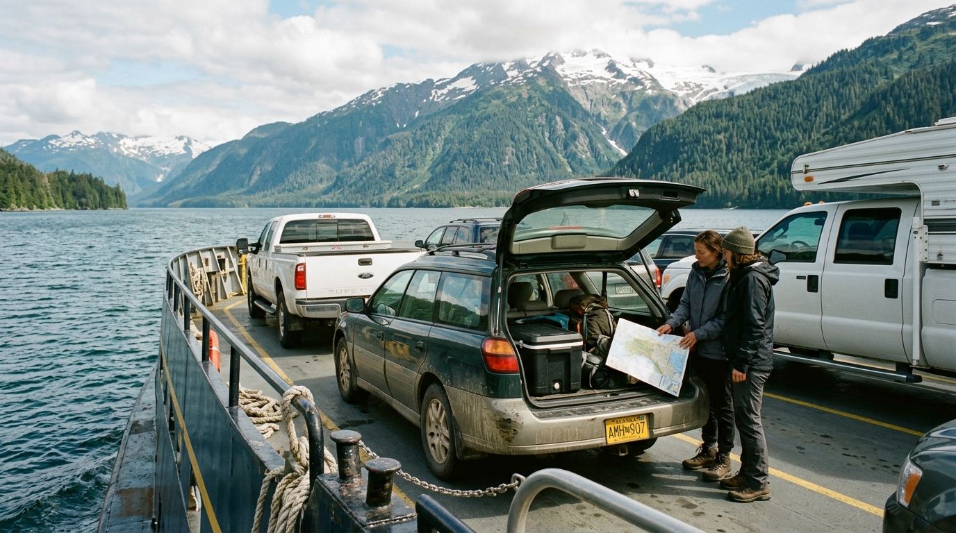
When you embark on an AMHS mainline vessel in Bellingham, deck crews direct you down tight vehicle ramps and guide you into bumper-to-bumper vehicle lanes. Once the vessel departs, vehicle decks are strictly locked and off-limits to passengers for safety reasons while underway. You cannot walk down to your car to retrieve an extra sweater, check on luggage, or sleep inside your camper van. Everything you need for the three-to-four-day journey must be packed into carry-on bags and hauled up to the passenger lounges or your private cabin before the ship gets underway.
Onboard, the rhythm slows down dramatically. You spend hours sitting in the forward observation lounge watching the temperate rainforests of British Columbia and Southeast Alaska glide by. The solarium on the top deck offers heated overhead panels where adventurous travelers pitch tents directly on the deck, securing them with heavy duct tape against the sea winds. Cabins are clean, utilitarian, and functional, equipped with small bunks, a modest desk, and a compact private shower and head. Dining is available in a cafeteria-style dining room offering basic, hearty meals, hot soup, and coffee, though many experienced ferry passengers bring their own non-perishable groceries, fruit, and snacks.
For pet owners, ferry transit presents unique challenges. Because the car deck is secured, pets must remain in your vehicle or in terminal-provided car-deck kennels for the duration of the voyage. The ship sounds brief "car deck calls" roughly every six to eight hours while at sea or during port stops, allowing owners 15 minutes to escort pets to a designated car-deck relief box filled with wood chips.
Life Along the Northern Highways
The overland highway experience is defined by vast, empty horizons, roadside gravel, and active engagement. Driving the Alaska Highway or Stewart-Cassiar requires constant driver vigilance. You are monitoring road surfaces for orange marker flags that signal massive pavement dips and frost heaves, watching road verges for black bears grazing on dandelions, and keeping an eye on your fuel needle.
Stretches along the Stewart-Cassiar Highway can leave you without cell reception or commercial fuel stations for 100 to 150 miles. You must adopt a strict northern driving rule: whenever you pass an open fuel pump, you stop and fill your tank regardless of whether you have half a tank remaining. To make sure you do not get caught off guard by remote pump closures, reference our guide to fuel planning for an Alaska road trip.
The rewards of the highway, however, are immense. You can pull over at Muncho Lake to admire its deep jade-green water, take a mid-morning soak at the natural Liard River Hot Springs while wood bison graze near the boardwalk, and photograph stone sheep clinging to cliffs in Stone Mountain Provincial Park. For those who enjoy active road-tripping, the overland drive delivers a genuine frontier journey that marine transit cannot replicate.
Combining Sea and Highway: The Best of Both Worlds Loop
You do not necessarily have to pick just one transit method. One of the most rewarding northern road trip routes merges both modes into a single loop, capturing the coastal fjords of the Inside Passage alongside the high-alpine interior passes of the Yukon and British Columbia.
The "Sail Up, Drive Down" Triangle
The standard way to execute a combined itinerary is booking a northbound vehicle berth aboard the AMHS vessel from Bellingham to Haines. You relax on the water for four days, bypass the long drive through southern British Columbia, and disembark with a fresh vehicle in Southeast Alaska.
From the port of Haines, you point your vehicle north along the stunning Haines Highway, climbing over the Chilkat Pass into British Columbia and the Yukon Territory. This road hugs the edge of Kluane National Park and Reserve—home to Canada's highest peaks and massive non-polar icefields—before connecting with the historic Alaska Highway at Haines Junction.
From Haines Junction, you can turn west to enter mainland Alaska through Tok, explore the interior, and later complete your journey southward by driving the full length of the Alaska Highway through Whitehorse, Watson Lake, and Dawson Creek back to the contiguous United States. This route completely eliminates backtracking, providing entirely fresh landscapes every single day.
The Top of the World Highway Connection
Travelers seeking even deeper wilderness can drive north from Whitehorse to historic Dawson City, cross the Yukon River via the free public ferry, and traverse the unpaved Top of the World Highway. This remote ridge-line road winds across alpine tundra before dropping into the tiny frontier community of Chicken, Alaska, and rejoining the Taylor Highway into Tok. If you are considering this path, study our route notes on the Top of the World Highway, as its international border crossing operates strictly on seasonal summer daytime hours and features rough gravel surfaces.
Rental Car Restrictions on Combined Loops
A major obstacle to the "sail one way, drive the other" strategy arises if you do not own the vehicle you are driving. If you fly into Anchorage or Fairbanks planning to rent an SUV, take a regional ferry to Southeast Alaska, and drop the vehicle off somewhere else, you will hit strict corporate rental car brick walls.
Nearly all major airport-based car rental franchises explicitly prohibit taking their vehicles aboard commercial ferry vessels without prior authorization, and almost none permit one-way drop-offs between mainland Alaska and the Lower 48. Independent local vehicle outfits sometimes permit ferry travel or one-way regional returns, but they charge steep repositioning surcharges that can double your vehicle budget. Review our comparison between renting an RV vs a standard car in Alaska to evaluate vehicle constraints before booking deck space.
Top Pitfalls When Planning an Alaska Road Trip Ferry vs Drive Journey
Planning mistakes on remote northern routes carry heavy penalties in time, money, and personal safety. Avoid these critical missteps when mapping out your 2026 travel logistics.
1. Waiting Too Long for Summer Vehicle Deck Space
Because the Alaska Marine Highway operates limited vehicle capacity on its mainline routes, summer vehicle slots for vehicles over 19 feet vanish almost immediately upon schedule publication. Travelers who wait until April or May to book passenger cars or camper vans for a July voyage are routinely relegated to waitlists. If you plan to use the ferry in 2026, monitor AMHS schedule release dates closely and book your vehicle slot the morning the booking portal opens.
2. Forgetting the Distance from Southeast Alaska Ferry Terminals to Mainland Hubs
A common geographic mistake made by first-time visitors is assuming that disembarking from the ferry puts them "in Alaska" with immediate access to places like Denali or the Kenai Peninsula. The mainline ferry terminates in Haines or Skagway. Haines to Anchorage is approximately 750 driving miles. Haines to Fairbanks is roughly 650 driving miles. That means getting off the ferry still leaves you with two full days of demanding, 8- to 10-hour highway driving across Canada before you reach the mainland Alaska road system.
3. Ignoring 2026 Seasonal Infrastructure and Highway Closures
Northern infrastructure changes every year due to environmental conditions and active road reconstruction. If your route connects from Haines or Tok toward the interior to visit national parks, you must verify local road access conditions before setting daily mileage targets.
For example, travelers heading toward the interior must account for the ongoing Pretty Rocks Landslide construction work, which limits private vehicle access and standard visitor transit buses along the Denali Park Road past mile 43. Current status reports, project updates, and shuttle transit boundaries are maintained directly on the National Park Service Denali Current Conditions page. Failing to factor in transit limits past mile 43 will derail a poorly planned itinerary.
4. Traveling Without a Secondary Full-Size Spare Tire
Whether you choose to drive the full length of the Alcan or take the ferry to Haines and drive north through the Yukon, you will encounter long stretches of unpaved construction detours, sharp shale gravel, and deep potholes. Modern crossovers often carry compact "donut" spares or temporary tire-sealant cans, neither of which will help you if you slice a sidewall 80 miles outside of Destruction Bay. Carry a true full-size spare tire, a working 12-volt air compressor, and a heavy-duty tire plug kit.
Taking the Overwhelm Out of Your 2026 Alaska Route Logistics
Building a successful Alaska road trip route requires balancing an exhausting number of moving pieces. You have to sync state ferry sailing dates with continental driving distances, cross-reference Canadian border regulations, verify remote gas station operating hours, and secure lodging in tiny subarctic towns where local hotels have fewer than 35 total rooms.
For many travelers, DIY trip planning stalls out right here. You spend weeks reading outdated internet forum threads from years past, cross-referencing conflicting ferry timetables, and guessing whether an eight-hour driving leg between Haines Junction and Tok will leave you stranded at an unmanned border post after dark.
This is where expert routing removes the friction. Instead of spending your evenings piecing together unverified advice, you can travel with a rock-solid, custom day-by-day plan built specifically around your travel dates, vehicle size, and personal pace.
Alaska Road Trip creates custom day-by-day itineraries tailored directly to your preferences. Every itinerary is hand-built by a named founder who has driven thousands of Alaska miles across multiple seasons. Alaska Road Trip hand-picks lodging and gives you direct booking links, but you book it yourself — it does not make reservations on your behalf, so you keep full control and flexibility. The same applies to daytime excursions: Alaska Road Trip recommends activities and tours with timing and booking links; you reserve them yourself. Furthermore, Alaska Road Trip does not book flights or rental cars; you arrange those independently.
You receive your route plan as a clean, printable, offline-ready PDF delivered in 3 to 5 business days, complete with one to two revision rounds to fine-tune every stop. Transparent pricing keeps your planning overhead predictable: Lite costs a measurable budget (1–5 days), Standard costs a measurable budget (up to 14 days), Plus costs a measurable budget (15+ days), and Concierge costs a measurable budget adding a 30-minute live call with the founder. Alaska Road Trip is a one-time flat fee, not a subscription — there are no recurring charges. Every plan is backed by a published 14-day money-back guarantee with a full refund and no questions asked.
Crucially, your itinerary reflects current-season research gathered at build time, incorporating active conditions like the 2026 Denali Park Road mile 43 access limits; Alaska Road Trip does not provide real-time booking availability, live tracking, or intended live condition monitoring. You bypass the stress of DIY routing while retaining complete ownership of your bookings and calendar.
Frequently Asked Questions
Can you sleep in your car or RV on the Alaska Marine Highway ferry?
No, you cannot sleep in your car, camper, or RV while the ferry is underway. Coast Guard maritime regulations require vehicle decks to be locked and cleared of all passengers shortly after departure. While the vessel is at sea, you must remain in passenger lounge areas, private passenger cabins, or inside a tent pitched on the outdoor solarium deck. You will only have brief, scheduled access to the car deck during designated pet-care intervals or during active port stops.
Is it cheaper to take the Alaska ferry or drive the Alaska Highway in 2026?
For a standard passenger car, crossover, or small truck, driving the Alaska Highway is generally more economical than taking the mainline ferry from Bellingham to Haines. While the overland drive incurs fuel, motel rooms, and meals across 2,000+ miles, total ferry costs—combining vehicle deck space, passenger tickets, and a cabin—carry a substantially higher upfront price tag. For large motorhomes, campers, and towed trailers, driving overland is drastically cheaper because ferry vehicle tariffs escalate sharply for every linear foot over 19 feet.
How far in advance do I need to book an Alaska ferry vehicle spot?
You should book vehicle deck space as soon as the Alaska Marine Highway System opens its summer schedule, which typically occurs between late fall and early spring. Vehicle berths for passenger cars and RVs traveling during peak summer months (June through August) frequently sell out on popular mainline vessels within days or weeks of release. If you plan to travel during peak season with any vehicle over standard car length, reserve your spot immediately upon schedule release.
Can you take a standard rental car on the Alaska ferry?
Most corporate rental car agencies in the Lower 48 and mainland Alaska strictly prohibit taking their vehicles onto commercial ferry vessels or crossing unpaved northern highways without explicit, written contract riders. Furthermore, one-way rental car drop-offs between the continental United States and Alaska are virtually non-existent or carry drop fees running into thousands of dollars. If you wish to travel via the ferry in a rental car, you will generally need to rent from specialized local outfits that explicitly allow marine deck transit, or rent separate vehicles on either end of your ferry run.
Stuck between ferry deck bookings and highway miles? Get a custom, day-by-day itinerary hand-built by a named founder who has driven thousands of Alaska miles across multiple seasons. Alaska Road Trip gives you an offline-ready PDF with direct lodging and activity booking links for a flat one-time fee—backed by a published 14-day money-back guarantee.
See a real Alaska itinerary before you spend a dollar
A real 3-day plan with driving times, lodging picks, and a daylight chart — free, in your inbox.
One email. No spam. Unsubscribe anytime. Or view it right now — no email needed ↗
Ready for the full plan? Get your custom itinerary — from $197 · 5-day delivery →