Most people see a mountain. The best road trippers see a massive geological collision in slow motion. When you embark on an Alaska road trip geology adventure, you're not just driving through scenic vistas; you're traversing a living, breathing geological textbook. Understanding the immense forces that shaped this incredible landscape—from towering peaks to vast glaciers and active volcanoes—transforms your journey into an immersive educational experience. This guide will help you decode the dramatic geological history along Alaska's major corridors, enhancing every mile of your 2026 adventure. For first-time visitors or those returning for a deeper dive, connecting with the land's ancient story makes your self-drive Alaska experience truly unforgettable.
The Unseen Architects: Forces Shaping Alaska's Landscape
Alaska's dramatic scenery is no accident; it's the result of millions of years of powerful geological processes. Understanding these fundamental forces is key to appreciating the Alaska road trip geology you'll witness. For a comprehensive overview of the state's geological history and features, the National Park Service provides detailed information on Alaska's geology.
Tectonic Activity: Where Plates Collide
Alaska sits at one of the most active tectonic boundaries on Earth, part of the Pacific Ring of Fire. Here, the Pacific Plate is slowly but relentlessly sliding beneath the North American Plate—a process called subduction. This collision is responsible for:
- Mountain Building: The immense pressure and uplift create the towering mountain ranges you'll drive through, like the Chugach and Alaska Ranges.
- Volcanoes: As the Pacific Plate melts deep within the Earth, magma rises to the surface, forming a chain of active volcanoes, particularly along the Aleutian Arc and into Southcentral Alaska.
- Earthquakes: Alaska experiences thousands of earthquakes annually, a constant reminder of the ongoing tectonic dance. While most are small, the region is prone to powerful quakes, which further shape the landscape. You can learn more about Alaska's seismic activity from the U.S. Geological Survey (USGS) Alaska Science Center.
Glaciation: Sculptors of the Land
While tectonic forces lift the land, glaciers carve and sculpt it. Alaska is home to some of the largest and most accessible glaciers in North America, and their impact on the landscape is profound:
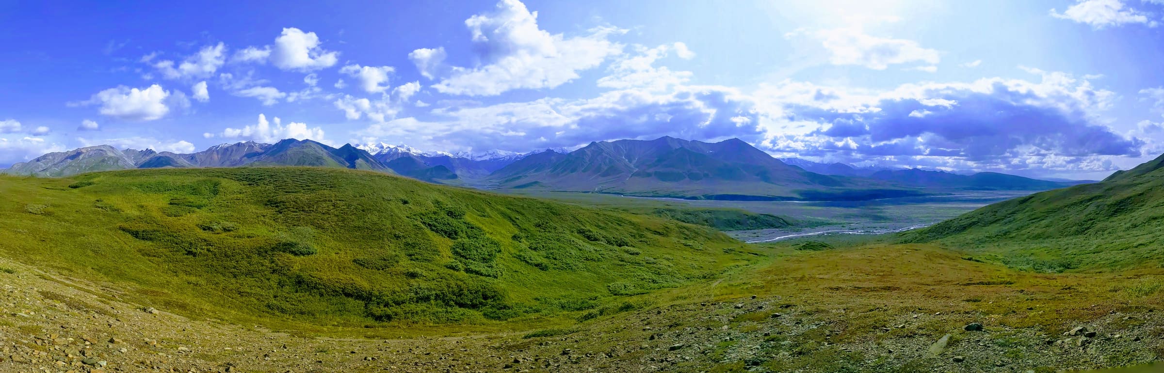
- U-Shaped Valleys and Fjords: Massive ice sheets and valley glaciers act like giant bulldozers, grinding away rock and leaving behind distinctive U-shaped valleys and deep coastal fjords, like those you'll see along the Seward Highway.
- Moraines and Outwash Plains: As glaciers retreat, they leave behind piles of rock and sediment called moraines, and vast plains of gravel and sand carried by meltwater, known as outwash plains. These features are common along many Alaskan roads.
- Glacial Lakes: Meltwater often collects in depressions carved by glaciers, forming stunning turquoise or milky-blue lakes, colored by fine rock flour suspended in the water.
Erosion and Weathering: The Ongoing Refinement
Even after the major forces of tectonics and glaciation, the landscape continues to evolve. Water, wind, and ice constantly break down rocks and transport sediment, creating river deltas, coastal plains, and the ever-changing face of Alaska's mountains.
Reading the Road: Geological Features You'll Encounter
As you drive, knowing what to look for will transform your Alaska road trip geology experience. Here are some common features:
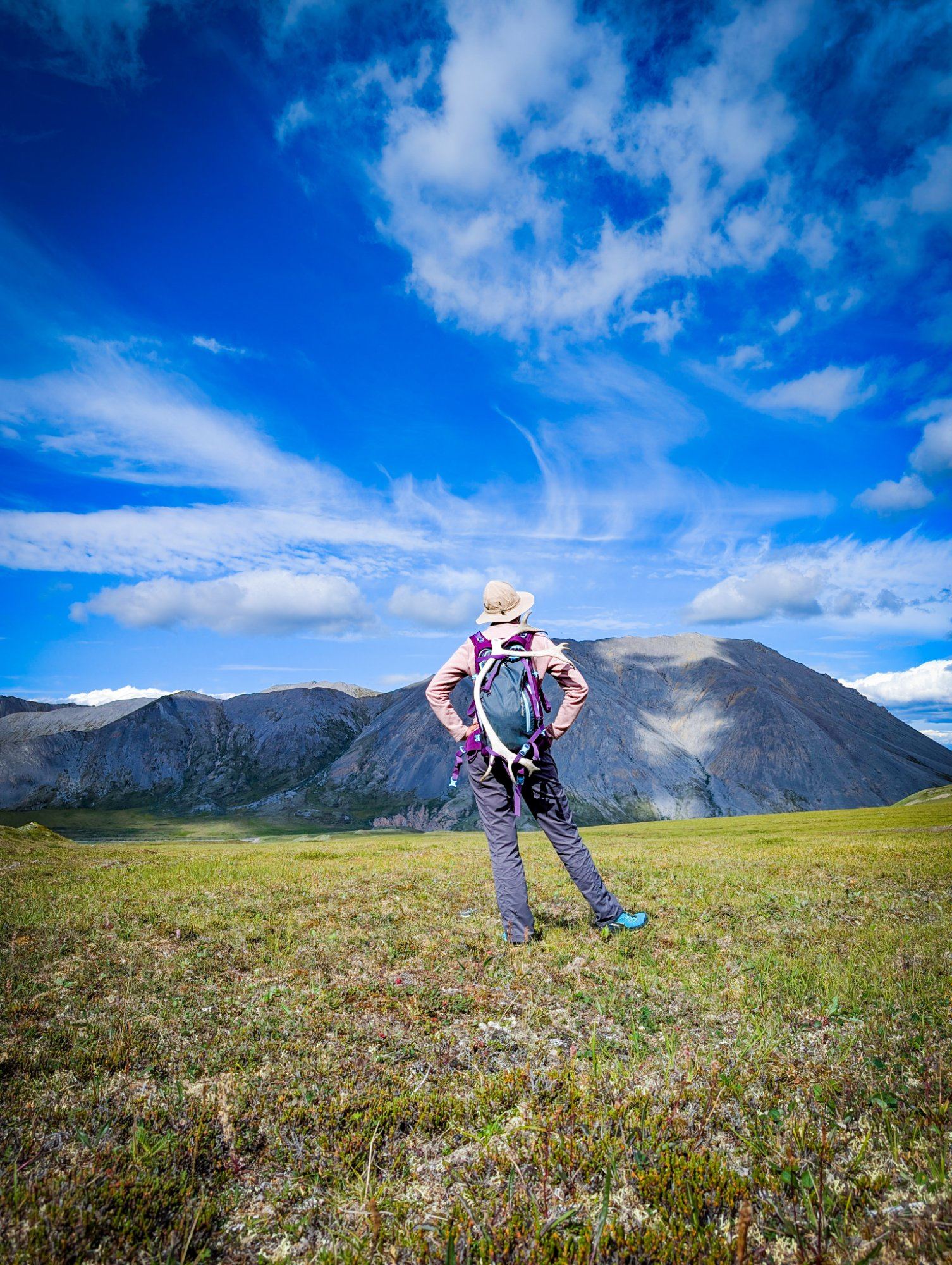
- Towering Peaks and Mountain Ranges: Look for jagged peaks that show evidence of ongoing uplift, often with visible layers of rock tilted or folded by tectonic pressure. The Chugach Mountains, visible from Anchorage, are a prime example of this ongoing uplift.
- Glacial Valleys and Fjords: Notice the characteristic U-shape of valleys, distinct from the V-shape carved by rivers. Along the coast, deep, narrow inlets with steep sides are fjords, remnants of ancient glaciers.
- Active Volcanoes: From a distance, you might spot the conical shapes of stratovolcanoes like Mount Redoubt or Mount Spurr, often with snow-capped summits. Keep an eye out for steam plumes, though these are not often present.
- Glacial Ice: Many roads offer views of active glaciers, some even accessible for closer inspection. Note the blue ice, crevasses, and the debris (moraine) carried on their surfaces.
- Permafrost Features: In interior and northern regions, permafrost (permanently frozen ground) can create unique landforms like thermokarst lakes (depressions formed by thawing ice) and uneven road surfaces, a constant challenge for road builders.
- Rock Formations: Observe the different types of rock. Dark, dense igneous rocks often indicate volcanic activity. Layered sedimentary rocks tell tales of ancient seas or riverbeds. Metamorphic rocks, often banded or folded, show signs of intense heat and pressure from mountain building.
Key Road Trip Corridors and Their Geological Stories
Each major highway in Alaska offers a distinct geological narrative. Planning your route with an eye for these stories will enrich your Alaska road trip geology adventure.
The Seward Highway: Where Mountains Meet the Sea
Often hailed as one of America's most scenic drives, the Seward Highway (Alaska Route 1) is a geological marvel. As you leave Anchorage, you're immediately greeted by Turnagain Arm, a long, narrow fjord carved by massive glaciers during the last ice age. The dramatic tidal flats and the bore tide are direct results of this glacial carving and the subsequent sea-level changes.
The Chugach Mountains, rising steeply from the Arm, showcase intense tectonic uplift and metamorphism. As you head south, you'll pass through areas heavily glaciated, with numerous hanging valleys and waterfalls. Near Seward, you can visit Exit Glacier, one of the most accessible glaciers in Alaska, offering a tangible connection to the ongoing process of glacial retreat and its impact on the landscape. For a deeper dive into this iconic route, consult our Seward Highway guide.
The Parks Highway: From Volcanoes to Glacial Valleys
The Parks Highway (Alaska Route 3), connecting Anchorage to Fairbanks, offers a journey through the heart of Alaska's interior and the shadow of North America's highest peak. The most prominent geological feature here is the Alaska Range, home to Denali. This colossal mountain is a testament to immense tectonic uplift, rising over 18,000 feet from its base. The surrounding landscape is a mosaic of glacial valleys, braided rivers, and evidence of past volcanic activity.
As you drive north, you'll notice layers of volcanic ash, particularly from eruptions of Mount Spurr and Mount Redoubt, which have periodically blanketed the region. These ash layers provide a visible timeline of geological events. Inside Denali National Park, the landscape is dominated by glacial erosion, permafrost, and active fault lines. Be aware that for 2026, the Denali Park Road is closed to private vehicles beyond Mile 43 due to a landslide, a stark reminder of Alaska's dynamic geology. Visitors should always check the Denali National Park and Preserve website for the latest road conditions. Planning your journey along this route requires careful consideration of these conditions. Our Anchorage to Denali guide offers more specific details for your trip.
The Glenn Highway: A Journey Through Time
The Glenn Highway (Alaska Route 1) offers a diverse geological experience, from the coastal plains near Anchorage to the rugged Talkeetna and Chugach Mountains. One of its highlights is the Matanuska Glacier, a massive valley glacier easily viewed and even accessible for guided walks directly from the highway. This glacier provides a living example of glacial dynamics, with its terminal moraine and meltwater river.
Further along, the landscape reveals evidence of ancient marine environments, with sedimentary rock formations hinting at times when this region was submerged under vast seas. Coal deposits, found in areas like the Matanuska Valley, are remnants of lush prehistoric forests. The dramatic changes in elevation and rock types along the Glenn Highway tell a complex story of uplift, erosion, and deposition over millions of years.
The Richardson Highway: Gateway to the Interior
Alaska's oldest highway, the Richardson (Alaska Route 1 and 4), traverses a vast and varied geological landscape. From Valdez, a fjord town nestled at the head of Prince William Sound, the highway climbs through the Chugach Mountains, revealing spectacular waterfalls and steep, glaciated terrain. As it heads north towards Fairbanks, it skirts the western edge of Wrangell-St. Elias National Park and Preserve, home to some of the largest volcanoes and glaciers in North America.
The Copper River Basin, a vast plain, shows evidence of massive ancient glacial lakes. The highway also offers views of the Trans-Alaska Pipeline, an engineering marvel that navigates diverse and challenging geological conditions, including permafrost and seismic zones. The sheer scale of the landscape along the Richardson Highway is a testament to the powerful and ongoing geological processes that define Alaska.
Understanding Alaska's Geological Timeline
To truly appreciate the Alaska road trip geology, it helps to have a basic grasp of its timeline:
- Mesozoic Era (252 to 66 million years ago): This was a period of significant mountain building and volcanic activity, as tectonic plates began their collisions, forming the core of many Alaskan ranges.
- Cenozoic Era (66 million years ago to present): Continued tectonic uplift, especially of the Alaska Range and Chugach Mountains, shaped the modern landscape. The most recent epoch, the Quaternary (last 2.6 million years), saw multiple cycles of massive glaciation, carving the valleys and fjords we see today. The current interglacial period has seen significant glacial retreat, a process still actively shaping the land.
Practical Tips for Your Geological Road Trip
An Alaska road trip geology focus requires a bit of preparation to maximize your experience:
- Road Conditions: often check current road conditions, especially during spring and fall, as geological events like landslides or rockfalls can impact travel. Websites like 511.alaska.gov are invaluable.
- Visitor Centers: National and State Park visitor centers often have excellent geological exhibits and rangers who can provide specific insights into the local geology.
- Maps and Guidebooks: Invest in detailed maps and geological guidebooks specific to Alaska. These can point out features you might otherwise miss.
- Pacing: Don't rush. Allow ample time for stops at scenic overlooks, interpretive signs, and short hikes to truly absorb the geological wonders. Trying to cram too much into a single day can lead to missed opportunities.
- Safety: Be aware of wildlife, especially when stopping on roadsides. often pull completely off the road.
- Photography: Capture the scale and detail of the geological features. Wide-angle lenses are great for landscapes, while a telephoto can highlight distant volcanic peaks or glacial details.
Why Understanding Geology Enhances Your Alaska Experience
For many travelers, an Alaska road trip is about stunning scenery. But for those who take the time to understand the geology, the experience becomes far richer. It's the difference between seeing a beautiful painting and understanding the artist's technique and inspiration. Knowing the story behind the mountains, glaciers, and volcanoes adds layers of appreciation, connecting you more deeply to the land and its history. It helps explain why certain wildlife thrives in particular areas, why rivers flow where they do, and even why communities are located in specific spots. This deeper understanding transforms a simple drive into a profound journey through time and natural forces.
Beyond the Map: Simplifying Your Alaska Road Trip Geology Adventure
Planning an Alaska road trip geology adventure, especially for first-time or second-time visitors, can quickly become overwhelming. Researching specific geological sites, understanding road conditions (like the 2026 Denali Park Road closure at Mile 43), finding suitable lodging, and weaving it all into a coherent, enjoyable itinerary takes significant time and local knowledge. Many couples, families, and retirees find themselves bogged down in DIY research, comparing countless options and worrying about missing out.
That's where Alaska Road Trip comes in. Alaska Road Trip's service is designed to take the pain out of planning, allowing you to focus on the excitement of your journey. The company offers custom, day-by-day Alaska road-trip itineraries, hand-built by its Alaska-based founder. Having driven thousands of miles across multiple seasons, Alaska Road Trip's founder possesses the concrete Alaska detail—drive times, seasonal considerations, and local insights—that generic travel blogs or AI tools simply can't provide. The service understands the nuances of an Alaska road trip, whether you're interested in specific geological formations, wildlife viewing, or simply enjoying the scenery.
Alaska Road Trip's itineraries are delivered as a printable, offline-ready PDF in 3-5 business days, with 1-2 revision rounds to ensure they are perfect for you. The service recommends lodging and activities with booking links, so you book directly, maintaining control over your choices. Alaska Road Trip does not book flights, cars, or accommodations, but provides all the necessary information. The flat one-time fees are straightforward: Lite for 1-5 days ($97), Standard for up to 14 days ($197), and Plus for 14+ days ($297). For those who want an extra layer of personalized guidance, the Concierge service ($497) adds a 30-minute live call with the founder. Alaska Road Trip stands by its service with a 14-day money-back guarantee, full refund, no questions asked. Let Alaska Road Trip handle the complexities of planning, so you can enjoy the geological wonders of Alaska.
Frequently Asked Questions
What are the most common geological features I'll see on an Alaska road trip?
On an Alaska road trip, you'll most commonly encounter towering, tectonically uplifted mountain ranges (like the Chugach and Alaska Ranges), U-shaped glacial valleys and fjords, active and retreating glaciers, and evidence of past volcanic activity such as ash layers and conical volcanoes. You'll also see various rock formations—igneous, sedimentary, and metamorphic—each telling a part of Alaska's ancient story.
How do glaciers impact the roads in Alaska?
Glaciers have a significant impact on Alaska's roads, both historically and currently. According to the Alaska Division of Geological & Geophysical Surveys (DGGS), ancient glaciers carved the valleys where many roads now lie. Today, glacial meltwater contributes to powerful rivers that can erode roadbeds or cause flooding. Furthermore, the presence of permafrost, often linked to past glacial periods, can lead to uneven road surfaces and requires specialized engineering to maintain infrastructure, as seen on many northern routes. The dynamic nature of glaciers also means that features like glacial lakes can shift, impacting drainage and road stability.
Are there active volcanoes visible from Alaska's roads?
Yes, several active volcanoes are visible from Alaska's main road corridors, particularly along the Parks Highway and in the Cook Inlet region. Mount Redoubt and Mount Spurr are two prominent stratovolcanoes that can often be seen on clear days from the Anchorage area and parts of the Parks Highway. While you won't drive directly to their summits, their imposing presence is a constant reminder of Alaska's position on the Pacific Ring of Fire. For specific viewing points, local visitor centers can provide guidance.
How can I learn more about the specific geology of my route?
To delve deeper into the geology of your specific Alaska road trip route, utilize resources like state and national park visitor centers, which often have interpretive displays and knowledgeable staff. Geological survey websites, such as the Alaska Division of Geological & Geophysical Surveys (DGGS), offer detailed information. Additionally, specialized geological guidebooks for Alaska's highways can provide mile-by-mile explanations of the features you're seeing. Don't hesitate to ask locals or tour guides for their insights, as they often have a wealth of practical knowledge.
Ready to Explore Alaska's Geological Wonders?
An Alaska road trip geology adventure is more than just a vacation; it's an exploration of Earth's raw power and beauty. While the thought of planning such a detailed trip can be daunting, you don't have to do it alone. Let Alaska Road Trip craft your perfect custom itinerary. Our founder, an Alaska expert, will build a day-by-day plan tailored to your interests, ensuring you experience the best of Alaska's landscapes, including its incredible geology, without the stress of DIY research. Visit our site to plan your trip today and transform your 2026 Alaska adventure into an unforgettable journey through time and terrain.

See a real Alaska itinerary before you spend a dollar
A real 3-day plan with driving times, lodging picks, and a daylight chart — free, in your inbox.
One email. No spam. Unsubscribe anytime. Or view it right now — no email needed ↗
Ready for the full plan? Get your custom itinerary — $197 · 5-day delivery →