
No, you cannot drive to Alaska without going through Canada. There is no continuous road system connecting the Lower 48 directly to Alaska through United States territory.
Every overland highway route heads north through the Canadian provinces of British Columbia and Alberta, continuing through the Yukon before crossing into Alaska. If your goal is to sit behind the wheel and roll your tires directly onto Alaska soil from the contiguous United States, crossing an international border is mandatory. When travelers ask if can you drive to alaska without going through canada, they are usually looking for a way to avoid border customs, transport specific cargo, or bypass the long overland trek. Geography dictates this reality.
Mainland Alaska is separated from Washington State by hundreds of miles of rugged British Columbia wilderness and coastal fjords. No bridge, tunnel, or coastal corridor spans this distance. The overland network funnels through a small number of interior corridors. You have two practical route choices to move a vehicle to Alaska from the contiguous states: drive the Alaska Highway through Canada, or drive your vehicle onto a marine ferry in Washington State. The ferry bypasses the Canadian highway system, but it presents logistical realities of its own.
The short answer: no road reaches Alaska without crossing Canada
Every paved and unpaved road between the Lower 48 and Alaska enters Canada. The landmass of British Columbia sits directly between northern Washington and southern Alaska. Because of this geography, no domestic highway links the contiguous United States to its northernmost state. You cannot avoid Canada by road.
The overland highway routes converge in northern British Columbia and funnel through the Yukon. The primary route follows the Alaska Highway, terminating near Delta Junction, Alaska. Alternative land approaches, such as the Stewart-Cassiar Highway, also traverse British Columbia before merging into the Yukon highway system. Both paths require entering Canadian territory and clearing customs in both directions.
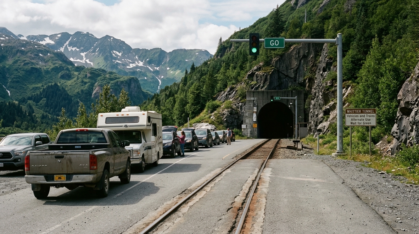
The sole alternative that avoids driving through Canada is putting your vehicle on a vessel. The state-operated marine ferry sails from Bellingham, Washington, into Southeast Alaska. This ferry route bypasses the international land border on the water. However, the ferry does not drop you into Anchorage or Fairbanks. It lands in Southeast Alaska ports like Ketchikan, Juneau, or Haines. To drive from Southeast Alaska into the main road system of Anchorage and the Interior, you must drive through Canada anyway from ports like Haines or Skagway.
The ferry requires significant planning. It is a multi-day voyage, vehicle spaces sell out many months ahead, and it costs considerably more than an ordinary highway fuel bill. Deciding between driving the highway or loading onto a vessel comes down to your vehicle type, your calendar, and your tolerance for border regulations.
Why the 'no-Canada' question comes up so often
Travelers investigate bypassing Canada for three common reasons: border documentation rules, cargo restrictions, and a desire to keep travel logistics domestic. Border rules require strict compliance.
Passports create immediate confusion for first-time road trippers. United States citizens crossing into Canada by land must carry a valid passport, a U.S. Passport Card, an Enhanced Driver's License, or a trusted traveler card such as NEXUS. A standard state driver's license or REAL ID card is insufficient for land border entry into Canada. When a family member or passenger lacks these documents, drivers scramble to find an all-domestic driving route that does not exist.
Firearms and hunting gear prompt another major wave of questions. Canada enforces strict firearm classifications. Handguns, short-barreled rifles, and certain semi-automatic firearms are either prohibited or tightly restricted. Bringing an allowed non-restricted hunting rifle or shotgun into Canada requires an advance declaration, an inspection, and a fee at the border crossing. Travelers relocating to Alaska with personal collections often find the regulations prohibitive.
Traveling with pets also introduces specific requirements. Dogs entering Canada must meet rabies vaccination protocols with veterinary documentation. Commercial pet foods containing certain animal byproducts face import restrictions depending on current agricultural rules.
For most vacation travelers, clearing Canadian border control is straightforward. The primary challenge of the Canadian drive lies in remote logistics: managing long distances between towns, spacing out fuel stops, and booking scarce motel rooms across northern British Columbia and the Yukon Territory.
Option one: the Alaska Highway through Canada
The classic overland path is the Alaska Highway. To make the trip, you cross the United States border into British Columbia or Alberta, connect to BC Highway 97, and proceed to Dawson Creek, British Columbia. Dawson Creek marks Mile 0 of the Alaska Highway. From there, the highway winds roughly 1,400 miles through Fort St. John, Fort Nelson, Watson Lake, and Whitehorse before reaching Delta Junction, Alaska.
From Delta Junction, travelers connect to the Richardson Highway to reach Fairbanks or head south on the Glenn Highway toward Anchorage. When examining your driving to alaska route options, evaluate total mileage realistically. Dawson Creek to Fairbanks alone takes four to six days of steady driving at 300 to 400 miles per day. A complete overland run starting from Seattle, Washington, typically requires seven to ten days of driving each way, before you spend a single day touring central Alaska.
Clearing customs along the highway requires preparation. Have your vehicle registration, current insurance card, and identity documents ready in your hand before approaching the booth. Declare all alcohol, tobacco, meat products, plants, and weapons accurately. Border officers ask concise questions about your destination, length of stay, and contents of your vehicle. Answer directly without elaboration.
Fuel spacing demands deliberate attention across northern regions. While the Alaska Highway is fully paved, distances between operating fuel pumps can stretch past 100 miles. Carry extra fuel if your range is low. Many remote service stations operate on limited daylight hours or close down outside peak summer. Never pass an open fuel pump when your tank drops below half. You can review our detailed guide on fuel planning in Alaska to prepare for these long stretches.
The seasonal window for typical passenger vehicles runs from late May through early September. Outside this period, seasonal motels and repair shops shutter, temperatures drop below freezing, and early snow creates severe driving conditions. Check road conditions through official state agencies such as the Alaska Department of Transportation 511 road conditions service before crossing into remote territory. For a complete segment breakdown of this drive, review our dedicated Alaska Highway guide.
Option two: the Alaska ferry with your vehicle
The state-owned marine route provides the only vehicle transit path that bypasses the Canadian highway corridor. The Alaska ferry system for vehicles, officially designated as the Alaska Marine Highway System (AMHS), operates large vehicle-carrying vessels from Bellingham, Washington. Summer ferry space is limited.
These vessels are transport ferries without cruise amenities. The mainline ferry departs Bellingham and sails up the Inside Passage, stopping at coastal communities including Ketchikan, Wrangell, Petersburg, Juneau, and Haines. Vehicles drive directly onto open or enclosed car decks via loading ramps. Drivers secure their vehicles, take their personal bags, and head upstairs to passenger areas. Car decks remain locked and off-limits while the ship is underway between ports for maritime safety reasons.
The ferry presents significant trade-offs that trip planners must weigh:
- Sailing from Bellingham to Haines requires roughly three to four continuous days on the water.
- Vehicle deck space and private passenger sleeping cabins sell out many months in advance, particularly for peak summer travel between June and August.
- Vehicle deck fares scale aggressively based on bumper-to-bumper vehicle length, vehicle height, and trailers.
- The mainline ferry drops vehicles off in Southeast Alaska rather than central road junctions.
The geographic destination of the ferry is the critical detail most DIY planners overlook. The ferry terminal at Haines connects to the Haines Highway, while Skagway connects to the South Klondike Highway. Both of these roads lead into the Yukon Territory of Canada. To reach Anchorage or Fairbanks from the ferry, you still have to drive across British Columbia and the Yukon before re-entering Alaska at Beaver Creek. Taking the ferry avoids the southern half of the Canadian highway system, but entering the Interior road network from Southeast Alaska still requires crossing an international border.
For travelers who secure tickets early, the ferry provides valuable benefits. It eliminates 1,000 miles of highway driving, offers marine views of coastal fjords, and grants access to isolated Southeast Alaska towns that have no outside road connections. Many experienced travelers choose a hybrid route: booking the ferry in one direction and driving the highway in the other.
Comparing the two routes on the things that actually decide it
Choosing between the overland Alaska Highway and the marine ferry comes down to four practical factors: time, cost, border logistics, and vehicle dimensions. Neither route is universally simpler; each option presents its own distinct points of friction. Both routes demand careful preparation.
| Decision Factor | The Alaska Highway (Overland) | Alaska Marine Highway (Ferry from WA) |
|---|---|---|
| Transit Time | 7 to 10 days from Seattle to Alaska border | 3 to 4 days sailing to Haines, plus 2 days driving to Interior |
| Border Crossings | Two land crossings (US-Canada and Canada-US) | Bypasses lower border; land crossing required from Haines/Skagway |
| Primary Costs | Vehicle fuel, remote highway motels, road food | Ferry vehicle fare, passenger tickets, private cabin, onboard meals |
| Vehicle Limitations | Standard clearance handles paved routes; high tire wear | Rigid overall length and height limits; deck space bookings sell out |
| Scenery Profile | Boreal forest, mountain passes, rivers, roadside wildlife | Coastal fjords, coastal rainforest, marine wildlife, islands |
| Booking Flexibility | High flexibility; adjust dates and driving pace as you go | Low flexibility; strict cancellation rules and sold-out summer decks |
Families traveling with school-age children often prefer the highway route. Driving your own vehicle allows for predictable roadside stops, flexible daily driving distances, and lower total upfront ticket costs. However, highway travel demands high physical stamina from the driver over consecutive eight-hour driving days.
Retirees and travelers taking an extended summer trip often lean toward the ferry. The ferry removes several thousand miles of vehicle vibration, road construction delays, and daily driving fatigue. You sit in passenger lounges or your cabin while the vessel covers hundreds of nautical miles. The trade-off is booking rigidity. If your vehicle breaks down or your arrival date shifts, transferring a peak-season ferry booking to a different departure date is almost impossible due to full car decks.
What neither route solves for you
Getting your vehicle across the Alaska border is merely the transit phase. Crossing the border does not solve the hardest part of Alaska travel planning: coordinating your actual itinerary across the state.
Alaska is massive. Driving from the border entry point near Tok down to the Kenai Peninsula adds another 400 to 500 miles. Driving north to Fairbanks and west toward Denali National Park involves long, isolated corridors. Many travelers arrive in Alaska exhausted from seven days of highway transit, only to discover their in-state schedule requires another 200 miles behind the wheel every single day.
The 2026 infrastructure conditions create specific planning constraints. In Denali National Park, the Pretty Rocks landslide continues to affect the transit corridor. As detailed by the National Park Service Denali road conditions page, the Denali Park Road remains closed to public transit buses past mile 43. Travelers expecting to ride tour buses out to Wonder Lake or Kantishna must adjust their expectations. A successful park visit requires knowing how to maximize the open miles east of the East Fork bridge. You can check our detailed breakdown of the Denali Park Road 2026 status to adapt your stops accordingly.
Lodging availability poses an even tighter bottleneck than road closures. Towns like Seward, Homer, Talkeetna, and Valdez have small commercial centers with limited numbers of hotel rooms, cabins, and RV slips. During July and August, local accommodations operate at full capacity. Independent travelers who show up without lodging reservations often find themselves driving three extra hours to find an open vacancy, or sleeping in roadside pullouts.
This is where self-planned trips tend to break down. Drivers spend weeks researching the border crossing through Canada, but fail to balance the daily pacing, ferry connections, and excursion timings once they arrive in Alaska proper.
How to decide in an afternoon, not a month
You can finalize your route strategy quickly by answering three straightforward questions instead of spending weeks browsing internet travel forums.
- Confirm border documentation for all passengers. If anyone in your vehicle lacks a valid passport, passport card, or enhanced ID, your options narrow immediately. You must secure travel documents before departure, or choose an entirely different travel model, such as flying into Anchorage and renting a vehicle locally.
- Assess total calendar days available for the journey. If your vacation window is two weeks total, driving overland from the Lower 48 is not sensible. You will spend 14 to 16 days driving back and forth through Canada, leaving zero time to explore Alaska. Driving your personal vehicle to Alaska demands a minimum of three to four weeks round-trip. If your schedule is shorter, fly into Anchorage or Fairbanks and start your driving loop inside the state.
- Choose between highway flexibility and fixed ferry schedules. If you want the freedom to alter your daily stops, drive the highway. If you prefer to rest while moving and can commit to rigid travel dates six months ahead, book the ferry from Bellingham.
Calculate your trip pacing by subtracting your transit days from your total calendar first. Transit days reduce sightseeing time. If you have 21 days available, and you spend 8 days driving north through Canada and 8 days driving south, you have exactly 5 days left inside Alaska. Over-scheduling those remaining 5 days leads to driver burnout.
A hand-built day-by-day plan removes this guesswork. Alaska Road Trip builds custom itineraries for a flat one-time fee across tiered options based on trip length: Lite covers shorter visits, Standard covers up to two weeks, and Plus covers longer self-drive journeys. For direct input on your driving strategy, the Concierge tier adds a thirty-minute live founder call. Every plan comes with a published 14-day money-back guarantee with a full refund, no questions asked.
Where a done-for-you itinerary fits in
Once you enter Alaska, executing a smooth road trip requires realistic drive times, tested route staging, and reliable stops. Alaska Road Trip creates custom road trip plans delivered as a printable, offline-ready PDF within 3 to 5 business days, including 1 to 2 revision rounds to refine details.
Alaska Road Trip hand-picks lodging and gives you direct booking links, but you book it yourself; it does not make reservations on your behalf, so you keep full control and flexibility. This independence allows you to manage your own loyalty programs, payment methods, and cancellation terms directly with property owners. Booking remains in your hands.
The same principle applies to local excursions. Alaska Road Trip recommends activities and tours with timing and booking links; you reserve them yourself. You pick the exact departure times that match your energy levels, while following an itinerary that accounts for driving buffers and road construction delays. Alaska Road Trip does not book flights or rental cars; you arrange those independently.
Pricing remains straightforward and predictable. Alaska Road Trip is a one-time flat fee, not a subscription; there are no recurring charges.
Every itinerary is hand-built by a named founder who has driven these routes on eight Alaska trips between 2015 and 2024, across four seasons. You receive routes verified against real Alaska road conditions, mountain passes, and driving limits.
Itineraries reflect current-season research at the time they're built. The trip dashboard can check available park, road, weather, and aurora data, but Alaska Road Trip does not provide real-time booking availability, live tracking, or guaranteed live condition monitoring. You receive an accurate, reliable blueprint tailored to the realities of the current summer driving season.
Frequently asked questions
Can you drive to Alaska without going through Canada?
No, you cannot drive to Alaska without going through Canada. No overland road connects the contiguous 48 states to Alaska without crossing Canadian territory. The only way to move a vehicle to Alaska without driving through Canada is by loading it onto a ferry or cargo barge departing from Washington State. Canadian transit is mandatory by road.
Can you drive to Alaska without a passport?
You cannot drive through Canada to Alaska using only a standard state driver's license. U.S. citizens traveling by land must present an approved travel document: a valid U.S. Passport book, a U.S. Passport Card, an Enhanced Driver's License from an approved state, or a trusted traveler card such as NEXUS. Children under age 16 crossing by land may present an original or certified copy of their birth certificate.
How long does the Alaska ferry take from Bellingham with a vehicle?
The Alaska Marine Highway System ferry takes roughly three to four continuous days on the water to sail from Bellingham, Washington, to the Southeast Alaska ports of Haines or Skagway. From those ports, reaching Anchorage or Fairbanks requires two additional days of highway driving across northwestern British Columbia and the Yukon Territory.
Is the Alaska Highway drivable in winter?
The Alaska Highway remains open year-round and is maintained by Canadian and Alaska highway road crews. However, winter driving involves severe sub-zero temperatures, drifting snow, black ice, and reduced daylight. Many roadside motels, gas stations, and repair shops operate on reduced hours or close completely from October through April, requiring extreme self-sufficiency.
What is the shortest driving route from the Lower 48 to Alaska?
The shortest overland driving route begins at the Sweet Grass, Montana, border crossing, heads northwest through Calgary and Edmonton, Alberta, connects to Dawson Creek, British Columbia, and follows the Alaska Highway to Tok, Alaska. This trip runs from the Montana border to the Alaska boundary.
The bottom line
You cannot drive to Alaska without going through Canada, but you can choose how you manage the journey. If you have three or more weeks and enjoy open roads, driving the Alaska Highway through British Columbia and the Yukon is a rewarding overland trek. If you want to skip thousands of highway miles and view the Inside Passage, book the marine ferry from Bellingham well in advance.
Once you have picked your entry route, let Alaska Road Trip build the Alaska days around it. You receive a custom day-by-day PDF for a flat one-time fee, backed by a 14-day money-back guarantee. Start at Plan Your Trip.

See a real Alaska itinerary before you spend a dollar
A real 3-day plan with driving times, lodging picks, and a daylight chart — free, in your inbox.
One email. No spam. Unsubscribe anytime. Or view it right now — no email needed ↗
Ready for the full plan? Get your custom itinerary — from $197 · 5-day delivery →