The Dalton Highway: Alaska's Ultimate Adventure Drive
The Dalton Highway, also known as the "Haul Road," runs 414 miles from the Elliott Highway junction north of Fairbanks to Deadhorse, the industrial camp at Prudhoe Bay on the Arctic Ocean. It is the northernmost road in the United States, one of the most isolated highways in the world, and a bucket-list drive for serious road trippers.
Built in 1974 to support construction of the Trans-Alaska Pipeline, the Dalton Highway parallels the pipeline for much of its length. The road crosses the Yukon River, climbs over the Brooks Range at Atigun Pass (4,739 feet), traverses the vast Arctic tundra of the North Slope, and ends at the oil fields of Prudhoe Bay. Along the way, there are exactly three tiny communities, two fuel stops, and no cell service for the entire 414 miles.
This is not a casual drive. But if you are prepared, it is one of the most extraordinary road experiences on Earth.

Thirty days on the Haul Road — unfiltered, north of the Arctic Circle.
Before You Go: Vehicle Preparation
The Dalton Highway demands more from your vehicle than any other road in Alaska. While technically passable in a two-wheel-drive car in good summer conditions, most experienced drivers and rental companies recommend a truck or SUV. Review our guide on whether you need 4WD in Alaska for more on vehicle selection.
Essential Vehicle Prep
- Two full-size spare tires: This is not optional. Flats are extremely common on the gravel sections. Bring two spares, not one.
- Tire repair kit and portable air compressor: A plug kit can save you from being stranded.
- Extra fuel: Carry at least 5-10 gallons of extra fuel in approved containers. There are only two fuel stops on the entire highway.
- Headlight covers or protective film: Flying gravel from trucks will crack an unprotected headlight or windshield.
- CB radio: Truckers use Channel 19 to communicate about road conditions and oncoming traffic. This is extremely useful on blind curves and hills.
- Windshield repair kit or extra windshield: Cracked windshields are so common that some drivers consider them inevitable.
Road Conditions: What to Expect
The Dalton Highway is roughly 25% paved and 75% gravel. The paved sections are concentrated near Fairbanks and around Atigun Pass. The rest is packed gravel and dirt that varies from smooth hardpack to washboard nightmare depending on when it was last graded.
Industrial truck traffic is constant. Tractor-trailers hauling supplies to Prudhoe Bay barrel down the road at high speed and throw up clouds of dust and gravel. When a truck approaches, slow down, pull as far right as possible, and protect your windshield. Trucks always have the right of way in practice, regardless of what the law says.
Speed recommendations vary by section, but plan on averaging 35 to 50 mph for the trip. The 414 miles typically take 10 to 14 hours of driving time each way.
The Route: Mile by Mile Highlights
Fairbanks to the Yukon River (138 Miles)
From Fairbanks, drive north on the Elliott Highway for 73 miles to the Dalton Highway junction at Livengood. The Elliott Highway is paved and a straightforward drive. Once you turn onto the Dalton, the character changes immediately.
The first major landmark is the Yukon River crossing at Mile 56. The wooden-decked bridge offers your last reliable services before Coldfoot: a gas station, basic food, tire repair, and a phone. The visitor station here is staffed in summer and worth a quick stop.
After the Yukon River, the road climbs through rolling hills of spruce and birch forest. The Hot Spot Cafe at Mile 60 sometimes has food and coffee. Do not rely on it being open.
Yukon River to Coldfoot (120 Miles)
This section crosses the Arctic Circle at Mile 115, marked by a sign and pullout where most travelers stop for a photo. In June, this is where the midnight sun becomes real: the sun does not set for weeks around the summer solstice.
The road continues north through the boreal forest to Coldfoot, a tiny community at Mile 175 that serves as the main resupply point on the highway. Coldfoot has:
- Fuel (expect to pay $7-$10+ per gallon)
- A restaurant and basic lodging at Coldfoot Camp
- Tire repair services
- An Arctic Interagency Visitor Center (Bureau of Land Management) with excellent information about the road ahead
Stop at the visitor center. The staff provide current road condition reports and weather forecasts that are invaluable for the rest of the drive.
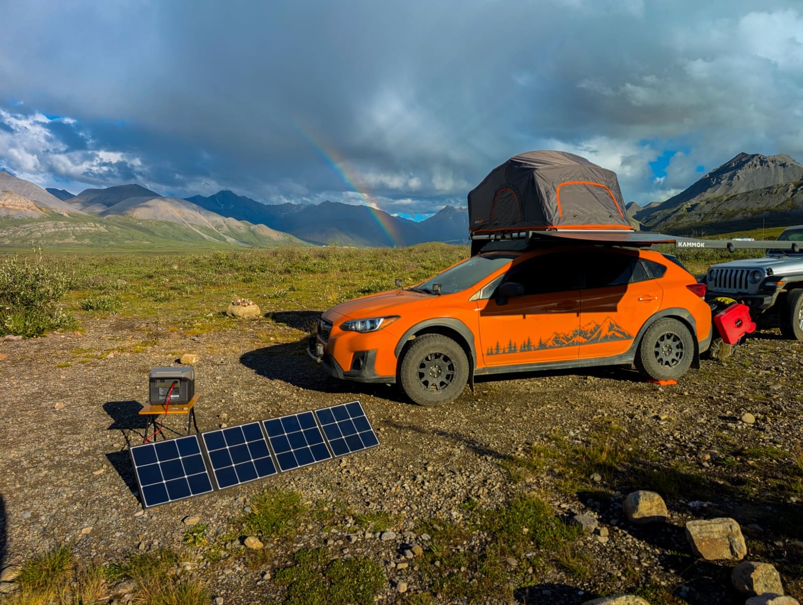
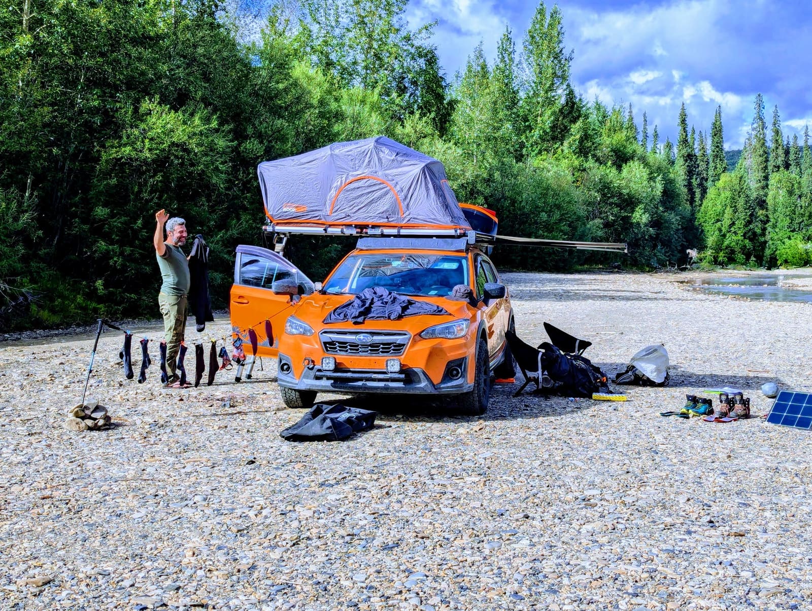
For overnight options beyond Coldfoot Camp's rooms, BLM-maintained campgrounds at Five Mile (Mile 60), the Arctic Circle (Mile 115), and Marion Creek (Mile 180) are all free or low-cost and let you wake up under the midnight sun. Our Dalton Highway camping guide breaks down each site, vehicle requirements, and the standout Galbraith Lake spot just past Atigun Pass.
Want a custom itinerary built for your trip? We'll plan your entire Alaska road trip around your dates, budget, and interests. Get your custom itinerary →
Coldfoot to Atigun Pass (120 Miles)
North of Coldfoot, the road enters the Brooks Range, and the scenery becomes truly extraordinary. The forest thins and gives way to alpine tundra as you climb toward Atigun Pass.
Wiseman, a tiny historic mining community three miles off the highway at Mile 189, is worth a short detour. A handful of residents live here year-round in log cabins, and the setting among the peaks of the Brooks Range is stunning.
The climb to Atigun Pass is the most dramatic section of the drive. The road switchbacks up through narrow valleys with mountain walls rising on both sides. At 4,739 feet, Atigun Pass is the highest highway pass in Alaska. Snow can be present here even in July. The descent down the north side is steep, with grades up to 12%, and can be challenging in wet conditions.
Atigun Pass to Deadhorse (170 Miles)
Once over the Brooks Range, the landscape transforms completely. The trees vanish, and you enter the Arctic Coastal Plain: flat, treeless tundra stretching to the horizon in every direction. In summer, this tundra is alive with wildflowers, nesting birds, and caribou. The road is often straight for miles at a time across this section.
The last fuel stop before Deadhorse is Coldfoot, 239 miles behind you. This is the longest fuel gap on any public road in the United States. Do not run short.
Deadhorse itself is an industrial camp, not a town. There are no public services in the traditional sense. A few operations cater to tourists with lodging, meals, and most importantly, guided shuttle trips to the Arctic Ocean (you cannot drive to the shore yourself, as it is within the Prudhoe Bay oil field and requires a shuttle tour). Book your Arctic Ocean tour in advance during peak season.
Fuel Planning
Fuel logistics are the single most important planning element for the Dalton Highway. Here is what you need to know:
- Yukon River (Mile 56): Last fuel before Coldfoot. Fill up completely.
- Coldfoot (Mile 175): The only mid-highway fuel stop. Fill up and top off your spare containers.
- Deadhorse (Mile 414): Fuel available at the Tesoro station in Deadhorse. Expensive but available.
The longest gap without fuel is the 239-mile stretch from Coldfoot to Deadhorse. Most vehicles need at least 8-10 gallons for this distance, more in poor road conditions. Carry extra fuel. For broader Alaska fuel planning, see our fuel planning guide.
When to Drive the Dalton Highway
The Dalton Highway is open year-round, but tourist travel is practical only from mid-June through early September. This window offers:
- The best road conditions (frozen ground has thawed, roads are graded)
- Services open at Coldfoot and Deadhorse
- Nearly 24 hours of daylight in June and early July
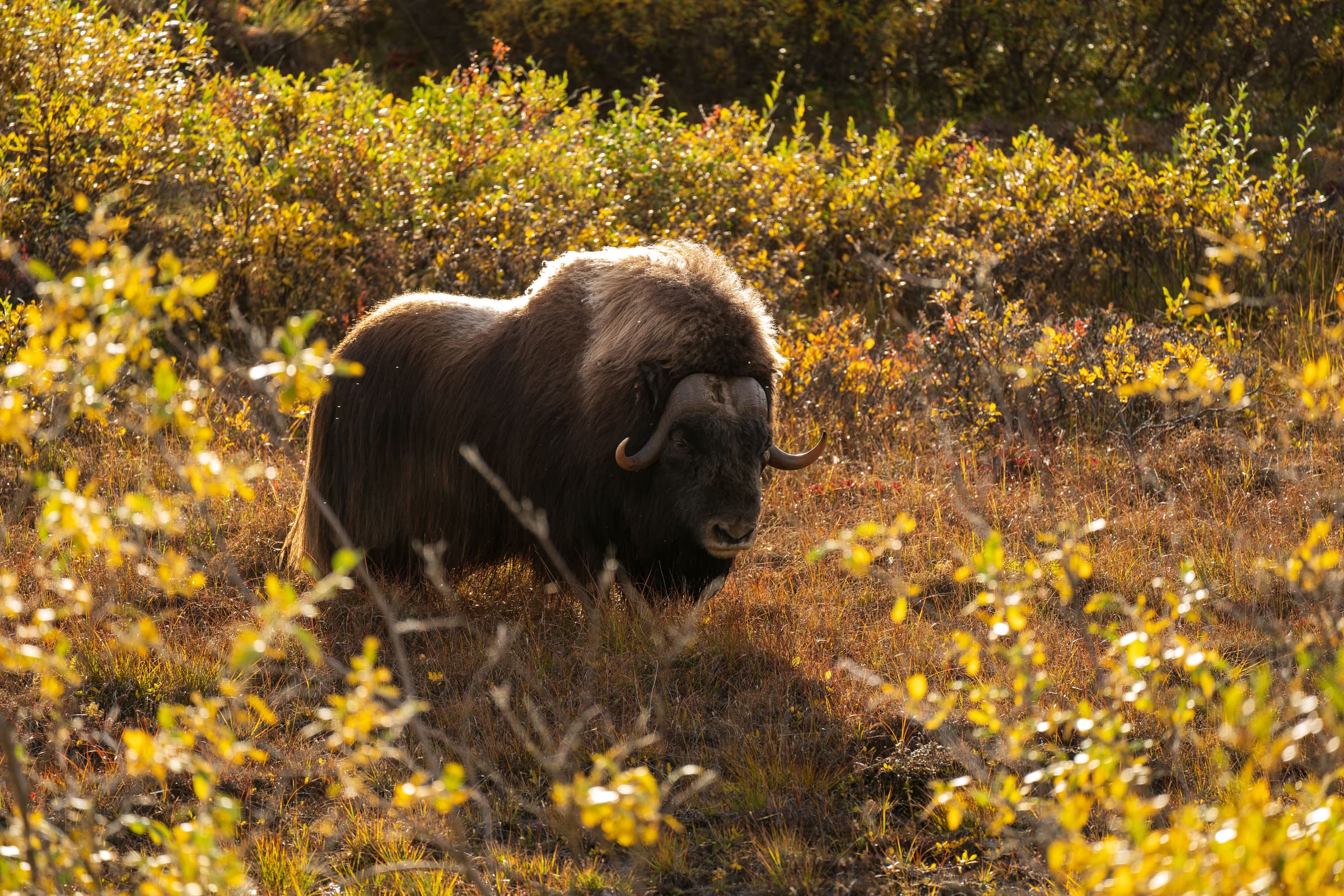
- Wildlife activity (caribou, muskox, grizzly bears, arctic foxes)
Late August and early September bring fall colors to the Brooks Range and the chance to see the northern lights, but daylight hours are shorter and weather can be unpredictable.
Wildlife on the Dalton
The Dalton Highway crosses the migration route of the Western Arctic caribou herd, one of the largest caribou herds in North America. In late summer, you may see thousands of caribou streaming across the tundra. Grizzly bears are common throughout the route, especially in the Brooks Range. Muskox are occasionally spotted on the North Slope near Deadhorse. Review our wildlife safety tips before heading out.
Rental Car Restrictions
Most rental car companies in Alaska explicitly prohibit driving the Dalton Highway. If you drive a standard rental car on the Dalton and damage it, you will be responsible for all costs, including towing (which from the middle of the Dalton can exceed $5,000). A few specialty companies in Fairbanks offer vehicles permitted for the Dalton, typically trucks or SUVs with extra insurance coverage. Expect to pay a premium.
How Many Days Do You Need?
A minimum of three days is recommended: one day driving north, one day at Deadhorse (including the Arctic Ocean shuttle tour), and one day driving south. Four or five days is better, allowing time to explore the Brooks Range, stop for wildlife, and avoid the fatigue of 10+ hours of challenging driving in a single day.
A sample itinerary:
- Day 1: Fairbanks to Coldfoot (250 miles, 6-8 hours)
- Day 2: Coldfoot to Deadhorse (240 miles, 6-8 hours), evening Arctic Ocean tour
- Day 3: Deadhorse to Coldfoot (240 miles, 6-8 hours)
- Day 4: Coldfoot to Fairbanks (250 miles, 5-7 hours)
Is the Dalton Highway Worth It?
If you are the kind of traveler who craves genuine adventure and wild places, yes. The Dalton Highway is demanding, dusty, and occasionally nerve-wracking. But standing at the Arctic Ocean, having driven across the Brooks Range and the vast tundra to get there, is a feeling few roads on Earth can deliver. Just come prepared.
See a real Alaska itinerary before you spend a dollar
A real 3-day plan with driving times, lodging picks, and a daylight chart — free, in your inbox.
One email. No spam. Unsubscribe anytime. Or view it right now — no email needed ↗
Ready for the full plan? Get your custom itinerary — $197 · 5-day delivery →