Alaska is a land of unparalleled wilderness and adventure, but navigating its vast expanses requires a different approach than most places. Forget traditional street addresses; in the Last Frontier, "Mile 142.5" is often a more precise and useful location identifier than any street name. For anyone planning an unforgettable journey with Alaska Road Trip, understanding how to read Alaska mileposts is not just helpful—it's essential for safety, planning, and truly experiencing the state. Get ready to transform your Alaska road trip from a mere drive into an informed expedition.
The Foundation of Alaskan Navigation: Understanding the Milepost System
Unlike the grid systems or named roads found in most urban and suburban areas, much of Alaska's road network relies on a milepost system. This system is a direct response to the state's unique geography: vast distances, sparse population centers, and a landscape that often defies conventional mapping. Mileposts are small, numbered signs typically found on the side of the road, indicating the distance from a specific starting point.
What Are Mileposts and How Are They Numbered?
Mileposts are essentially roadside markers that count the distance along a particular highway. Each highway in Alaska has a designated "Mile 0" or starting point, from which all subsequent mile markers are measured. For example, on the Seward Highway, Mile 0 is typically considered to be in Anchorage, and the numbers increase as you drive south towards Seward. Conversely, on some highways, the numbering might start at a border crossing or a major junction. These markers are usually small, green or white signs with black numbers, often indicating whole miles, but sometimes you'll see smaller markers for half-mile or quarter-mile increments, especially near services or points of interest.
Why Alaska Relies on Mileposts
The primary reason Alaska relies so heavily on mileposts is the sheer lack of traditional street addresses outside of its few major cities. Many roads traverse hundreds of miles of undeveloped wilderness where there are no named streets, no intersections, and often no discernible landmarks for long stretches. Mileposts provide a consistent, universally understood method for pinpointing locations, whether you're looking for a specific campground, a scenic overlook, or trying to describe your position to a tow truck. This system is deeply ingrained in Alaskan culture and travel, making it indispensable for anyone venturing beyond city limits.
Historical Context and Why Older Guidebooks Rely on Them
The milepost system isn't new; it's been the backbone of Alaskan road travel for decades. Older guidebooks, some of which are still highly valued for their detailed descriptions of roadside attractions and services, almost exclusively use milepost references. Before GPS devices became ubiquitous, these guidebooks, like the venerable "The Milepost" guide, were the primary tools for travelers. They would list every gas station, lodge, fishing spot, and scenic pullout by its corresponding milepost number. Even in 2026, while GPS is invaluable, the milepost system continues to be a crucial and consistent way to refer to locations along Alaska's highways, especially when cell service is nonexistent. This historical reliance underscores the enduring importance of knowing how to read Alaska mileposts for any serious traveler.
Deciphering the Language of the Road: Common Milepost Markers and Signs
Beyond simply indicating distance, mileposts often serve as reference points for a variety of critical road signs and conditions. Understanding these signs in relation to the milepost system is crucial for safe and informed travel, particularly in Alaska's dynamic environment.
Standard Mile Markers and Their Variations
As mentioned, standard mile markers are your primary guide. They typically denote whole miles, but don't be surprised to see smaller signs indicating fractions of a mile (e.g., "M 142.5"). These fractional markers are particularly useful for pinpointing specific, often smaller, points of interest or turn-offs that might not have their own dedicated signage. Travelers should pay attention to the direction of travel relative to the increasing or decreasing numbers, as this can vary by highway.
Specific Hazard Signs in the Backcountry
Alaska's roads are often carved through rugged terrain, exposing drivers to unique hazards. Mileposts frequently serve as the reference point for these warnings. Here are some common hazard signs you'll encounter and what they mean:
- Rockfall/Falling Rock: Often seen in mountainous areas, these signs (sometimes accompanied by a "Next X Miles" plaque) warn of areas prone to rocks falling onto the roadway. Exercise extreme caution, reduce speed, and be prepared for sudden obstacles.
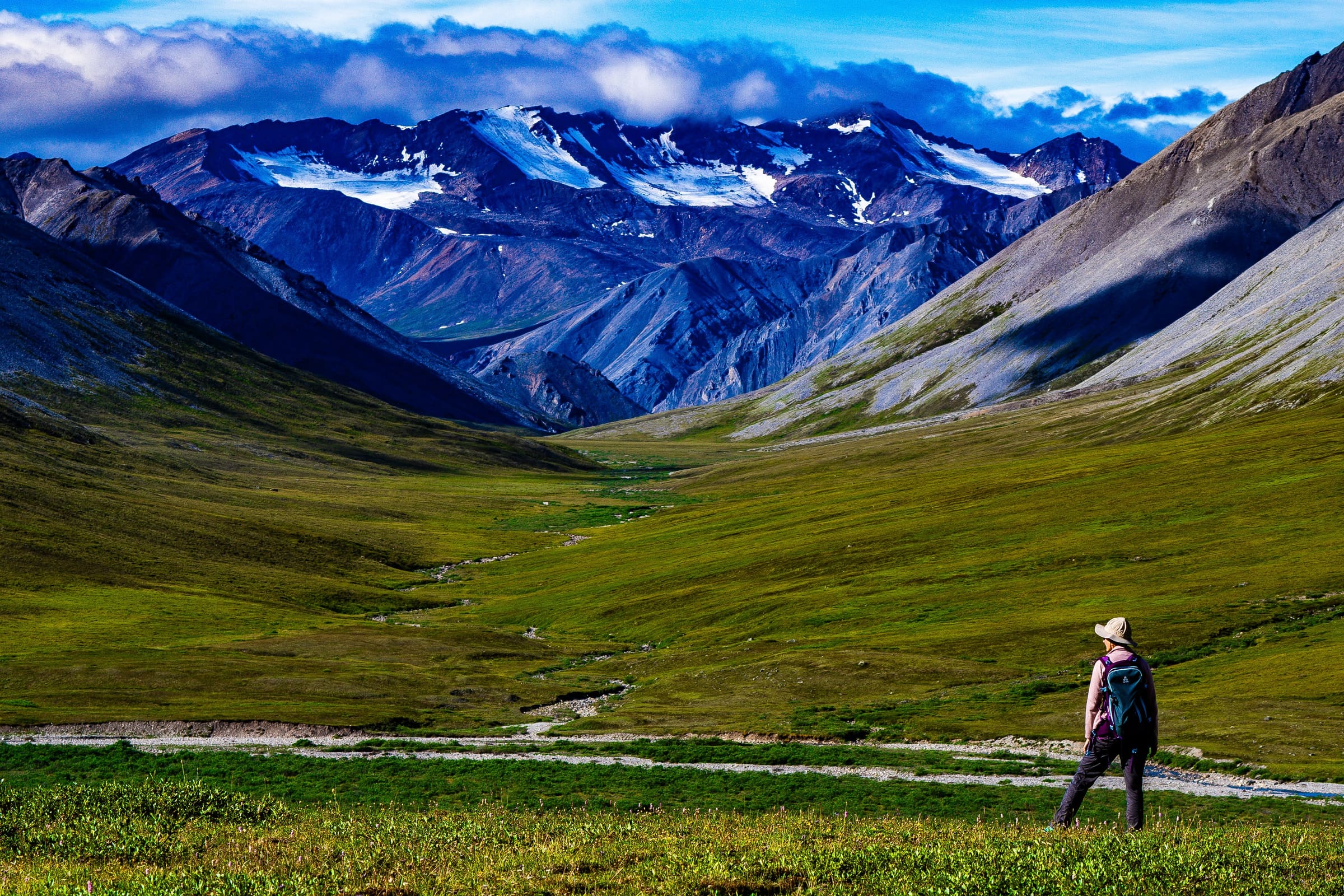
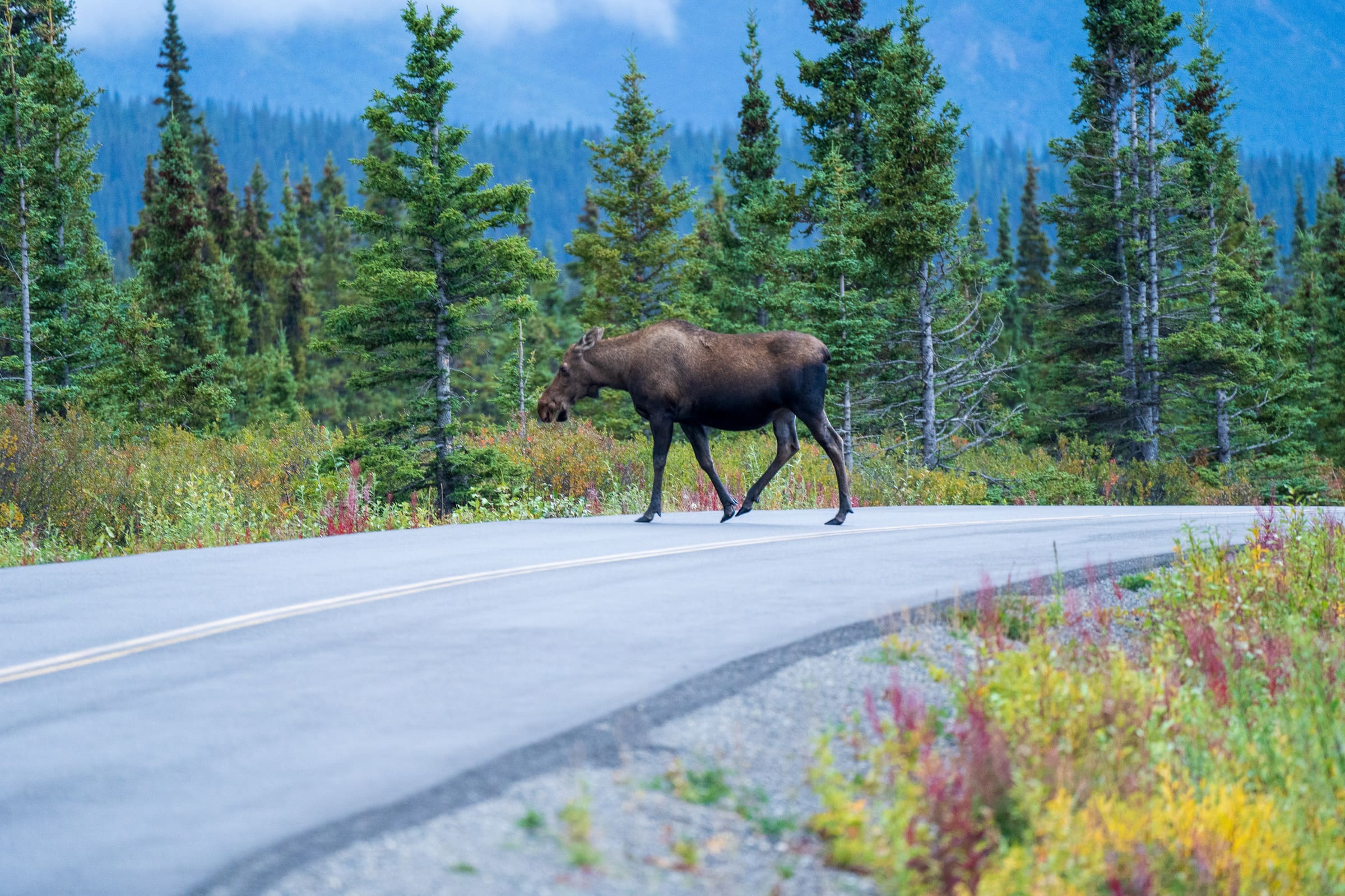
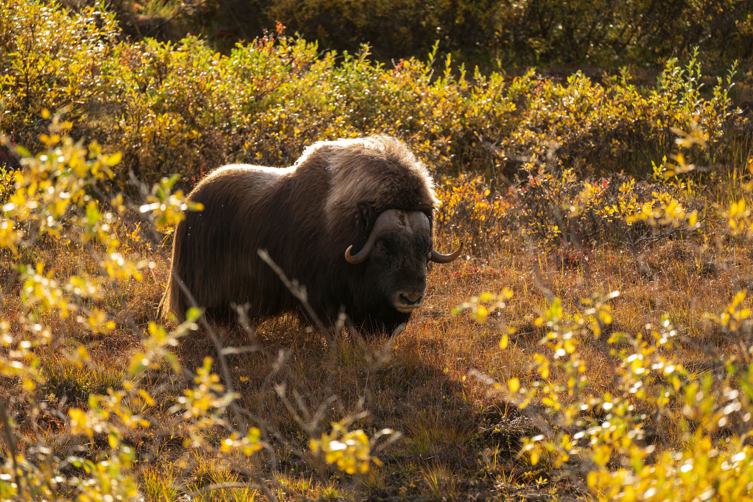
- Wildlife Crossing: Alaska is teeming with wildlife. Signs depicting moose, caribou, bears, or deer indicate areas where animals frequently cross the road. These are not suggestions; they are serious warnings. Be extra vigilant, especially at dawn and dusk. For more on staying safe and understanding wildlife behavior, consult resources from the Alaska Department of Fish and Game or our wildlife safety guide for Alaska.
- They can range from minor undulations to severe, vehicle-damaging potholes. Signs often warn "Rough Road" or "Frost Heaves Ahead." Slow down significantly to avoid damage to your vehicle and maintain control.
- Narrow Bridges/Single Lane: Many older or remote bridges in Alaska are narrow or even single-lane. Signs will indicate "One Lane Bridge" or "Narrow Bridge." Travelers should often yield to oncoming traffic if necessary and proceed with caution.
- Construction Zones: Road construction is a constant in Alaska during the warmer months, as crews race against the short summer season. Construction signs will indicate reduced speeds, flaggers, and potential delays. Travelers should often obey posted limits and flagger instructions for their safety and of the workers. Source: Dot Alaska source.
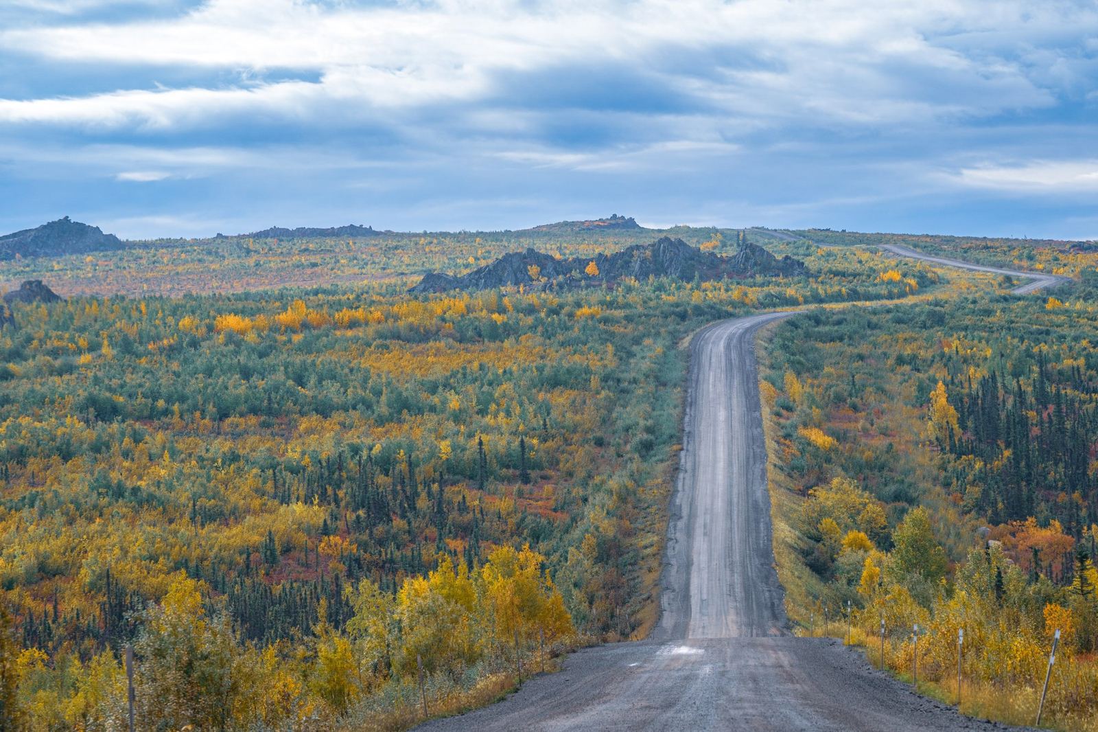
- Gravel Road/Unpaved: Many of Alaska's most scenic routes, or sections of major highways, are unpaved gravel. Signs will indicate the transition. Be prepared for dust, loose gravel, and reduced traction. Your speed should be significantly lower on gravel roads.
Seasonal Considerations and Road Conditions
The meaning and urgency of these signs can change dramatically with the seasons. A "Rockfall" sign in spring, after snowmelt, might indicate a higher risk than in late summer. Similarly, wildlife activity peaks at certain times of the year. Travelers should always check current road conditions before and during their trip. The Alaska Department of Transportation & Public Facilities (DOT&PF) provides up-to-date information on road closures, construction, and weather advisories, often referenced by milepost. You can find current road conditions and alerts on the Alaska DOT&PF website.
Beyond Navigation: Using Mileposts for Safety and Emergency Communication
While mileposts are excellent for finding your way, their utility extends far beyond simple navigation. In Alaska's vast and often remote landscapes, they become a critical tool for safety and emergency preparedness.
Communicating Your Location to Emergency Services
This is perhaps the most vital non-navigational use of mileposts. If you experience a breakdown, an accident, or a medical emergency in an area without cell service, your ability to accurately describe your location can be the difference between a swift response and a prolonged wait. Emergency responders, including the Alaska State Troopers, often utilize milepost numbers for location identification. When you do get a signal, or if you're able to use a satellite communicator, always provide the highway name and the nearest milepost number. For example, "I am on the Parks Highway, northbound, at Mile 147.5." This precision allows responders to locate you quickly and efficiently, even in the middle of nowhere.
Meeting Points and Rendezvous
Traveling with multiple vehicles or meeting up with friends in a remote area? Mileposts are the perfect rendezvous points. Instead of trying to describe a vague landmark, simply agree to meet at "Mile 98 of the Denali Highway" or "Mile 55 of the Seward Highway, at the pullout." This eliminates confusion and ensures everyone arrives at the correct location.
Tracking Progress and Planning Stops
For long drives, especially on routes like the Alaska Highway or the Dalton Highway, mileposts help you track your progress and manage expectations. You can easily see how far you've come and how much further you have to go to reach your next planned stop. This is particularly useful for fuel planning in Alaska, as gas stations can be few and far between. Knowing that the next fuel stop is at Mile 120 and you're currently at Mile 80 allows you to calculate if you have enough fuel or if you need to conserve. Similarly, you can plan rest stops, photo opportunities, or even overnight camping spots based on their milepost locations.
Understanding Itinerary Details from Alaska Road Trip
When you plan your adventure with Alaska Road Trip, our detailed itineraries often incorporate milepost references to guide you to specific attractions, lodging, or points of interest. This ensures that you can easily find everything outlined in your personalized plan, making your journey seamless and stress-free. Our expertise in Alaskan travel means we leverage the milepost system to provide you with the most accurate and practical directions possible.
Practical Application: Integrating Mileposts into Your Alaska Road Trip Planning
Now that you understand the "why" and "what" of mileposts, let's look at how to actively integrate them into your road trip planning for a smoother, safer, and more enjoyable experience.
Pre-Trip Research Using Mileposts
Before you even set foot in Alaska, you can use mileposts to your advantage. When researching attractions, campgrounds, or services, make a note of their milepost locations. Create a simple spreadsheet or a marked map that lists key points of interest along your chosen routes by their milepost number. This proactive approach will give you a clear mental picture of what to expect and where things are located. For comprehensive planning, consider Alaska Road Trip's travel itinerary planning services, where we incorporate these details into your custom itinerary.
Mapping Out Services (Gas, Lodging, Food)
This is perhaps the most critical planning aspect. On many Alaskan highways, services are scarce. Knowing that the next gas station is at Mile 100, and the next restaurant at Mile 150, allows you to make informed decisions about when to fill up, when to eat, and where to plan your overnight stays. Travelers should not assume services will be readily available; it's crucial to plan ahead using milepost information. This is especially true on longer, more remote stretches like the Dalton Highway or sections of the Alaska Highway.
The Role of Mileposts on Specific Highways
- Seward Highway (Anchorage to Seward): This scenic highway is well-traveled, but mileposts are still crucial for finding trailheads, scenic pullouts, and small towns like Girdwood or Portage.
- Parks Highway (Anchorage/Fairbanks to Denali National Park): Mileposts are essential for locating Denali National Park's entrance (Mile 237), various lodges, campgrounds, and services along this busy route.
- Dalton Highway (Fairbanks to Prudhoe Bay): On this extremely remote and challenging road, mileposts are your lifeline. Services are almost non-existent, and every single point of interest, from the Arctic Circle sign to the few available fuel stops, is referenced by milepost. Knowing these numbers is paramount for survival and planning.
- Alaska Highway: Originating in Dawson Creek, BC, and ending in Delta Junction, Alaska, this iconic highway's mileposts are fundamental for navigating its thousands of miles, especially through Canada where services can be sparse.
Using Mileposts with GPS and Digital Maps
While GPS and digital maps are invaluable, their reliability can be intermittent in Alaska's remote areas. Satellite signals can be intermittent in canyons or dense forests, and downloaded offline maps might not often have the most up-to-date information on small businesses or temporary closures. Mileposts provide a reliable, physical backup. Cross-reference your GPS with mile markers to confirm your location, especially if your GPS seems to be acting erratically. Many digital maps also allow you to search for points of interest by milepost number, bridging the gap between traditional and modern navigation.
Frequently Asked Questions
Are mileposts always accurate?
Generally, yes, mileposts are highly accurate for their intended purpose. They are maintained by the Alaska Department of Transportation & Public Facilities. However, minor discrepancies can occur over very long distances due to road realignments or resurfacing. For practical travel purposes, you can rely on them as precise location markers.
Do all Alaska roads have mileposts?
Most major state-maintained highways and many secondary roads in Alaska have mileposts. However, very small, local roads, city streets, or private access roads typically do not. Travelers can generally assume that if they're on a designated highway, mileposts will be present.
What if I don't see a milepost for a long time?
It's not uncommon for mileposts to be spaced out, especially in very remote areas or on long, straight stretches of road. If you haven't seen one in a while, don't panic. Keep an eye out. They can sometimes be obscured by vegetation or snow, or simply be further apart than you expect. If you're concerned, cross-reference with your GPS or a physical map to confirm you're on the correct route.
How do I find services using mileposts?
The best way is through pre-trip planning. Consult detailed Alaska travel guides, online resources, or your personalized Alaska Road Trip itinerary, which will often list services (gas, food, lodging, campgrounds) by their corresponding milepost numbers. Keep a list handy in your vehicle, especially for longer stretches between towns.
Conclusion: Master the Mileposts, Master Your Alaska Road Trip
Understanding how to read Alaska mileposts is more than just a navigational trick; it's a fundamental skill for anyone embarking on a road trip through the Last Frontier. From deciphering critical hazard warnings in the backcountry to providing precise location information during an emergency, mileposts are your silent, ever-present guide. By integrating this knowledge into your planning and on-the-road awareness, you'll unlock a deeper appreciation for Alaska's unique infrastructure and ensure a safer, more confident, and ultimately more rewarding adventure. Ready to explore Alaska with expert guidance? Let Alaska Road Trip craft your perfect itinerary, complete with all the essential details you'll need to navigate like a seasoned local. Contact us today to start planning your unforgettable 2026 journey!

See a real Alaska itinerary before you spend a dollar
A real 3-day plan with driving times, lodging picks, and a daylight chart — free, in your inbox.
One email. No spam. Unsubscribe anytime. Or view it right now — no email needed ↗
Ready for the full plan? Get your custom itinerary — $197 · 5-day delivery →