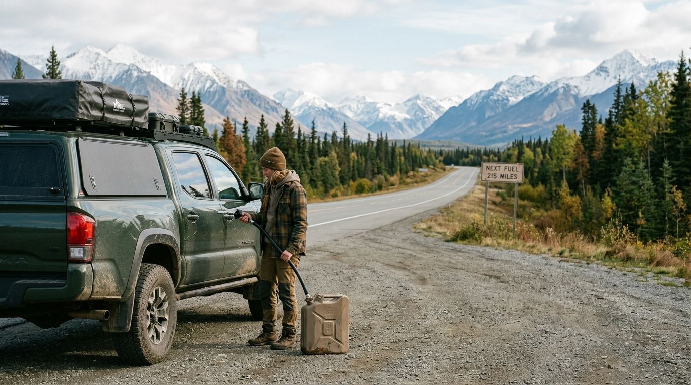
Planning your route around reliable alaska road trip fuel stops is the difference between an unforgettable wilderness journey and an expensive emergency tow with zero cellular reception. Across the Last Frontier, distances between operational service stations frequently exceed 100 to 240 miles, making spontaneous fill-ups an impossible luxury for self-drive travelers.
Whether you are renting a compact SUV in Anchorage, piloting a 30-foot Class C motorhome through interior mountain passes, or pulling a travel trailer along the highway corridors, fuel logistics require deliberate preparation. Operating hours change without notice, rural pumps run dry waiting for weekly tanker deliveries, and satellite card terminals regularly drop offline. This comprehensive 2026 guide breaks down the critical pump corridors, seasonal fuel gaps, diesel considerations, and range calculations you need to navigate Alaska safely.
The Golden Rule of the Last Frontier: Why the Half-Tank Mark is Your New Empty
In the lower 48 states, dropping below a quarter of a tank is rarely a crisis. Interstate exits feature illuminated signs advertising clusters of competing 24-hour service plazas every ten to fifteen miles. In Alaska, operating under that mindset will leave you stranded on a gravel shoulder in grizzly habitat.
The geographic reality of driving in Alaska is defined by immense, uninhabited gaps. Services along secondary routes and even primary state highways are clustered only in small trading posts, historic roadhouses, or native villages separated by vast sub-arctic wilderness. A marked town on a standard map might turn out to be nothing more than an unmanned airstrip, a closed seasonal lodge, and a private residence with no public services.
Furthermore, remote stations operate under severe logistical constraints. Unlike urban centers connected to continuous pipeline distribution, rural Alaska stations depend on long-haul tanker trucks dispatched from marine terminals in Valdez, Seward, or rail hubs in Anchorage and Fairbanks. If frost heaves, washouts, or seasonal road construction delay a tanker run, a rural outpost can run completely dry of 87-octane unleaded or diesel fuel for 48 hours at a time. Mechanical failure of single-pump stations is equally common; when an isolated dispenser breaks down, replacement parts may take days to arrive via bush plane.
For every self-drive traveler, the foundational rule is non-negotiable: treat the half-tank mark as your absolute empty. Whenever your fuel gauge touches the halfway point and you pass an operational pump, pull in and top off your tank. Eliminating range anxiety early prevents stressful decisions later in the day when scheduled stops turn out to be shuttered, unpowered, or out of fuel.
Critical Alaska Road Trip Fuel Stops by Major Highway Corridor
Navigating the state's paved highway network requires identifying the anchor towns where fuel is guaranteed, alongside the intermediate outpost pumps that bridge long gaps. If you are outlining your route alongside a seasonal travel timeline, use the corridor breakdowns below to anchor your daily driving legs.
Parks Highway (Route 3): Anchorage to Fairbanks
Connecting Alaska’s two largest population centers, the George Parks Highway is heavily traveled, yet it still features deceptive gaps—particularly around Denali National Park and Preserve. Leaving Anchorage and the Matanuska-Susitna Valley hubs of Wasilla and Houston, fuel is dense. However, past the Talkeetna Spur junction (Mile 98.7 at Sunshine), services thin rapidly.
- Sunshine / Talkeetna Junction (Mile 98.7): The last major multi-pump stations before a long climb north. Fuel here if you plan to detour 14 miles down the spur into Talkeetna.
- Cantwell (Mile 210): Located at the western terminus of the gravel Denali Highway. Cantwell features reliable pumps and serves as an indispensable stop if you are heading north toward the park or striking east into the interior.
- Denali Canyon / Glitter Gulch (Mile 238): Seasonal convenience stores and pumps operate just outside the park entrance from late May through mid-September. Expect pump prices to run noticeably higher per gallon than in Anchorage. For regional infrastructure and access updates, check the National Park Service Denali current conditions before setting out.
- Healy (Mile 248): Just ten miles north of the park entrance, Healy is a year-round service community offering more competitive commercial pricing, standard diesel, and card-lock pumps.
- Nenana (Mile 304): The final major fuel depot before reaching the outskirts of Fairbanks.
Alaska Highway Connections: Tok to Delta Junction
The final stretch of the historic route brings travelers through rugged eastern interior plains. Drivers relying on gas stations on alaska highway corridors should mark Tok and Delta Junction as their primary fuel bases.
- Tok (Mile 1314): The trade crossroads of eastern Alaska, where the Alaska Highway intersects the Glenn Highway (Tok Cut-Off). Multiple full-service stations, commercial card-locks, and convenience stores operate here. It is the most critical fuel junction before venturing north to Delta Junction or south toward Glennallen.
- Delta Junction (Mile 1422): The official end of the Alaska Highway and junction with the Richardson Highway. Large truck stops here provide reliable diesel, DEF, and 87-octane. Between Tok and Delta Junction, independent roadhouses exist, but their shoulder-season operating dates can be erratic.
Glenn Highway & Richardson Highway: Palmer, Glennallen, and Valdez
Traversing the Matanuska Valley through the Chugach and Wrangell ranges requires mindful monitoring. After leaving Palmer, you will ascend toward Eureka Summit (elevation 3,322 feet). The fuel stretch between Sutton (Mile 61) and Glennallen (Mile 187) spans 126 miles of mountainous elevation gain.
- Eureka Lodge (Mile 128): Situated near the summit, this historic outpost offers emergency fuel, basic supplies, and diner food. Hours vary outside the core summer window, and prices reflect the remote mountain location.
- Glennallen (Mile 187): The central hub connecting the Glenn and Richardson Highways. The town features two large gas stations with commercial diesel, making it the mandatory fill-up point whether you are heading north toward Tok or south toward Valdez.
- Tonsina and Kenny Lake: Small, intermittent pumps operate near the turnoffs for the Edgerton Highway and Chitina (the gateway to Wrangell-St. Elias). rarely bypass Glennallen assuming Chitina will have fuel available.
- Thompson Pass to Valdez: No fuel exists over the steep grade of Thompson Pass until you enter the coastal terminal city of Valdez at the southern end of Route 4.
Kenai Peninsula: Seward and Sterling Highways
Travelers exploring south of Anchorage on the Seward Highway corridor face heavy weekend recreational traffic, which can cause long queues at single-lane dispensers.
- Girdwood (Mile 90): The last reliable fuel station before rounding Turnagain Arm and climbing through Turnagain Pass.
- Tern Lake / Moose Pass (Mile 37-29 of Seward Hwy): Modest fuel stops operate seasonally near the junction of the Sterling Highway, but queues can be lengthy during the July salmon run.
- Cooper Landing (Mile 48, Sterling Hwy): Several seasonal stations serve anglers along the Kenai River.
- Soldotna and Kenai: Massive commercial hubs offering competitive pricing, multiple wholesale clubs, and unlimited fuel access.
- Homer (Mile 172, Sterling Hwy): The end of the road on the southern Kenai Peninsula, featuring extensive automotive services and marine diesel at the spit.
Extreme Gaps: Fuel Strategy for the Dalton, Denali, and Top of the World Highways
Venturing onto Alaska's remote gravel highways requires specialized remote alaska fuel planning. On these corridors, fuel depots are not conveniences; they are survival waypoints managed under severe operational conditions.
| Highway Corridor | Longest Gap Between Fuel | Surface Type | Primary Risk Factors |
|---|---|---|---|
| Dalton Highway (Route 11) | 240 miles (Coldfoot to Deadhorse) | Gravel, chip-seal, dirt | Industrial truck traffic, zero services, Atigun Pass grade |
| Denali Highway (Route 8) | 135 miles (Cantwell to Paxson) | Unpaved, washboard gravel | Lodge pumps require cash/generator power; card failures |
| Top of the World Highway | 108 miles (Dawson City to Chicken/Tok) | Narrow dirt, chip-seal | International border operating windows; steep climbs |
The Dalton Highway (Route 11)
The haul road running 414 miles from north of Fairbanks to Deadhorse on the Arctic Ocean contains the longest fuel desert in North America. After fueling in Fox or the Hilltop Truck Stop outside Fairbanks, your next reliable pump is at the Yukon River Camp (Mile 56). From there, you can fuel at Coldfoot Camp (Mile 175).
North of Coldfoot, you enter a 240-mile desolate stretch crossing the Brooks Range and the continental divide at Atigun Pass (elevation 4,739 feet) before reaching Deadhorse. There are zero public services, tow trucks, or emergency call boxes between Coldfoot and Deadhorse. Official road guidelines published by the Bureau of Land Management Dalton Highway Visitor Guide stress that drivers must maintain a minimum range of 250 to 300 miles under severe load conditions to clear this gap safely.
The Denali Highway (Route 8)
Spanning 135 miles between Paxson on the Richardson Highway and Cantwell on the Parks Highway, Route 8 is a rough, unpaved wilderness road. While rustic lodges such as Clearwater Mountain Lodge and Maclaren River Lodge maintain private above-ground tanks for guests and passing motorists, their fuel is brought in by seasonal contractors. Pumps operate on private generator systems, and card transactions rely on intermittent satellite internet. rarely embark on the Denali Highway without filling your tank to the brim in Cantwell or Glennallen/Delta Junction before beginning the crossing.
Top of the World Highway (Route 9)
Connecting Dawson City in Yukon, Canada, with Tok via the border crossing at Poker Creek, this high-ridge gravel highway spans roughly 108 miles of alpine tundra. Fuel is available in Dawson City and intermittently at the historic gold-mining settlement of Chicken, Alaska. However, the Chicken pumps operate strictly within seasonal tourist windows (typically Memorial Day to mid-September) during daytime retail hours. Factor in the strict operating schedule of the international border crossing, which closes nightly.
Carrying Spare Fuel Cans: Rules and Realities
Many travelers assume the easiest insurance against remote gaps is strapping two five-gallon plastic fuel jugs to their bumper. While common among outfitted local overland rigs, commercial car and RV rental contracts universally prohibit the transport of volatile fuel containers inside passenger compartments or storage bays. Spilling gasoline inside an enclosed trunk or SUV cargo hold causes severe vapor hazards and will result in catastrophic cleaning fees. Unless your vehicle features exterior, lockable, DOT-approved jerry-can mounts, plan your route so your onboard fuel tank handles the gaps independently.
Diesel Availability Alaska Road Trippers Must Know for Trucks and RVs
Managing a diesel engine in the sub-arctic introduces logistical variables that gas drivers rarely encounter. Tracking accurate diesel availability is vital when commanding modern heavy-duty platforms.
While standard 87-octane unleaded is universal at every functioning pump across the state, #2 ultra-low-sulfur diesel is not. Remote outposts with only one or two storage tanks often dedicate their entire capacity to regular gasoline and heating fuel, skipping retail automotive diesel entirely.
Diesel Exhaust Fluid (DEF) Bottlenecks
Modern turbo-diesel trucks and Class C motorhomes built after 2010 require Diesel Exhaust Fluid (DEF) to run. If your DEF tank runs dry, modern engine control modules will force the vehicle into limp-mode, capping road speeds at 5 mph—a disastrous scenario on a one-lane gravel highway with haul trucks barreling behind you. While major hubs like Anchorage, Fairbanks, Soldotna, and Glennallen sell DEF at bulk pump dispensers or by the 2.5-gallon jug at auto parts retailers, remote outposts rarely stock it. Buy a sealed 2.5-gallon container of DEF in Anchorage or Fairbanks and keep it stowed safely in your vehicle throughout the trip.
Seasonal Blends and Waxing
If your journey takes place during shoulder seasons (late April to mid-May or late September to October), pay attention to fuel temperature ratings. Sub-freezing interior temperatures cause standard #2 diesel to paraffin wax, clogging fuel filters and starving injectors. Alaska fuel suppliers transition to winterized diesel blends (often blended with #1 diesel or anti-gel additives) in early autumn. When renting a diesel rig late in the season, confirm with your rental provider whether fuel anti-gel conditioners are permitted or provided.
The RV Weight Penalty
Towing a travel trailer or piloting a cab-over motorhome radically reduces fuel economy when tackling northern topography. Climbs like Keystone Canyon, Hurricane Gulch, and the ascent from Turnagain Arm up Turnagain Pass will drop an RV getting 10 mpg on flat ground down to 5 or 6 mpg. Couple this increased burn rate with persistent coastal head-winds along Turnagain Arm or Cook Inlet, and your usable range can decline by 35% in a single afternoon. If you are debating platform options, review our breakdown of choosing an RV rental versus a standard passenger car to understand these structural operating trade-offs.
Operating Realities: Hours, Automated Pumps, and Payment Pitfalls off the Grid
Modern travelers have grown accustomed to illuminated digital card readers operating 24 hours a day, 365 days a year. Across rural Alaska, fuel infrastructure functions under very different rules.
Most remote roadhouse pumps are tied to the retail shop's physical operating hours. It is common for rural stations to lock their pump handles at 7:00 PM or 8:00 PM sharp, leaving stranded motorists to sleep in their vehicles until staff arrive at 8:00 AM. Even in peak summer months, 24-hour cardlock pumps exist primarily along major freight arteries (the Parks and Richardson corridors) and urban areas.
Payment systems in the bush present another critical vulnerability. Automated card readers require reliable satellite or cellular uplink to process merchant authorizations. During frequent telecom dropouts, cloud cover disruptions, or local generator power swaps, digital card readers drop offline. If the pump cannot ping its merchant bank, the dispenser handle remains disabled.
Because of these regular electronic failures, often carry emergency physical cash broken into small denominations (a measurable budget and a measurable budget bills). When telecom links go down, roadhouse operators will frequently switch their pumps to manual overrides and accept cash payments, whereas cashless travelers are left parked at the fence.
Finally, exercise extreme caution when checking operating status on mobile mapping applications. Crowdsourced navigation apps routinely list abandoned roadhouses, defunct trading posts, and seasonal lodges closed for years as "Open 24 Hours." Relying on unverified pins on a smartphone map while driving through isolated regions is one of the most common causes of preventable highway stranding. Always confirm road conditions through official state monitoring via the Alaska Department of Transportation 511 system rather than trusting algorithmic travel platforms.
Calculating Vehicle Range: How Weather, Grades, and Speeds Drain Fuel Faster
The fuel economy estimates stamped on your rental vehicle's window sticker were calculated under ideal, flat, temperate conditions. Alaska driving conditions systematically reduce those baseline ratings.
Sub-Arctic Driving Physics
Several regional factors degrade vehicle range simultaneously:
- Unpaved Gravel Friction: Driving on loose gravel surfaces like the Denali or McCarthy Highways dramatically increases rolling resistance compared to smooth asphalt. Your engine works continuously harder to maintain 35 to 45 mph.
- Sub-Arctic Ambient Air Density: Cooler air temperatures increase aerodynamic drag, while cooler drivetrain lubricants create higher parasitic mechanical resistance in wheel bearings, differentials, and transfer cases.
- Mountain Passes: Climbing sustained grades across the Alaska Range, Chugach Mountains, or Kenai Mountains burns through fuel reserves at twice your typical baseline rate.
- Construction Zones and Pilot Cars: Extensive summer road work seasons mean prolonged idling periods waiting for single-lane pilot cars, burning fuel without generating odometer miles.
To safely calculate your range between remote waypoints, apply the Usable Capacity Formula:
Safe Usable Range = (Fuel Tank Capacity in Gallons) x (Conservative Highway MPG) x 0.70
The remaining 30% acts as your buffer against mandatory detours, unanticipated construction idling, sudden weather fronts, or needing to backtrack around seasonal road closures. To explore full vehicle cost profiles across a complete itinerary, consult our Alaska road trip financial budget breakdown.
Mapping Alaska Road Trip Fuel Stops Without DIY Planning Headaches
Spending forty hours cross-referencing out-of-print highway milepost logs, checking internet forums for outdated roadhouse operating hours, and guessing whether a seasonal lodge in Cantwell or Eureka still sells diesel is exhausting. When planning a northern vacation, guessing wrong about logistics does not just cost money—it costs precious vacation days spent waiting on gravel shoulders for an emergency tow truck.
Eliminating those headaches is why smart travelers work directly with a dedicated route expert. Alaska Road Trip provides a custom day-by-day Alaska road-trip itinerary, hand-built by a named founder who has driven thousands of Alaska miles across multiple seasons. Rather than relying on generic AI scrapers or unverified internet forums, your driving plan is built around realistic driving speeds, validated service hubs, and seasonal waypoints.
Itineraries reflect current-season research at the time they are built, including active infrastructure realities such as the 2026 Denali Park Road mile 43 closure. The service operates on transparent, simple pricing: a flat one-time fee of a measurable budget for Lite (1–5 days), a measurable budget for Standard (up to 14 days), and a measurable budget for Plus (15+ days), while the Concierge tier (a measurable budget) adds a 30-minute live founder call. Alaska Road Trip is a one-time flat fee, not a subscription—there are no recurring charges.
Every itinerary is delivered in 3 to 5 business days as a printable, offline-ready PDF with 1 to 2 revision rounds, guaranteeing your navigation maps and fuel markers remain accessible when driving through cellular dead zones. Furthermore, Alaska Road Trip hand-picks lodging and gives you direct booking links, but you book it yourself—it does not make reservations on your behalf, so you keep full control and flexibility over your reservations. In the same way, Alaska Road Trip recommends activities and tours with timing and booking links; you reserve them yourself, and Alaska Road Trip does not book flights or rental cars; you arrange those independently. Every plan is backed by a published 14-day money-back guarantee with a full refund, no questions asked.
If you are debating between tackling route logistics alone or getting professional guidance, learn more by exploring our detailed trip planning options.
Essential Packing and Route Checklist for Remote Driving Confidence
Before turning the key each morning, a quick five-minute operational check will preserve your safety throughout remote transit legs.
Vehicle Equipment Checklist
- 12-Volt Portable Tire Inflator: Remote pump stations often lack public compressed air lines, or their air lines are broken. A compact 12V direct-to-battery compressor ensures you can air back up after rough gravel roads.
- Tire Plug Kit and Full-Size Spare: Confirm your rental car or truck contains an actual inflated spare tire and operating jack, not merely a temporary can of aerosol sealant.
- Microfiber Towel or Rag: Alaska highway dust, calcium chloride road treatments, and mud quickly cake over pump displays, fuel filler doors, and backup cameras. Keeping a clean rag handy prevents abrasive road grit from falling into your fuel tank neck during fill-ups.
- Physical Highway Map: A laminated, paper map of Alaska rarely loses battery power or satellite signal when your digital phone navigation crashes.
Communication Essentials
- Two-Way Satellite Messenger: A satellite communicator (such as a Garmin inReach or ZOLEO device) allows you to transmit SOS distress beacons or text roadside dispatchers regardless of zero cellular coverage.
- Downloaded Offline Maps: Download Google Maps or Maps.me regions directly to your device storage before departing your hotel in Anchorage or Fairbanks.
The Morning Departure Protocol
- Inspect tire tread conditions and verify cold pressure visually.
- Check fuel levels; rarely depart a major accommodation hub with less than a full tank.
- Verify your physical cash stash contains adequate emergency funds in small bills.
- Confirm current highway alerts, construction pilot car delays, and pass conditions on the state 511 system.
- Identify your primary and secondary mid-day fuel targets along that day's specific driving segment.
Frequently Asked Questions
How far can you drive in Alaska without seeing a gas station?
On primary paved routes, the longest fuel gaps typically run between 80 and 130 miles (such as along the Glenn Highway between Palmer and Glennallen). However, on remote northern and unpaved corridors, the gaps expand dramatically. The Dalton Highway contains a 240-mile desolate stretch between Coldfoot and Deadhorse with zero retail facilities, and the gravel Denali Highway features a 135-mile gap between Cantwell and Paxson where intermediate lodge pumps are subject to seasonal and operational closures.
Do gas stations in rural Alaska stay open 24 hours?
No. Outside of primary urban hubs like Anchorage, Fairbanks, Wasilla, and Kenai/Soldotna, most rural highway gas stations and roadhouses are family-run operations that close by 7:00 PM or 8:00 PM. While some locations offer automated cardlock pumps accessible overnight, these pumps rely on satellite uplinks that regularly fail during weather disruptions or telecom outages. rarely plan an itinerary assuming overnight fuel access will be available in small communities.
Is diesel fuel widely available across all Alaska highways?
Standard #2 ultra-low-sulfur diesel is widely stocked along major freight corridors like the Parks Highway (Route 3) and Richardson Highway (Route 4). However, remote roadhouses and smaller seasonal communities frequently stock only standard 87-octane gasoline. Furthermore, Diesel Exhaust Fluid (DEF) is rarely stocked in remote trading posts, meaning drivers of modern turbo-diesel vehicles should carry an extra 2.5-gallon jug of DEF purchased in major cities.
Can you carry spare fuel cans in an Alaska rental car or RV?
Almost all commercial rental vehicle agreements strictly forbid transporting portable fuel containers inside passenger cabins, trunks, or internal RV storage compartments due to severe fire, vapor, and spill hazards. Unless your personal or overland-equipped rental vehicle features certified, external, lockable jerry-can mounts, you should not carry spare gasoline. Instead, manage fuel safety by adhering strictly to the half-tank fill-up rule.
How much more does gasoline cost in remote Alaska roadhouses compared to Anchorage?
Because remote stations must truck in their supply over hundreds of miles of frost-damaged highways, pump prices at interior roadhouses and Arctic stations run noticeably higher per gallon than pump prices in Anchorage or Fairbanks. During peak summer travel, remote stations along the Dalton Highway or inside small interior junctions reflect substantial surcharges to cover hazardous hauling logistics.
Ready to explore Alaska without the stress of guessing where your next fill-up will be? Let an experienced local handle the route logistics. Order your custom day-by-day Alaska Road Trip itinerary for a flat one-time fee, delivered as an offline-ready PDF backed by a 14-day money-back guarantee.

See a real Alaska itinerary before you spend a dollar
A real 3-day plan with driving times, lodging picks, and a daylight chart — free, in your inbox.
One email. No spam. Unsubscribe anytime. Or view it right now — no email needed ↗
Ready for the full plan? Get your custom itinerary — from $197 · 5-day delivery →