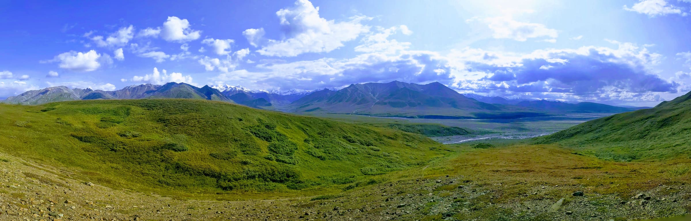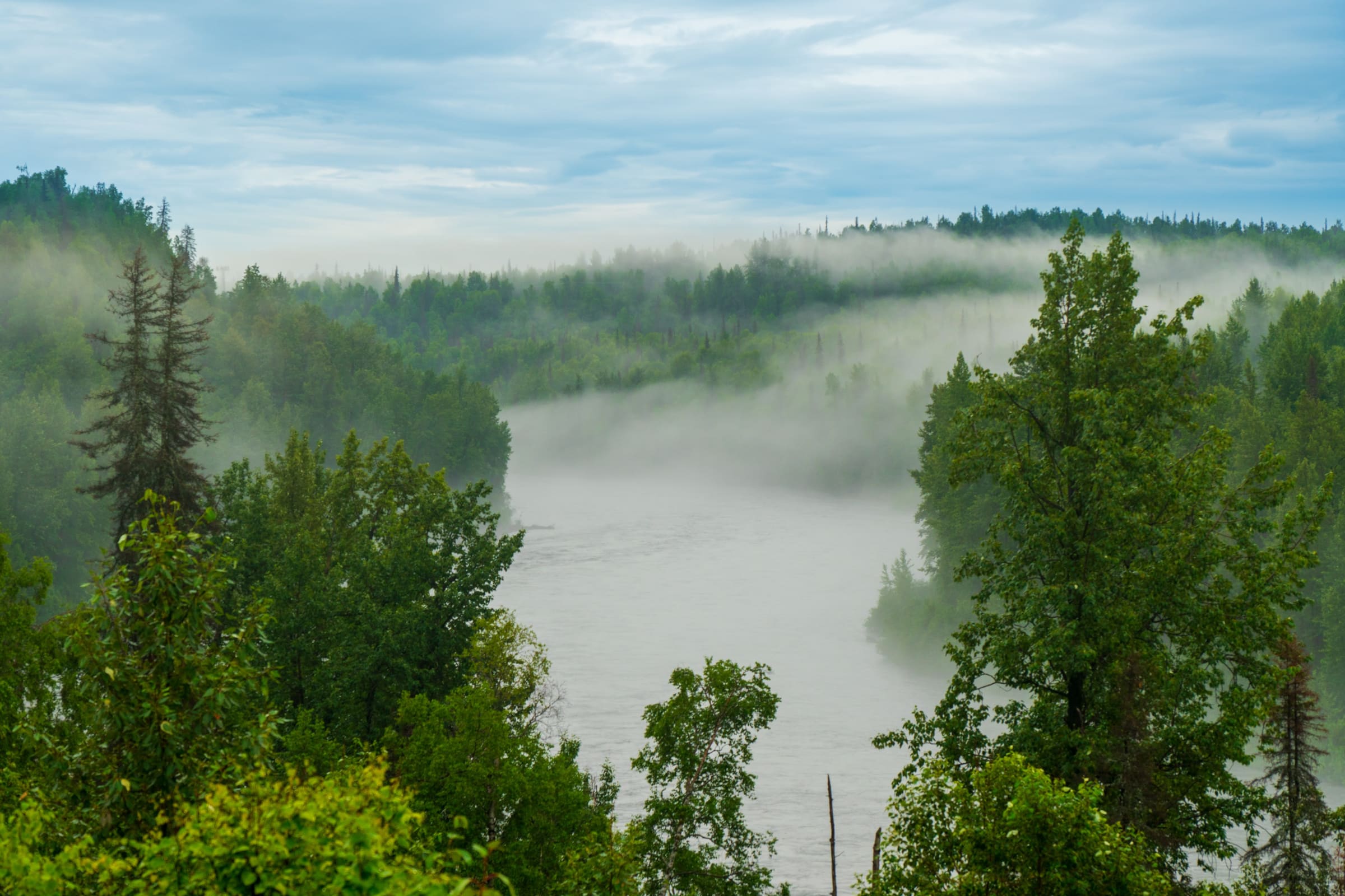
Skip the bumper-to-bumper tourist traffic on the main highways. While most visitors to the Last Frontier flock to the standard, well-trodden tour-bus routes of the Kenai Peninsula or the Parks Highway, Hatcher Pass offers dramatic, high-alpine tundra driving that feels completely disconnected from the crowds. Nestled in the breathtaking Talkeetna Mountains between the towns of Palmer and Willow, this mountain pass is a paradise of jagged peaks, vibrant wildflowers, and rich gold-rush history. For more regional information, you can consult the official Travel Alaska visitor portal. Whether you are planning a rugged mountain detour or a scenic day trip from Anchorage, this comprehensive hatcher pass driving guide will help you navigate this spectacular destination safely and confidently in 2026.
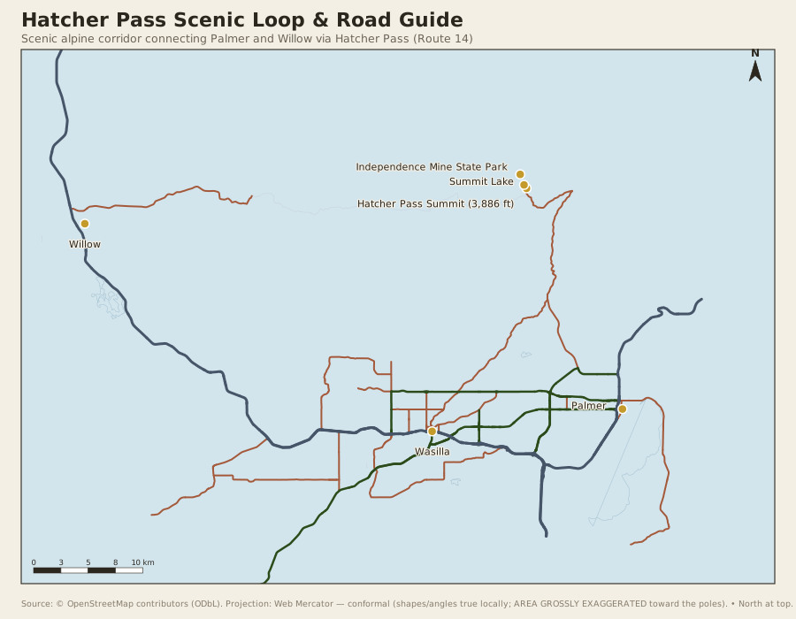
Driving Hatcher Pass is not your average highway cruise. It is an adventure that transitions from smooth, sweeping paved curves to a narrow, winding gravel road that climbs high above the tree line. To make the most of your journey, you need to understand the unique geography of the pass, the stark differences between its eastern and western approaches, and the specific vehicle requirements needed to conquer its most challenging sections. In this hatcher pass driving guide, we will break down everything you need to know, from road conditions and vehicle clearance to historic sites and crowd-avoidance strategies.
An Overview of Hatcher Pass Road
Hatcher Pass Road, also known as the Fishhook Road (and designated as Route 14), spans approximately 49 miles from Palmer to Willow. However, treating this as a standard 49-mile drive is a mistake. The road is divided into two distinct sections: the paved eastern side (Palmer-Fishhook Road) and the unpaved, rugged western side (Willow-Fishhook Road). The summit itself sits at an elevation of approximately 3,886 feet, offering panoramic views of the surrounding valleys and glaciers.
The eastern approach from Palmer is fully paved up to the Independence Mine State Historical Park turnoff. This section is accessible to virtually any vehicle, including standard sedans, rental cars, and large RVs. It features well-maintained asphalt, moderate grades, and stunning views of the Little Susitna River rushing alongside the road. If you are looking for a gentle, scenic drive with easy access to historic ruins and beautiful alpine views, this is the section for you. To help you decide when to incorporate this drive into your broader itinerary, check out our guide on the best time to plan your Alaska road trip.
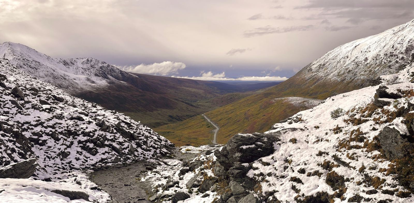
The western approach from Willow, however, is a completely different beast. This side is entirely unpaved, consisting of rough gravel, washboards, and narrow lanes with steep drop-offs and no guardrails. The two sides meet at the summit, connected by a series of tight, steep switchbacks. Because of the challenging terrain, the gravel portion over the summit is only open seasonally—typically from early July through late September, depending on the winter snowpack. During the winter and spring, the summit road is closed to vehicle traffic and becomes a playground for snowmobiles, backcountry skiers, and fat-bike enthusiasts.
The Willow Side Switchbacks & Vehicle Clearance Requirements
If you plan to drive the entire length of Hatcher Pass Road from Palmer to Willow (or vice versa), you must be prepared for the rugged gravel switchbacks on the Willow side. This is where a standard rental sedan or a large motorhome will run into serious trouble. A key focus of our hatcher pass driving guide is ensuring you have the right vehicle for the job.
The road is too narrow, the switchbacks are too tight, and there are very few places to turn around if you encounter oncoming traffic or deteriorating road conditions. If you are traveling in an RV, stick to the paved Palmer side, park at the designated lots near Independence Mine, and enjoy the scenery from there.
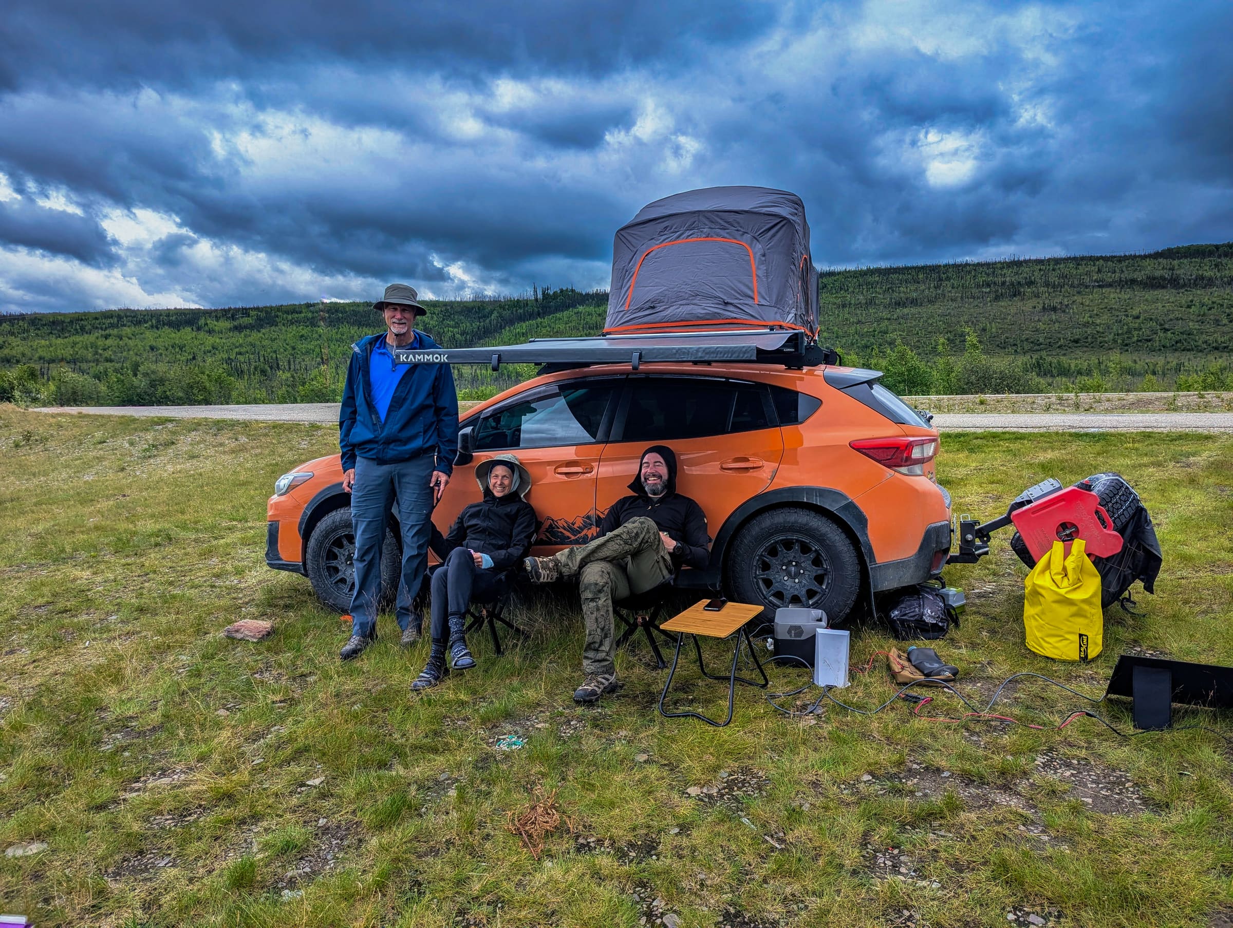
For passenger vehicles, high clearance is highly recommended, and four-wheel drive (4WD) or all-wheel drive (AWD) is strongly advised. While a standard front-wheel-drive sedan can technically make it over the pass in perfect summer conditions if driven with extreme caution, the risk of scraping the undercarriage on exposed rocks, bottoming out in deep potholes, or losing traction on the steep, loose gravel switchbacks is high. Vehicles with higher ground clearance are generally preferred on the gravel sections to help minimize the risk of undercarriage damage from loose rocks and deep ruts. If you are renting a vehicle, be aware that many standard rental car agreements explicitly prohibit driving on unpaved roads, including the gravel portion of Hatcher Pass. Violating these terms can void your insurance coverage. For those planning to tackle the rougher roads of the Last Frontier, we highly recommend renting a four-wheel-drive vehicle in Alaska to ensure peace of mind and compliance with rental policies.
When driving the switchbacks, remember these safety rules:
- Yield to uphill traffic: Vehicles traveling uphill have the right of way on narrow mountain roads. If you are driving downhill and meet another vehicle, be prepared to pull over to a safe turnout or back up if necessary.
- Control your speed: Keep your speed low—typically between 15 and 20 miles per hour on the gravel sections, and even slower on the tightest curves. This reduces the risk of skidding, minimizes flying gravel that can chip windshields, and gives you more time to react to oncoming traffic.
- Use low gear: When descending the steep grades, shift your vehicle into a lower gear to use engine braking. This prevents your brakes from overheating and losing effectiveness.
- Watch for washboards: The gravel road can develop severe washboard ripples, especially after heavy rain or periods of high traffic. These ripples can cause your vehicle to lose traction and drift if you are driving too fast.
Best Times of Day and Seasons to Visit
Because of its proximity to Anchorage (about a 90-minute drive) and the Matanuska-Susitna Valley, Hatcher Pass is a popular destination for both locals and tourists. During the peak summer months of July and August, the parking lots around Independence Mine and the popular trailheads can fill up quickly, leading to crowded trails and congested roads. To enjoy the serene, wild atmosphere that makes this place so special, timing is everything.
Our hatcher pass driving guide recommends visiting either early in the morning (before 9:00 AM) or in the late afternoon and evening (after 6:00 PM). Because of Alaska's famous midnight sun in the summer, you will have plenty of daylight to explore even late into the evening. Visiting during these shoulder hours not only helps you avoid the crowds but also offers the best lighting for photography, as the low sun casts dramatic shadows across the rugged peaks of the Talkeetna Mountains.
In terms of seasonal planning, the paved road to Independence Mine is kept open year-round, though winter driving conditions require snow tires or chains, and active avalanche mitigation is common in the area. The gravel road over the summit, however, is strictly seasonal. It typically opens in early July and closes with the first major snowfall in late September or early October. Before you set out, always check the latest road conditions and closures on the Alaska 511 road conditions map maintained by the Alaska Department of Transportation and Public Facilities.
Exploring Independence Mine State Historical Park
No trip to Hatcher Pass is complete without a stop at Independence Mine State Historical Park. Located near the end of the paved portion of the road on the Palmer side, this historic site offers a fascinating glimpse into Alaska's gold-mining past. In the early 20th century, Independence Mine was a bustling community where hundreds of miners lived and worked, extracting millions of dollars worth of gold from the hard rock of the Talkeetna Mountains.
Today, the park is a beautifully preserved ghost town. Visitors can take a self-guided walking tour among the historic wooden buildings, including the massive mill building, the assay office, the bunkhouses, and the mess hall. Some of the buildings have been restored and feature museum exhibits, while others are in a state of picturesque decay, standing as silent sentinels against the dramatic mountain backdrop.
Here are a few tips for visiting Independence Mine:
- Parking Fees: Visitors should expect a standard day-use parking fee at designated state park trailheads and historical sites. You can verify the current 2026 rates and permit options directly on the official Alaska State Parks portal, which also provides details on annual parking passes. The parking lot can fill up by midday, so plan accordingly.
- Accessibility: The main paths around the historic townsite are gravel and relatively flat, making them accessible for most visitors. However, some of the upper trails and building entrances require climbing stairs or walking on steeper, uneven ground.
- Guided Tours: During the peak summer season, naturalists and historians often offer guided tours of the camp and the interior of some buildings. Check the Alaska State Parks Independence Mine portal for the current schedules and visitor center hours.
Top Hiking Trails and Scenic Overlooks
Hatcher Pass is a premier hiking destination, offering trails that range from short, family-friendly strolls to challenging, multi-day backcountry routes. The high-alpine environment means you don't have to hike far to get above the tree line and enjoy sweeping views of the tundra.
April Bowl Trail
Starting near the summit of the pass, this trail climbs steeply up a series of switchbacks to a beautiful alpine bowl containing several small, turquoise tarns (mountain lakes). If you have the energy, you can continue climbing past the lakes to the ridge line for a breathtaking 360-degree view of the Talkeetna Mountains and the valley below. Because of the steepness and loose gravel, trekking poles are highly recommended.
Summit Lake
If you prefer a scenic view without the strenuous hike, Summit Lake is located right next to the road near the top of the pass. This small, pristine lake reflects the surrounding peaks like a mirror on calm days. It is a perfect spot for a picnic, a short stroll along the shoreline, or a quick photo stop. Be aware that snow can linger around the lake well into July.
Reed Lakes Trail
For experienced hikers seeking a world-class alpine adventure, the Reed Lakes Trail is a must-do. This challenging 9-mile round-trip hike takes you deep into a dramatic granite valley, past rushing waterfalls, and over a massive boulder field to two stunning, glacier-fed turquoise lakes. The trail gains about 2,200 feet of elevation and requires scrambling over large boulders, so it is best suited for those in good physical condition with proper hiking footwear. The trailhead is located off Archangel Road, a rough gravel road branching off the Palmer-Fishhook Road.
When hiking in Hatcher Pass, safety should always be your top priority. The weather can change rapidly in the mountains, transitioning from warm sunshine to cold rain or even snow in a matter of minutes. Always carry layers, rain gear, and plenty of water. Additionally, Hatcher Pass is active bear and moose country. Be sure to carry bear spray, know how to use it, and review our Alaska wildlife safety guide before hitting the trails.
Essential Packing and Preparation Checklist
Because Hatcher Pass is a remote mountain environment with limited services, proper preparation is key to a successful trip. There are no gas stations, grocery stores, or cell towers on the pass itself, so you must bring everything you need with you.
Before you leave Palmer or Willow, make sure you have completed the following:
- Fuel up: Ensure your gas tank is full. There are plenty of fuel stations in Palmer and Wasilla on the east side, and in Willow on the west side, but none along the 49-mile pass road. For more tips on managing your fuel stops across the state, consult our Alaska fuel planning guide.
- Download offline maps: Cell service is extremely spotty and completely non-existent in many parts of Hatcher Pass. It is highly recommended to download offline maps and inform a reliable contact of your planned route before heading into the mountain pass where cellular reception is unavailable.
- Pack layers: The temperature at the summit can be 10 to 15 degrees cooler than in the valleys below, and wind is common. Pack a windproof and waterproof outer shell, a warm fleece or down jacket, a hat, and gloves.
- Bring water and snacks: While there is a small cafe near the base of the Palmer side and occasional food trucks near the mine in summer, options are limited. Bring plenty of water and high-energy snacks for your hikes and drives.
- Carry a spare tire and tools: The gravel roads can be sharp and unforgiving. Ensure your vehicle has a fully inflated spare tire, a working jack, and a lug wrench, and that you know how to use them.
Frequently Asked Questions
Is Hatcher Pass Road paved the whole way?
No. Only the eastern portion of the road (from Palmer up to the Independence Mine area) is paved. The western portion (from the mine area over the summit and down to Willow) is a rough, unpaved gravel road that is only open during the summer months.
Can you drive an RV over Hatcher Pass?
However, as emphasized by regional safety advisories, driving an RV, motorhome, or vehicle towing a trailer over the summit or down the gravel Willow side is highly discouraged due to narrow lanes, steep grades, and tight switchbacks.
When does Hatcher Pass Road open for the summer season?
The paved Palmer side is open year-round, weather permitting. Exact opening dates vary each year based on snowpack and maintenance schedules.
Do I need a 4WD vehicle for Hatcher Pass?
While a 4WD or AWD vehicle is not strictly required for the paved Palmer side, it is highly recommended if you plan to drive the gravel Willow side or access rougher side roads like Archangel Road. Vehicles with higher ground clearance are generally preferred on the gravel sections to help minimize the risk of undercarriage damage from loose rocks and deep ruts.
Is there cell service at Hatcher Pass?
Cell service is highly unreliable and completely absent in many areas of the pass, especially near the summit and on the Willow side. It is highly recommended to download offline maps and inform a reliable contact of your planned route before heading into the mountain pass where cellular reception is unavailable.
Plan Your Ultimate Alaska Road Trip
Hatcher Pass is a spectacular testament to the raw, untamed beauty of Alaska's mountain landscapes. By following this hatcher pass driving guide, you can safely navigate the rugged switchbacks, explore the rich history of Independence Mine, and stand atop alpine ridges looking out over endless fields of tundra. To seamlessly integrate this incredible mountain pass into a broader, stress-free adventure through the Last Frontier, explore our professionally designed, customizable Alaska travel itineraries. Let us handle the logistics so you can focus on the drive of a lifetime.
Get notified when road & ferry status changes
One email when conditions change for this route, plus a heads-up when the booking window opens for next season.
One email. No spam. Unsubscribe anytime.
Planning ahead? Skip the wait: Get your custom itinerary — from $197 · 5-day delivery → See a sample first — no email needed ↗