Finding the best alaska road trip stops for photography requires understanding how subarctic geography, unpredictable weather fronts, and immense scale dictate your shooting angles. The most dramatic viewpoints—from the tidal mudflats of Turnagain Arm to the towering ice face of Matanuska Glacier—are accessible directly from paved highway pullouts if you know the exact mileposts, light angles, and seasonal shifts before you get behind the wheel.
Driving across Alaska with a camera presents challenges you will rarely encounter in the Lower 48. Highway distances are deceptive, lighting angles behave unusually at high latitudes, and roadside pullouts can transition rapidly from wide asphalt pads to soft, unmarked gravel shoulders. Whether you are aiming a 400mm lens at Dall sheep cliffs or composing wide-angle panoramas of the Alaska Range, this field guide breaks down the premier highway viewpoints, technical shooting recommendations, and practical routing realities for your journey.
Planning Your Drive Around Alaska's Unique Golden Hour Light
Landscape photography in Alaska is governed entirely by latitude. During June and July across Southcentral and Interior Alaska, the sun dips below the horizon for only a brief twilight window, stretching the traditional twenty-minute "golden hour" into a four- to five-hour shooting session that spans late evening into the early morning. While this extended window gives you ample time to work a scene, it also demands careful itinerary pacing. If you spend your evening driving between distant towns rather than being parked at a scenic viewpoint, you risk squandering the day's best light.
By late August and September, the lighting dynamics flip. Days shorten rapidly by five to six minutes each day, and sunset compresses back into a punchy, high-contrast transition. Late-season light brings richer amber and gold tones across the tundra, but it leaves zero margin for driving delays. If road construction or slow-moving motorhomes delay your transit along the Parks or Glenn Highways, your evening shoot will quickly be lost to darkness. Travelers can check active highway maintenance and delays through Alaska 511 Traveler Information before setting out on long driving legs.
Mid-day light in Alaska poses its own technical hurdles. Glacial rivers carrying fine rock flour (glacial silt) act like massive, milky reflectors under direct midday sun, washing out water detail and throwing off standard camera metering. High-elevation granite peaks along the Alaska Range and Chugach Mountains create intense dynamic range challenges between blinding snowfields and deep basalt shadows. To manage these scenes, keep a high-grade circular polarizer mounted to cut glacial water glare and consider bracketed exposures to preserve both shadow detail in roadside boreal forests and highlights on distant nunataks.
Above all, mapping realistic drive times is critical. Building extra buffer time into your schedule ensures you reach your target pullout well before the light hits its peak angle.
Seward Highway Highlights: Best Alaska Road Trip Stops for Photography Along Turnagain Arm
Stretching south from Anchorage to the coastal port of Seward, the Seward Highway (Alaska Route 1 and Route 9) is designated as an All-American Road for good reason. Flanked by the precipitous Chugach Mountains on the east and the dramatic tidal basin of Turnagain Arm on the west, this corridor offers some of the best alaska road trip stops for photography within a short drive of the state's largest airport. For a deeper breakdown of this corridor, review our dedicated Seward Highway guide.
Beluga Point (Mile 110)
Beluga Point is a rocky promontory that juts directly into Turnagain Arm, providing a 180-degree panoramic vantage of the inlet's dramatic silt flats and jagged ridgelines. When planning your shoot here, consult local tide tables. The incoming tide often produces the famous Turnagain Arm bore tide—a rolling wave up to several feet high that surges across the mudflats.
- Optimal Focal Length: 16–35mm for sweeping mudflat textures; 70–200mm to isolate bore-tide surfers or small pods of white beluga whales hunting salmon in late summer.
- Lighting Note: Best shot during late-afternoon or evening side-lighting, which casts long, textured shadows across the exposed sediment channels.
- Compositional Tip: Use the dark, jagged metamorphic rocks in the foreground to anchor the frame against the shimmering, silver-grey waters of the Arm.
Bird Point (Mile 96)
Located fourteen miles south of Beluga Point, Bird Point features an extensive, elevated paved trail system and observation decks overlooking the water and surrounding cliffs. This is a primary stopping point for telephoto landscape work and wildlife compositions.
The sheer cliffs directly across and above the highway are a favored grazing area for wild Dall sheep. Using a 300mm to 600mm lens, you can capture these stark white animals perched against dark, sheer cliff faces. Bird Point also offers clear vistas toward the Kenai Mountains across the water, where morning mist frequently settles into mountain valleys before burning off by noon.
Tern Lake Junction (Mile 37)
At the junction where the Seward Highway meets the Sterling Highway toward Cooper Landing and Soldotna, Tern Lake sits nestled within a high-mountain bowl inside the Chugach National Forest. The wetland lake is sheltered from heavy coastal winds, frequently creating mirror-smooth reflections of surrounding alpine peaks.
Arrive here at dawn. Early morning light illuminates the northern mountain slopes while the lake surface remains glassy. The shallow marshes host nesting Arctic terns, loons, and swans throughout June and July. A sturdy tripod, low camera angle near the designated viewing platforms, and a slow shutter speed will capture dramatic reflections of the Kenai Peninsula wilderness.
Glenn Highway Pullouts: Framing Matanuska Glacier and Ancient Ice
Heading northeast from Palmer toward Glennallen, the Glenn Highway (Alaska Route 1) climbs along the Matanuska River valley, paralleling the northern edge of the Chugach Range. This National Scenic Byway is widely recognized for housing some of the premier landscape viewpoints in the state, anchored by continuous roadside views of active valley glaciers.
Caribou Creek State Recreation Site (Mile 107)
Caribou Creek offers an elevated canyon viewpoint perched high above the river gorge. From this vantage point, you look southwest down the river drainage directly toward the distant snout and terminus of Matanuska Glacier.
This stop provides dramatic spatial compression when shot with a telephoto lens (100–300mm). The deep, forested V-shaped canyon of Caribou Creek leads the viewer's eye straight toward the bright white and cobalt-blue seracs of the glacier. Autumn (late August through mid-September) is exceptional here, as the canyon slopes erupt into vivid yellow birch and crimson dwarf fireweed, contrasting sharply with the ancient blue ice beyond.
Matanuska Glacier State Recreation Site (Mile 101)
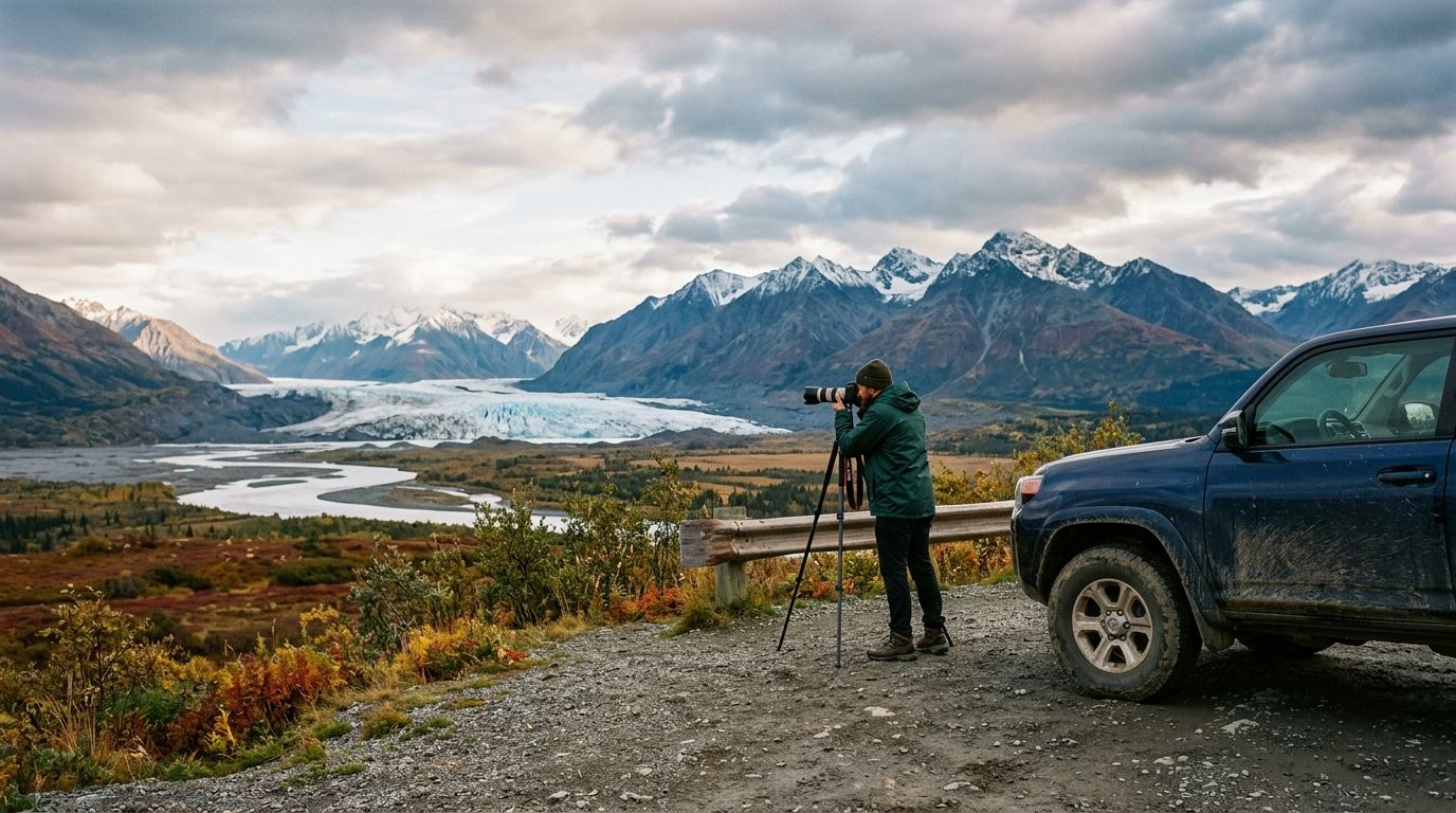
Unlike commercial glacier access points on the valley floor, the state recreation site at Mile 101 sits atop a high bluff surrounded by mature spruce-hardwood forest. A well-maintained trail system leads to edge-of-bluff viewing platforms overlooking the entire 27-mile-long Matanuska Glacier.
For wide-angle landscape photography (14–24mm), this is the definitive roadside vantage. The high perspective allows you to frame the entire ice tongue as it spills out of the Chugach Mountains, complete with lateral and medial moraine striping. Shoot here in the mid-to-late afternoon when the sun illuminates the north-facing ice wall, preventing harsh backlit shadows from obscuring the glacial crevasses.
Lion's Head Rock Formation (Mile 113)
Rising abruptly next to the highway near Glacier View, Lion's Head is an ancient volcanic neck that dominates the local topography. Photographers who pull off at designated gravel turnouts near Mile 113 can use this dark, imposing basalt formation to create bold structural contrasts against the sprawling white backdrop of the glacier below. In early autumn, the ground foliage along the lower shoulders turns a deep russet, creating an ideal foreground framing layer for panoramic mountain compositions.
Parks Highway Vantage Points: Best Alaska Road Trip Stops for Photography of the Alaska Range
The George Parks Highway (Alaska Route 3) spans 323 miles from the Glenn Highway junction north to Fairbanks. As it traverses the Susitna River valley and winds along the eastern perimeter of Denali State Park and National Park, it provides multiple viewpoints for photographing the highest peaks in North America. When planning, consider our Anchorage to Denali driving guide for realistic segment timing.
Denali View South (Mile 135.2)
Denali View South, situated inside Denali State Park, features a large, paved parking loop and elevated timber viewing decks. On clear days, this pullout offers an unobstructed, sweeping panoramic view of Denali (20,310 feet), Mount Foraker (17,400 feet), and Mount Hunter (14,573 feet) rising above the Susitna Valley flatlands.
Because these giant massifs generate their own localized weather, Denali is famously hidden by clouds roughly two out of every three summer days. Your highest probability of clear viewing occurs in the early morning hours (between 5:00 AM and 8:30 AM), before solar thermal heating generates heavy convective cumulus cloud cover over the Alaska Range. A panoramic stitch using a 50mm or 85mm prime lens yields exceptional fine-art detail without wide-angle horizon distortion.
Hurricane Gulch Bridge (Mile 174)
At Mile 174, the Parks Highway crosses Hurricane Gulch on a steel arch bridge suspended 254 feet above Hurricane Creek. Modern highway pullouts on both the north and south ends of the bridge allow photographers to safely step out and capture dramatic bridge engineering juxtaposed against untouched subarctic wilderness.
Shoot looking east down the canyon during mid-morning light to capture the turquoise water of the creek below, or frame wide-angle compositions that include the bridge's sweeping structural arches against the expansive taiga forest. Autumn colors peak exceptionally early here—often by the last week of August—painting the canyon walls in bright gold.
Denali View North (Mile 162.7)
Located roughly 27 miles north of Denali View South, Denali View North provides a substantially higher elevation perspective. The viewpoint sits on an open ridge that brings you geographically closer to the southern wall of Denali and the Ruth Gorge peaks.
This stop is ideal for long telephoto landscape compositions (200–400mm). The compression brings out the rugged serrations of the Mooses Tooth and Mount Huntington. In the evening, the setting sun casts a soft pink alpenglow across the southern glaciers long after the valley floor has fallen into deep shadow.
Factoring in 2026 Denali Park Road Transit Realities
When planning photography stops near the national park entrance, it is critical to account for current operational conditions. As documented by the National Park Service Denali Conditions, the Denali Park Road remains closed to private vehicles and transit buses beyond Mile 43 due to ongoing bridge construction at the Pretty Rocks landslide. For full logistical details on this ongoing project, read our analysis on the Denali Park Road status.
Because park road access past the East Fork River is restricted, highway viewpoints along the Parks Highway (such as Miles 135.2 and 162.7) have become even more valuable for travelers seeking unencumbered, large-scale landscape views of the mountain without relying on park shuttle reservations.
Richardson Highway Corridors: Waterfalls, Passes, and Glacier Close-Ups
The Richardson Highway (Alaska Route 4) links Valdez on Prince William Sound to Delta Junction in the Interior. The southern 100 miles of this route cut through the heart of the maritime Chugach Mountains, offering dense concentrations of cascading waterfalls, alpine tundra, and accessible moraines along wide scenic pullouts travelers can easily navigate.
Keystone Canyon (Miles 14 to 17)
Just outside Valdez, the Lowe River carves a narrow path through Keystone Canyon, where nearly vertical, thousand-foot rock walls rise directly from the road's edge. This narrow corridor contains two of Alaska's most famous roadside cascades: Horsetail Falls (Mile 13.5) and Bridal Veil Falls (Mile 14.5).
Because Keystone Canyon is deep and narrow, direct sunlight only reaches the canyon floor for a brief window around midday. Overcast or light rainy days are actually optimal here; flat lighting reduces extreme dynamic range, allowing you to use neutral density (ND) filters and slow shutter speeds (1/4 second to 2 seconds) to render silky, smooth water motions without blowing out highlights on wet rock surfaces.
Thompson Pass (Mile 26)
Climbing out of Keystone Canyon, the Richardson Highway ascends to Thompson Pass (elevation 2,805 feet). Renowned as one of the snowiest places in Alaska, the pass transforms into a lush alpine tundra meadow during July and August.
Thompson Pass sits directly on the boundary between coastal maritime weather and cold Interior air systems. This clash frequently produces dramatic atmospheric conditions: rolling low clouds, sea fog breaking over jagged peaks, and rapid weather shifts. Use a wide-angle lens with a graduated neutral density (GND) filter to balance the bright, cloud-filled sky against the dark, lupine-covered alpine terrain.
Worthington Glacier State Recreation Site (Mile 29)
Located just northeast of Thompson Pass, Worthington Glacier is one of the most accessible valley glaciers in the state. A wide, paved state recreation site parking lot provides immediate, unobstructed views of the glacier's massive hanging ice tongues and terminal moraine lake.
Photographers can capture sweeping landscape frames right from the viewing platform, or hike the paved, ADA-accessible boardwalk trails toward the lateral moraine for dramatic close-ups of turquoise ice crevasses and fast-flowing meltwater streams. Morning light illuminates the glacier face directly, while late afternoon creates dramatic, moody side-lighting across the moraine ridges.
Pullout Safety, Shoulder Etiquette, and Essential Field Gear
Capturing the best alaska road trip stops for photography requires maintaining strict roadside safety standards. Alaska highways are high-speed, two-lane corridors heavily trafficked by commercial freight trucks, oversized RVs, and tour motorcoaches with extended stopping distances.
Managing Highway Pullouts and Gravel Shoulders
- Verify Surface Firmness: rarely pull onto an unpaved shoulder at high speed. Alaska road shoulders frequently consist of deep, uncompacted gravel or soft muskeg soil that can destabilize a vehicle.
- Clear Sightlines: often pull completely past the solid white fog line. If a pullout is situated on a blind corner or steep crest, drive forward to a straight section with at least 500 feet of clear visibility in both directions before parking.
- Hazard Visibility: Keep your daytime running lights on, and activate hazard lights if you are parked near active travel lanes during dawn, dusk, or heavy coastal rain.
Roadside Wildlife Etiquette
Encountering wildlife along highway corridors is common, particularly moose along the Seward Highway and grizzly bears foraging on soapberries along the Glenn and Parks Highways. To protect yourself and avoid stressing animals, review our Alaska wildlife safety protocols and follow the official wildlife observation standards established by the Alaska Department of Fish and Game.
- Maintain a safe distance of at least 300 yards (900 feet) from bears and at least 25 yards (75 feet) from moose.
- rarely exit your vehicle if an animal is within close range of the roadside shoulder; use your vehicle as a mobile blind by rolling down your window and resting a telephoto lens on a beanbag or window mount.
- Carry EPA-registered bear spray on your person—not packed inside your trunk or gear bag—whenever you step away from your vehicle onto roadside trails or viewing platforms.
Essential Camera Equipment for Alaska Road Trips
To withstand subarctic conditions and capture high-contrast scenes, pack gear specifically suited to Alaska's terrain, as highlighted in our comprehensive Alaska road trip packing list:
- Circular Polarizer (CPL): Essential for cutting glare off silty glacial rivers, damp vegetation, and wet rock faces.
- Graduated Neutral Density (GND) Filters: Critical for balancing bright snowfields and midnight sun horizons against deep boreal valley shadows.
- Heavyweight Carbon Fiber Tripod: Coastal passes like Thompson Pass and Turnagain Arm experience sustained winds of 20 to 40 mph; a sturdy tripod with a center-column ballast hook is vital for sharp long-exposure photography.
- Waterproof Protective Covers: Weather in Southcentral Alaska changes in minutes. often carry silicone lens gaskets or dedicated waterproof rain sleeves.
Landscape Photography Highway Pullout Comparison
| Highway Corridor | Key Pullout & Milepost | Primary Photographic Subject | Optimal Lighting Window | Recommended Focal Length |
|---|---|---|---|---|
| Seward Highway | Beluga Point (MP 110) | Turnagain Arm mudflats, bore tides, Chugach cliffs | Late afternoon to sunset | 16–35mm (wide) / 70–200mm (action) |
| Seward Highway | Tern Lake (MP 37) | Glassy water reflections, wetland waterfowl | Early morning (dawn) | 24–70mm / 100–400mm |
| Glenn Highway | Caribou Creek (MP 107) | Matanuska Glacier snout, river canyon framing | Late afternoon / Early autumn | 70–200mm |
| Glenn Highway | Matanuska Rec Site (MP 101) | Full glacial valley panorama, blue seracs | Mid-day to mid-afternoon | 14–24mm |
| Parks Highway | Denali View South (MP 135.2) | Denali & Alaska Range panorama | Dawn (5:00 AM – 8:30 AM) | 50mm stitch / 70–200mm |
| Parks Highway | Hurricane Gulch (MP 174) | Gorge canyon, bridge architecture, fall colors | Mid-morning / Early September | 16–35mm / 24–70mm |
| Richardson Highway | Keystone Canyon (MP 14–17) | Horsetail & Bridal Veil Falls, vertical rock gorge | Overcast / Diffused light | 24–70mm with ND filter |
| Richardson Highway | Thompson Pass (MP 26) | Alpine tundra, atmospheric fog, mountain passes | Golden hour / Rolling storms | 16–35mm / 70–200mm |
Why DIY Pacing Fails Landscape Photographers (And How Done-for-You Routing Solves It)
The most common mistake landscape photographers and self-drive travelers make in Alaska is treating drive times like a standard road trip in the Lower 48. Online mapping apps regularly underestimate Alaska highway transit times because they do not account for frost heave slowdowns, single-lane bridge repairs, summer camper convoys, or the inevitable spontaneous wildlife stops. When your daily schedule is packed too tightly, you end up arriving at dramatic viewpoints during harsh, flat midday light and driving through the prime golden hour windows just to reach a distant hotel before the front desk closes.
Planning an efficient photography route requires balancing accurate driving distances, sun azimuth angles, seasonal ferry connections, and high-demand lodging hubs. Stitching this together on spreadsheets often takes forty to fifty hours of tedious research—leaving you stressed and uncertain about whether your daily mileage is realistic.
That is why working with an experienced specialist changes the entire dynamic of your journey. Alaska Road Trip delivers a custom day-by-day Alaska road-trip itinerary hand-built by a named founder who has driven thousands of Alaska miles across multiple seasons. Every custom route is crafted around realistic daily pacing, current-season road conditions (such as the 2026 Denali Park Road Mile 43 bridge closure), and precise photographic windows so you are standing at the edge of the canyon or glacier when the light is at its absolute peak.
Alaska Road Trip hand-picks lodging and gives you direct booking links, but you book it yourself — it does not make reservations on your behalf, so you keep full control and flexibility. Alaska Road Trip recommends activities and tours with timing and booking links; you reserve them yourself. Alaska Road Trip does not book flights or rental cars; you arrange those independently. Alaska Road Trip is a one-time flat fee, not a subscription — there are no recurring charges. Transparent pricing tiers make professional planning straightforward for every trip duration:
- Lite (a measurable budget): Perfect for focused 1- to 5-day regional road trips.
- Standard (a measurable budget): Comprehensive planning for road trips up to 14 days.
- Plus (a measurable budget): Extended, in-depth itineraries for 15+ day road trips across multiple highway systems.
- Concierge (a measurable budget): Complete custom itinerary design plus a 30-minute live founder call directly with the founder.
Every itinerary is delivered as a printable, offline-ready PDF within 3 to 5 business days, includes 1 to 2 revision rounds to dial in your exact route preferences, and comes backed by a published 14-day money-back guarantee with a full refund, no questions asked. When you eliminate the guesswork of DIY routing, you can focus on what matters most: capturing exceptional images across the Last Frontier. Source: Alaskaroadtrip source.
Frequently Asked Questions
What lens focal lengths are most useful for an Alaska road trip photography itinerary?
A versatile three-lens setup covers virtually every roadside scenario in Alaska: a wide-angle zoom (16–35mm f/2.8 or f/4) for expansive glacier and mountain reflections, a standard mid-range zoom (24–70mm) for canyon waterfalls and roadside landscapes, and a fast telephoto zoom (100–400mm or 150–600mm). The telephoto lens is crucial not only for maintaining safe, ethical distances from roadside moose and bears, but also for compressing distant Alaska Range peaks against mid-ground river valleys.
When is the best month for photography along Alaska's highway system?
Late August through mid-September is widely considered the premier window for landscape photography. During this late summer-to-autumn transition, roadside tundra turns vibrant red and gold, alpine peaks receive their first light dustings of fresh snow (known as "termination dust"), and darker night skies open up early opportunities to photograph the Aurora Borealis. If your goal is wildflowers, active bird nesting, and extended midnight sun shooting hours, late June through mid-July is ideal.
Is it safe to leave my car on highway shoulders while photographing scenery in Alaska?
You should only park in designated, paved or packed-gravel pullouts clearly separated from the flow of traffic. rarely park on soft, narrow road shoulders or on the outside of blind highway curves. often pull completely outside the white fog line, turn on hazard lights if visibility is compromised by rain or fog, and exit your vehicle on the non-traffic side whenever possible to avoid high-speed commercial traffic.
How does the Denali Park Road Mile 43 closure impact roadside photography in 2026?
The Denali Park Road remains closed at Mile 43 (Pretty Rocks) to all public transit and tour buses throughout the 2026 summer season while construction on the permanent bridge span continues. While visitors cannot access interior viewpoints like the Eielson Visitor Center or Wonder Lake via the park road, outstanding wide-angle and telephoto landscape views of the mountain remain fully accessible from high-elevation pullouts along the Parks Highway, including Denali View South (Mile 135.2) and Denali View North (Mile 162.7).
Ready to capture Alaska without spending 40+ hours stitching together spreadsheets and guessing drive times? Let Alaska Road Trip hand-build your custom, day-by-day 2026 itinerary with precise photo stops, vetted direct-booking links, and printable offline routes delivered in 3 to 5 business days.
See a real Alaska itinerary before you spend a dollar
A real 3-day plan with driving times, lodging picks, and a daylight chart — free, in your inbox.
One email. No spam. Unsubscribe anytime. Or view it right now — no email needed ↗
Ready for the full plan? Get your custom itinerary — from $197 · 5-day delivery →