
No overland route connects the lower 48 states to Alaska without passing through Canada. If you are planning on driving to Alaska from the United States, your trip requires crossing the international border into British Columbia or Alberta, traversing the Yukon Territory, and re-entering the United States at an Alaska border station.
For first-time and second-time travelers, this journey is rarely a quick commute. Whether you are a couple taking three weeks off work, a retired pair traveling between May and September, or a family navigating a summer road trip, driving to Alaska from the lower 48 demands precise logistics. The route covers thousands of miles of northern wilderness where fuel stations close early, cell towers disappear for half a day, and border officers inspect your vehicle cargo down to the brand of dog food in your trunk. This guide lays out the verified driving routes, realistic mileage targets, border inspection rules, seasonal road conditions, and practical strategies you need to reach Alaska safely in 2026.
What driving to Alaska from the United States actually involves
Driving to Alaska from the United States covers thousands of highway miles across remote terrain. From the Pacific Northwest border crossing at Blaine, Washington, to Anchorage, Alaska, the trip spans roughly 2,260 highway miles along the standard route. If your starting point is the Midwest (such as Minneapolis via North Dakota and Alberta) or the East Coast, total driving distances reach 3,500 to 4,500 miles one way.
The journey divides naturally into three major segments:
- The approach corridor: driving through the lower 48 to a Canadian port of entry in Washington, Idaho, or Montana.
- The Canadian transit: traversing British Columbia and the Yukon Territory along the paved Alaska Highway (or the Stewart-Cassiar Highway).
- The Alaska entry and interior corridor: crossing the border at Alcan into eastern Alaska and connecting through Tok toward Fairbanks or Anchorage.
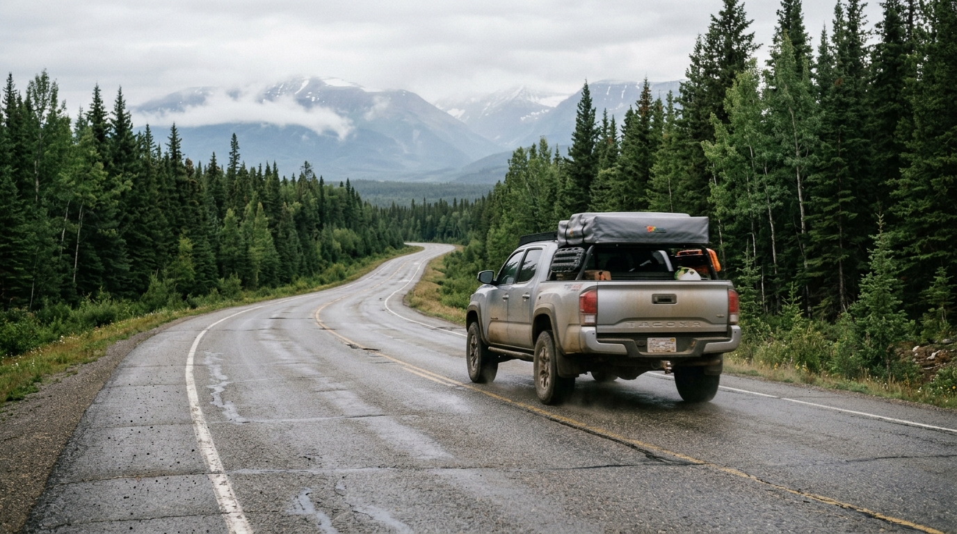
A widespread misconception is that the Alaska Highway remains an unpaved wilderness track. In reality, the entire primary corridor is paved with asphalt or high-grade chip seal. You do not need a custom four-wheel-drive vehicle or an expedition rig to complete the transit during the summer months. Sedans, minivans, and standard motorhomes make the drive every week from June through August.
Paved does not mean simple. Frost heaves warp the roadbed each spring. Summer road maintenance crews routinely reduce long sections to single-lane gravel with pilot cars, and distances between full-service towns frequently exceed 150 miles. A realistic transit pace requires five to seven full driving days just to reach the Alaska border from the northern contiguous United States, before you spend a single day sightseeing inside Alaska itself. Travelers who treat the approach as a minor weekend drive run into fatigue and disrupted schedules.
The route, leg by leg: from the lower 48 to the Alaska Highway
Planning your route requires understanding where the major highways connect and where services concentrate. The standard overland route follows established corridors through British Columbia and the Yukon.
Leg 1: lower 48 to the Canadian interior
Most travelers starting on the West Coast cross the border at Blaine (Peace Arch or Pacific Highway), Lynden, or Sumas in Washington. From there, British Columbia Highway 1 (the Trans-Canada Highway) leads east to Hope, where you connect to BC-97 North through the Cariboo region. Major supply hubs along this stretch include Cache Creek, Williams Lake, and Prince George. Prince George is the northern interior's largest city, located roughly 500 miles north of Vancouver. It is the primary staging point for groceries, vehicle inspections, and hardware before you head into more remote terrain.
Travelers originating in the central or eastern United States often cross the border at Sweet Grass, Montana, into Coutts, Alberta. From there, Alberta Highway 2 runs north through Calgary and Edmonton, connecting to Highway 43 toward Dawson Creek, British Columbia.
Leg 2: Dawson Creek to Fort Nelson (mile 0 to mile 300)
Dawson Creek marks Mile 0 of the historic Alaska Highway. The junction is marked by a traffic circle and a commemorative monument in the town center. From Dawson Creek, the highway (BC-97) heads northwest toward Fort St. John, an active energy sector hub with dependable lodging and mechanics. Continuing north, the road crosses the Prophet River region before reaching Fort Nelson at mile 300. Fort Nelson is at the foot of the Northern Rocky Mountains and provides the last major concentration of chain hotels and national-brand fuel stations for several hundred miles.
Leg 3: Fort Nelson to Watson Lake and Whitehorse (mile 300 to mile 918)
The stretch between Fort Nelson and Watson Lake, Yukon, crosses the highest elevation on the Alaska Highway at Summit Pass (4,250 feet). This section cuts through Stone Mountain Provincial Park and Muncho Lake Provincial Park, where jade-colored water borders steep limestone cliffs. Liard River Hot Springs is at mile 496. The provincial park maintains boardwalks leading to natural thermal pools along the northern highway network.
You cross into the Yukon Territory shortly before reaching Watson Lake at mile 635. Watson Lake is known for its Signpost Forest, a roadside collection started by an injured American soldier in 1942 that now contains over 100,000 signs brought by travelers worldwide. From Watson Lake, Yukon Highway 1 carries you 280 miles west to Whitehorse, the territorial capital. Whitehorse has full mechanical services, regional hospitals, outdoor gear retailers, and large grocery outlets. For deeper planning on this historical corridor, review our detailed guide to the Alaska Highway route.
Leg 4: Whitehorse to the Alaska border and Tok (mile 918 to mile 1314)
From Whitehorse, the highway passes through Haines Junction, positioned against the glacier-capped mountains of Kluane National Park and Reserve. Haines Junction is at the western gateway before the road tracks north along the shore of Kluane Lake. Road maintenance along Kluane Lake and through Destruction Bay can be slow due to permafrost melting underneath the highway sub-base.
Beaver Creek is at mile 1202 as Canada's westernmost community and the final staging post before the border. The Canada Border Services Agency office is inside the village, while the United States Customs and Border Protection post is 18 miles farther west along the neutral highway corridor. Once through U.S. border processing, you enter Alaska on Alaska Route 2, arriving in Tok 90 miles down the road. Tok is the highway junction: continue northwest on the Alaska Highway to Delta Junction and Fairbanks, or turn southwest on the Tok Cutoff (Alaska Route 1) to Glennallen and Anchorage.
Alternate route corridors
Drivers looking for different scenery often consider two alternate routes:
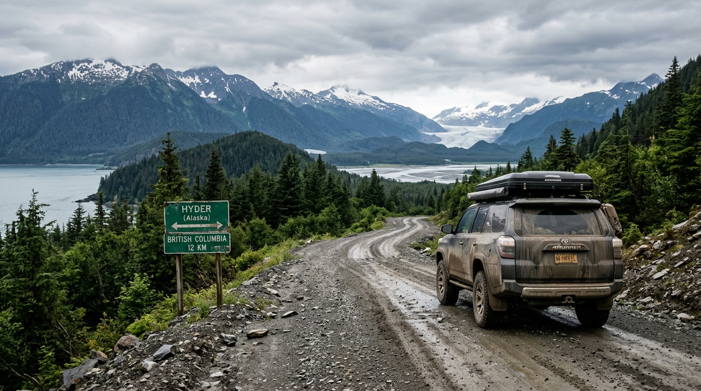
- The Stewart-Cassiar Highway (BC-37): Diverges from BC-16 west of Prince George and runs 450 miles north through remote wilderness to rejoin the Alaska Highway near Watson Lake. It is narrower, has fewer services, and has rugged scenery near the Meziadin Junction and Stewart/Hyder border area.
- The Top of the World Highway (Yukon Highway 9 / Alaska Route 5): Runs from Dawson City, Yukon, across an unpaved alpine ridge to Boundary and Chicken, Alaska. This route includes a river ferry across the Yukon River at Dawson City and is open only during summer daylight hours. It should only be attempted between June and early September.
The Alaska road trip border crossing: documents, questions, and time
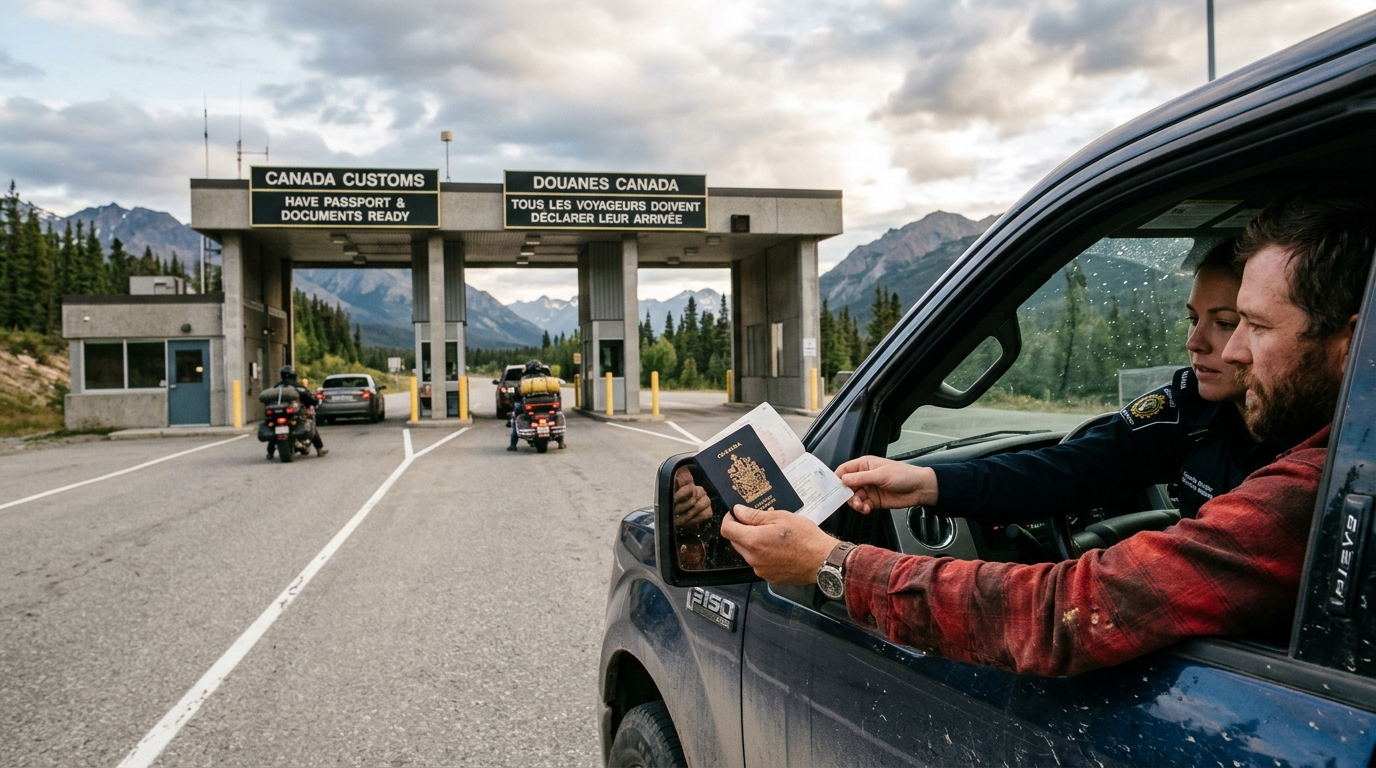
Because you must cross through Canada, every traveler must pass through international customs twice: once entering Canada from the contiguous United States, and once entering the State of Alaska. Completing an overland border crossing requires strict preparation regarding identification, vehicle contents, and admissibility.
Required identification
Every traveler in your vehicle must carry a valid passport book, passport card, or NEXUS card. A standard state-issued driver's license alone is not valid for land border crossings into Canada or re-entry into the United States. While U.S. citizens do not need a visa for tourist transit through Canada, Canadian border authorities will review your personal admissibility. Individuals with past criminal records, including misdemeanor driving-under-the-influence (DUI/DWI) convictions, can be denied entry into Canada unless they have received advance legal authorization, such as a Temporary Resident Permit or formal criminal rehabilitation. Verify your border requirements directly through the Canada Border Services Agency (CBSA) before your departure.
Border interview questions
Border agents at Canadian and American ports of entry ask direct, factual questions. When approaching the primary inspection booth, roll down the front and rear driver-side windows, remove sunglasses, turn off your engine, and have all passports open to the photo page. Standard questions include:
- What is the purpose of your trip?
- How long do you intend to stay in Canada?
- What is your final destination in Alaska?
- Where do you plan to spend your first night?
- Are you carrying any firearms, weapons, bear spray, alcohol, or commercial goods?
- Do you have fresh fruits, vegetables, meats, or pet foods in the vehicle?
Firearms and self-defense sprays
Firearms policies cause significant delays and vehicle seizures at northern border crossings. Handguns, automatic weapons, and short-barreled tactical firearms are prohibited or heavily restricted under Canadian law. You cannot transport handguns through Canada for personal protection or general target shooting. Non-restricted sporting rifles and shotguns require advance paperwork, a formal declaration at the border, and an inspection fee. Failing to declare a firearm in your vehicle is an offense under Canadian customs law that leads to arrest, vehicle impoundment, and substantial fines.
Bear spray is permitted into Canada, provided the canister is clearly labeled for animal deterrent use and registered with the EPA. Pepper sprays marketed for human self-defense are considered prohibited weapons in Canada and will be confiscated at the border.
Food and agricultural regulations
Both Canadian and U.S. customs inspect groceries and raw agricultural products to prevent pest migration. Fresh citrus fruits, stone fruits, apples, raw poultry, and certain beef products face intermittent restrictions based on regional biosecurity alerts. Commercially packaged pet food must be unopened, in its original retail packaging, and clearly labeled with its origin (typically limited to pet foods made in the U.S. or Canada). Keep grocery receipts organized. For re-entering the United States at the Alcan port of entry, refer to the agricultural guidelines published by U.S. Customs and Border Protection (CBP).
Border wait times at major crossings like Blaine, Washington, routinely range from 30 to 90 minutes during summer midday peaks. In contrast, remote northern crossing points, like the Alcan port of entry or the Little Gold Creek border station along the Top of the World Highway, rarely have long lines, but smaller stations operate on limited daylight hours. Verify operating hours before driving remote border spurs.
How many days to budget and where the time actually goes
Underestimating transit time is a frequent logistical error made by travelers driving to Alaska from lower 48 points of origin. You cannot calculate driving times in northern British Columbia and the Yukon using lower-48 interstate averages of 70 miles per hour. A sustained average of 45 to 55 miles per hour is realistic when accounting for winding grades, frost heaves, fuel stops, and road construction delays.
The table below provides a schedule breakdown for driving the primary corridor from the Washington border (Blaine/Sumas) to Anchorage, Alaska (approximately 2,260 miles):
| Pace Profile | Transit Days | Daily Mileage | Typical Stops Along the Route |
|---|---|---|---|
| Aggressive Transit | 5 Days | 450–470 miles | Cache Creek, Fort Nelson, Watson Lake, Beaver Creek, Anchorage |
| Balanced Transit | 7–8 Days | 280–330 miles | Prince George, Fort St. John, Muncho Lake, Watson Lake, Whitehorse, Destruction Bay, Tok, Anchorage |
| Exploratory Transit | 10–12 Days | 180–240 miles | Includes side excursions to Stewart/Hyder, Liard Hot Springs, Dawson City, and Kluane National Park |
For retirees, couples seeking relaxed evening dining, and families traveling with children, the seven-to-eight-day transit pace is practical. Capping your daily schedule at 300 to 350 miles allows you to arrive at your motel or campground before 6:00 PM, avoiding the risks of driving through heavy wildlife corridors during twilight hours.
Keep your transit days strictly separated from your Alaska sightseeing days. If you budget two weeks for your total vacation and spend 14 days driving round-trip between Seattle and Tok, you have no time left to explore Kenai Fjords, fish the Russian River, or tour Hatcher Pass. If you only have two weeks available, consider driving one way and utilizing a vehicle transport service, or check whether driving the full overland route matches your goals compared to flying to Alaska and renting a vehicle locally. You can also review alternative ways to reach the north in our guide on whether you can drive to Alaska without going through Canada.
Season, closures, and conditions that change the plan
The operational window for driving to Alaska runs from late May through mid-September. Outside of this summer window, the drive becomes a cold-weather expedition characterized by sub-zero temperatures, black ice, closed roadside services, and limited daylight.
Shoulder seasons: April and October
April and October bring severe weather volatility. While the Alaska Highway remains open year-round as a vital commercial trucking corridor, seasonal service stations, lodges, and provincial parks shut down from October through early May. Snowstorms can cover high elevation passes like Summit Pass (BC) and Steamboat Mountain well into May. If you drive in April or October, you must equip your vehicle with winter tires and carry cold-weather survival gear.
Summer road hazards
Summer brings distinct driving challenges:
- Frost heaves: Permafrost thawing underneath the road creates sharp dips and ripples in the asphalt. Highway crews mark severe humps with orange flags or reflective markers, but unmarked drops can damage standard passenger car suspensions if hit at full speed.
- Gravel breaks: Stretches of asphalt are ground down annually for repair, exposing loose gravel. Flying rocks kicked up by passing semi-trucks chip windshields and crack headlight lenses.
- Pilot-car construction: Infrastructure projects in British Columbia and the Yukon reduce two-lane sections to a single lane, resulting in 20-to-40-minute waits behind pilot vehicles.
Monitor updates for Alaska's interior highways directly through the Alaska Department of Transportation and Public Facilities 511 travel information network before departing Tok.
2026 Denali Park Road status
Once you reach Alaska, park accessibility requires current research. For the 2026 visitor season, access along the Denali Park Road remains restricted at Mile 43 due to ongoing bridge construction over the Pretty Rocks landslide. Transit buses and narrated tour buses operate only up to the East Fork bridge area. Visitors cannot drive passenger vehicles or ride buses to the traditional end of the road at Kantishna. For detailed logistical impacts, read our report on the Denali Park Road 2026 status.
Vehicle, fuel, and the mistakes that cost people days
Most mechanical breakdowns along northern highways stem from worn tires and missing spare parts. Addressing vehicle maintenance before departure prevents multi-day delays in remote towns with limited parts availability.
Vehicle specifications and tires
A standard front-wheel-drive or all-wheel-drive passenger car can complete the drive on the paved Alaska Highway. High ground clearance is beneficial but not mandatory unless you intend to drive unpaved side spurs such as the Top of the World Highway or the Dalton Highway. The most important vehicle component is your tires.
Do not attempt the drive on worn tires or space-saver donut spares. Ensure your tires have at least 5/32 inches of remaining tread depth before leaving. Inspect your spare tire to confirm it is fully inflated to manufacturer specifications, and ensure your vehicle jack, lug wrench, and wheel lock keys are present. In remote corridors between Fort Nelson and Watson Lake, a shredded sidewall combined with an unusable spare tire will leave you waiting for an expensive flatbed tow truck that may take 12 hours to arrive.
Fuel strategy
Running out of fuel is an avoidable logistical error. A practical rule for driving northern highways is straightforward: refill at open fuel stations once your tank drops below half full. While settlements appear every 50 to 100 miles on the map, independent roadside fuel stops can close without notice due to generator failures, card network outages, or supply truck delays. Keeping your tank above the half mark provides a reliable safety buffer if a scheduled fuel stop is closed.
Wildlife encounters
Northern British Columbia, the Yukon, and Alaska support dense populations of moose, woodland caribou, bison, black bears, and grizzly bears. Wood bison congregate directly on the gravel shoulders of the Alaska Highway north of Fort Nelson to graze on summer vegetation and escape roadside mosquitoes.
Moose represent an acute collision hazard. Because of their tall leg structure, an impact with an adult moose sends the animal's heavy torso through the vehicle windshield. Moose are active at dawn, dusk, and throughout the night. Adjust your daily driving schedule to avoid driving in darkness, scan road shoulders constantly, and reduce your speed around blind curves and river bottoms.
Communications and navigation
Cellular data coverage from major carriers terminates shortly after leaving major population centers in northern Canada. You will experience zero cell service for long stretches between Prince George and Whitehorse. Download offline mapping files to your mobile device before departure and carry a current physical road atlas. Satellite messaging communicators provide emergency signaling and two-way messaging independent of terrestrial cellular networks.
DIY vs. a hand-built itinerary: an honest comparison
Stitching together an overland itinerary to Alaska requires hours of mapping, calculating fuel windows, checking border regulations, and tracking down remote lodging availability. Many independent travelers enjoy spending months managing spreadsheets and reading regional travel forums. If your vacation time is limited or you feel overwhelmed balancing drive times against sightseeing, outsourcing the route design provides clear logistical advantages.
| Planning Factor | Do-It-Yourself Research | Alaska Road Trip Itinerary |
|---|---|---|
| Time Investment | Dozens of hours of manual route research, forum reading, and elevation checks | Zero hours building; custom plan delivered in 3–5 business days |
| Route Accuracy | Relies on outdated travel blog posts, crowd-sourced forums, and automated map apps | Hand-built with current road closures, verified drive times, and practical staging |
| Lodging & Activities | Manual cross-checking of open properties and driving distance buffers | Hand-picked lodging recommendations and tour timing with direct booking links |
| Financial Risk | Unrecoverable research time and potential non-refundable booking errors | Published 14-day money-back guarantee, full refund, no questions asked |
| Deliverable Format | Loose bookmarks, manual notes, and scattered browser tabs | Printable, offline-ready PDF with 1–2 revision rounds included |
Itineraries reflect current-season research at the time they are built, accounting for specific regional realities like the 2026 Denali Park Road access limitations. Alaska Road Trip hand-picks lodging and gives you direct booking links, but you book it yourself—it does not make reservations on your behalf, so you keep full control and flexibility. Similarly, Alaska Road Trip recommends activities and tours with timing and booking links; you reserve them yourself. Alaska Road Trip does not book flights or rental cars; you arrange those independently.
Alaska Road Trip is a one-time flat fee, not a subscription—there are no recurring charges. Every itinerary is hand-built by a named founder who has driven these routes on eight Alaska trips between 2015 and 2024, across four seasons. The custom itinerary provides exact drive times, fuel waypoint recommendations, and seasonal staging designed specifically around your travel dates. You can explore planning options on our trip planning page, backed by our straightforward money-back guarantee.
Frequently asked questions
Can you drive into Alaska from the United States?
Yes, you can drive into Alaska from the contiguous United States, but you must pass through Canada. The road network connects through British Columbia and the Yukon Territory via the paved Alaska Highway before entering Alaska at the Alcan border station near Tok.
Can you drive straight to Alaska?
You cannot drive straight to Alaska on a single domestic road without crossing international borders. Alaska is physically separated from the lower 48 states by Canadian territory. The shortest land transit takes five to seven consecutive driving days through Canada.
Do you go through Canada to get to Alaska?
Yes, any land route to Alaska requires traveling through Canada. The only way to move a vehicle to Alaska without entering Canada is to ship it by marine cargo transport or travel as a passenger with your vehicle on the Alaska Marine Highway System ferry from Bellingham, Washington, to ports in Southeast Alaska.
Can you drive through Canada to Alaska?
Yes, private vehicles drive through Canada to Alaska each year along well-maintained highways. American citizens do not need a special permit or visa for tourist transit, provided they meet standard passport requirements, comply with border import rules, and have no disqualifying criminal history.
Do you need a passport to drive to Alaska from the United States?
Yes, a valid passport book, passport card, or NEXUS card is legally required for all travelers entering Canada and returning to the United States. A standard state driver's license alone is not sufficient for international border processing.
The bottom line
Driving to Alaska from the contiguous United States requires treating the route through British Columbia and the Yukon as an active expedition. Budget five to seven days each way for the transit corridor alone, inspect your tires, carry offline navigation files, and verify your border documentation before you depart.
Every itinerary is hand-built by a named founder who has driven these routes on eight Alaska trips between 2015 and 2024, across four seasons. To skip stitching together drive times, border rules, and lodging links yourself, order a custom plan on our trip planning page, backed by our published 14-day money-back guarantee.

See a real Alaska itinerary before you spend a dollar
A real 3-day plan with driving times, lodging picks, and a daylight chart — free, in your inbox.
One email. No spam. Unsubscribe anytime. Or view it right now — no email needed ↗
Ready for the full plan? Get your custom itinerary — from $197 · 5-day delivery →